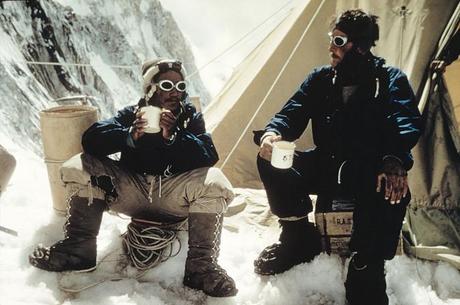
 Last week marked the 65th anniversary of the first ascent of Mt. Everest by Edmund Hillary and Tenzing Norgay. As you would expect, this was cause for celebration in Nepal, which takes a great deal of pride in being home to the world's highest peak. But the Nepali's weren't the only ones who took notice of this important occasion as National Geographic also marked the day by posting some great stories about the mountain as well.
Known for its vast library of impressive photos, Nat Geo began its own celebration by sharing some of the most impressive images ever taken on Everest. Those photos date back across the entire history of climbing on the mountain and include shots of George Mallory and his squad from 1924, as well as images of Hillary and Norgay, not to mention more modern photos as well. In total, there are 26 historic images to sort through with the entire gallery taking us across the entire history of climbing the Big Hill.
Nat Geo's other article in celebration of the 65th anniversary of the first ascent shares some vintage maps of the mountain as well. If there is anything that National Geographic is known for other than its photos, it is probably its impressive maps. In this case, the article shares some of the earliest charts from the area, with one dating back as far as 1933, which was the first ever to appear in the iconic National Geographic Magazine. The article also shares some history behind the maps, with insights on how they were made and their significance.
For mountaineering history buffs in particular, these articles will be fun to read and sort through. They also give us some insight into the ongoing fascination we have with Everest, which continues to hold a siren song for climbers and the mainstream public alike.

