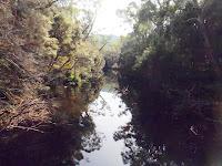
 I headed out from the Frenchman's Cap carpark on the Tuesday night and camped at a site just past the Franklin River. In the morning I headed out around 10.30 and marched through the not so sodden loddens on a beautiful sunny day. At the moment atleast I was having it easy. I made Vera around 3pm after a cruisy walk listening to my ipod most of the way. I was also testing out a set of prototype canvas gaiters made by Evan at Terra Rosa Gear which are pretty awesome.
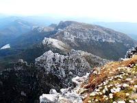
I legged it up the steep but beautiful climb from Vera up to Barron Pass and then on to Lake Tahune by 6pm. A few people were bunking down in the hut for the night. I threw my rucksack on the top bunk, grabbed my jacket and head torch and headed up Frenchman's Cap to take in the view on a beautiful evening. It was worth the effort and after enjoying the sunset I made it back down to Tahune by 8pm. I also scoped out the possibility of visiting Clytemnestra the next day if the weather was ok.
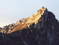 The weather wasn't perfect but on the Thursday I headed back up Frenchman's. I headed towards the southwest face and tried to find a direct route down to the saddle below. I clambered easily down the first terrace but was't too keen to downclimb the next section without seeing the bottom. I dislodged a large chockstone from a crack and watched it tumble to the terrace below. The misty rain rolled in and I wussed out and scampered back up to the top and moved further west. Only 200 or so metres along the cliffline I found a damp scrubby gully which was slippery but an obvious route. I clambered down to the terrace below but after eying the next section I moved east instead and clambered down eastwards in an easier gully which led towards the saddle leading towards Clytemnestra. There were a few dodgy bits but I'd do it again. The gully I followed down on the west at the top turns into a serious chimney at the bottom 40 metres so the east gully from the middle terrace is the safe choice.
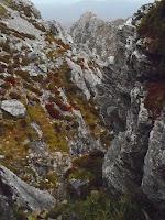 I climbed the west side of the unnamed peak south of Frenchman's and accross and up the following small summit. This looked like the easiest route from the north side at the time. From the top of the second small peak I clambered up Clytemnestra dodging between small cliffs and terraces and made the top by 1.30pm. I had lunch on the side of the unremarkable summit and then headed back down. The view through the cloud was limited but I could make out White Needle and Philps Peak to the east. On the way back I skirted the west side of both minor peaks and this was a fair bit quicker. It is also the obvious route if I'd actually bothered to look at my map.
 I walked up the broad saddle up to Frenchmen's Cap and scoped various routes for the return leg. There is a small but beautiful tarn perched north east of Lake Sophie which then leads to an easier walk up the west side of the cap but I decided to avoid wasting time by sticking to familiar territory. It was still windy and wet so I wasn't keen for too much more exploration. From the saddle the bottom section of the route from my original reccie looked doable so I walked straight up to the south side and started clambering up. I managed the first of three terraces ok with only a bit of exposure. At this point I found the chockstone I'd knocked off from above. I knew if I cleared the next section I could get up the last bit no worries.
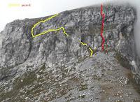 After a fair bit of mucking about I sucked it up and commited to a route which involved a slightly overhanging section and then up into the crack I'd peered down earlier. It would have been a sinch with a rope but in Keens, wet, windy and carrying a rucksack I was very cautious. I got up easily enough though and clambered straight back up to the flat top of Frenchies again. I would consider downclimbing this route in the future if I was feeling energetic. After the climb I headed through the mist to the awesome cairn come bivy spot and down the track and back to the hut by 5.45pm. It said 12c on the thermometer but I broke the rules and threw a few brickettes in the heater and lay my soaked gear out on the bench. No-one else was in Tahune Hut so I dried out and relaxed by myself for the evening. I also found a page of Chapman's notes which described a circuit visiting White Needle and Philps Peak which I brushed up on.
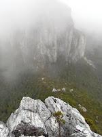 Friday saw me head out at 8.45 to visit Philps Peak. Feeling pretty tired already I wasn't overly excited but Clytemnestra the day before was pretty positive so I pressed on. After reaching Baron Pass along the track I followed the footpad to White Needle. It runs out when it hits the steep stuff. Thanks to Chapman's notes I kept the faith and clambered and climbed up over scrub and loose rock along the ridge line. The route I took was dodgy and I don't think any of my mates would happily follow up the same route. There was the odd overhang here or there with bags of exposure. I relied on the tree roots and dodgy rock a couple of times and broke a few of my own safety rules but in the end found myself at the top of White Needle in windy rainy weather. I was pretty stoked after some generous serves of anxiety.
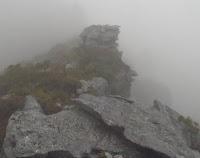 From White Needle the section to Philps Peak is fairly easy. A bit of clambering and scrub as I made made my way along the ridge and then an ascent up low scrub and scree to the top. I enjoyed lunch around 1.30pm on top. I was cold at this point despite wearing a merino top, jumper and goretex jacket. I had to keep moving or my hands would lose circulation. The visibity remained poor from Baron Pass onwards and I didn't get to see the major bluff of Frenchman's Cap from Philps. I followed the ridgeline south east past a few minor peaks before hitting a major cliffline. Even in poor visibility this made finding the turnoff easier because from there I only had to backtrack 200m to the east running ridge. The ridge was still hard to find in the mist but was made easier by a beautifully placed cairn.
 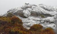 The odd footprint here and there confirmed the spectacular route swerving onto the minor 1200m peaks to the south east of Philps. I then cut a bearing north west until I hit an amazing bluff overlooking the Lodden Plains which were strangely illuminated in shades of sunlight through the rain. I guess the crappy weather most clustered around the peaks. From below the bluff I scoped out the various ridgleines running towards the track east of Lake Vera. I instead decided to follow the creek on the north west side of the plateau below the bluff. It heads north briefly before snaking its way east for two k's. It was the longest possible route I could have taken really but I didn't want to end up wading through dense scrub indefinately so I risked it.
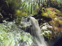 I descended through scrub beside a 50m cascade before stepping into the creek water. This section turned out to an amazing part of the journey. From the gray haze of dollerite and mist I was plunged into a world of vivid green moss and forrest. After the exposed cold of the peaks the aerobic activity of swerving through and under tree trunks in the water was actually quite warm. I kept my torso dry but didn't really have any fear of getting wet because I was fairly wet already and had woolen layers. I was actually ecstatic with the sudden contrast and beauty of the forrest as well as the excitement of plunging down cascades through moss covered rotten tree trunks and vines.
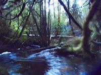 It took me about three hours to make it from the weak tributry to the deep creek section which is crossed by the creek. It wasn't fast I guess but the experience was quite spectacular. It was also pretty awesome to swin the final deep section to the bridge and clamber up onto the track. If someone was crossing at the time I would have looked like a bit of a nut job swimming in my full wet weather gear with rucksack on. I gave a cheer as I headed along the track towards the Loddens. I set out fairly quickly to stay warm. It was 7pm when I hit the track and I pulled into the second camp on the loddens around 8.45. Cold, tired and completely buggered I pitched the tent, strung up a clothes line and changed into my dry woolen thermals, bivy jacket and dived into my sleeping bag.
 Saturday morning I broke camp and headed to the carpark. It took about 4 long and tired hours and I got out about 12pm. Straight to the Hungry Wombat for a burger with the lot and a hot coffee.
