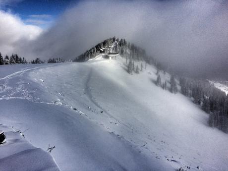
Crystal Mountain received a nice blanket of snow this weekend.

10″ of new snow at Crystal

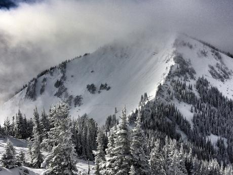
Powder Bowl isn’t looking to bad either
There’s about 8-12″ of snow in Green Valley, and its a nice dense base. One more storm like this and we can open the Gondola and Green Valley. The forecast for this weekend is calling for a few more systems starting on Friday. (The first system should be warm, which could actually help consolidate the base.) Here’s how the forecast discussion reads:
  A WEAK UPPER SHORTWAVE IN THE NORTHWEST FLOW WILL MOVE ACROSS THE
  FORECAST AREA WEDNESDAY NIGHT...FOLLOWED BY ANOTHER WEAKER FEATURE
  THURSDAY OR THURSDAY NIGHT. THE SHORTWAVES WILL PROBABLY SCATTER
  SOME LIGHT SHOWERS ACROSS WESTERN WASHINGTON AT TIMES. THE SNOW
  LEVEL WILL BE AROUND 3500 FT WEDNESDAY NIGHT AND RISE TO AROUND
  4500 FT THURSDAY NIGHT...AND SHOWERS COULD BRING 2 TO 5 INCHES OF
  NEW SNOW TO THE CASCADES FROM AROUND STEVENS PASS NORTHWARD. MCDONNAL

  .LONG TERM...ANOTHER WEAK UPPER RIDGE WILL MOVE QUICKLY ACROSS
  WESTERN WASHINGTON FRIDAY MORNING...THEN A COLD FRONT WILL DIG
  SOUTHEAST ACROSS THE AREA FRIDAY NIGHT AND SATURDAY. A SECOND
  FRONT WILL FOLLOW QUICKLY ON SUNDAY...WITH A FAIRLY DEEP UPPER
  TROUGH DIGGING OVER THE REGION ON MONDAY. THE SNOW LEVEL WILL RISE
  TO AROUND 6000 TO 7000 FT AHEAD OF THE FIRST FRONT...THEN FALL TO
  AROUND 3500 FT ON SUNDAY AND MAYBE ALL THE WAY TO 2000 FT ON
  MONDAY. MODELS AGREE WELL ON THIS SCENARIO OVERALL. MCDONNAL

8″ at bottom of GV
The bottom of Green Valley still needs a bit more snow. But currently it’s snowing lightly, and every little bit helps. What we need now is one of those big November snowfalls where it dumps 2 feet in 24 hours. (A girl can hope!)
Even if that doesn’t happen, since the crews this summer mowed down all the trees and brush in Green Valley and pretty much everywhere else on the main runs, it won’t take much to get open.
Let’s all start doing our snow dances (and ice-cube-flushing and frozen-spoon-under-the-pillow-sleeping) and get this season started!

