We’ve all been there. Sitting on the chairlift on our first ride up the hill, the guy next to us asks if we were here yesterday. “Dude!” He shakes his head. “It was epic. Yesterday was THE DAY. You should have been here.”
You remind yourself that today the conditions don’t look too bad. Even though the sky is leaden gray and the air is a bit too warm, the snow along the edges of the runs appears pretty soft. After a morning of “pretty good” you stop counting the number of times someone reminds you that yesterday, with a foot of fresh and clear blue skies, was probably the best day ever. And you missed it.
If you find yourself in this situation, of course the best method is to ignore yesterday’s perfection and enjoy the day you do have on the slopes. The mountains are always better than the city, any day in any conditions. I could write an entire post about finding pleasure in the current moment. And perhaps I will soon.
But today I’m offering some tips on predicting THE DAY. Let’s face it. We all want to be in the mountains under perfect conditions. Below are a few resources for sussing out the conditions, so that next time you get to be the smug guy saying, “You should have been here yesterday.”
Weather Forecast

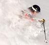
A sunny day means good visibility (and not hitting that snowboarder)
The good old National Weather Service is a perfect place to start when planning your day on the slopes. Most of us like good visibility. All things being equal, a sunny day on the slopes is better than a cloudy day. The 7-day forecast is your best resource for finding the sun. Yesterday was a perfect case in point. With firm conditions, the groomers offered the best skiing yesterday. I found dry, chalky snow in Powder Bowl, but the north side of the King was a breakable crust over avalanche debris. Having said that, yesterday was FUN. The sky was that dark mountain blue, the snow was sparkly and pretty and the view went on for miles. So if you can choose a sunny day over a cloudy one, your fun-o-meter will reach a higher potential.

A sunny day and uncrowded slopes=FUN
Check the temperatures and snow levels on the forecast. Know the elevation of your favorite ski area. Crystal Mountain elevation is close to 7,000 ft at the summit and 4,400 at the base. That means when the forecast is calling for 5,000 ft snow levels, we could have wet conditions at the base and snow at the top. This is a good day for Gore-tex and fat skis. You will want to ride the gondola or stay on the upper mountain. However, if the forecast is calling for high winds, the upper mountain might be shut down. Your “Gore-tex and fat ski” day could turn into a “rain slicker and hot chocolate in the lodge” kind of day.
NWAC Mountain Weather Forecast
The Northwest Weather and Avalanche Center (NWAC) is a great resource for skiers. In addition to a detailed backcountry avalanche forecast–a valuable tool for anyone skiing or riding outside of a ski area–NWAC offers other important weather data. Every morning I check the telemetry at Crystal.

Screenshot of Crystal telemetry 11-27-12
Take a moment to check out this graph. There is much you can learn from it. For example, the temperature and relative humidity have increased since midnight. This tells me that the dry snow from yesterday is picking up moisture. The wind is starting to increase out of the south south-west. We have not gotten any precipitation in the past 24 hours. It is important to note that the precipitation always reads from the past 24 hours. It never “resets”. However, the 24 hour snow totals do reset. That usually happens in the morning when a ski patroller clears off the stake and the reading returns to 0. We have two weather plots–one at the top of Discovery Chair and the other in Green Valley. The Green Valley telemetry only reads snow and temperature. Sometimes the snow totals can be way off because the trees don’t seem to protect the site as well as they once did. We are currently studying alternative plot sites in order to get the most accurate weather plot possible. However, just know that under consistent wind, the snow totals might be inaccurate.
Forecast Models
The University of Washington Atmospheric Sciences Department is a goldmine of weather information. It can be a bit daunting at first, until you spend some time clicking on the various loops. One of my favorites is the Western Washington 24 hour snowfall model. 
To the right is a screen shot of the WRF-GFS 4km Domain snowfall totals for the next 24 hours initialized at 12 UTC Tuesday November 27th. The WRF-GFS is a version of the GFS model that is specially “formulated” by UW for our location. This model takes into account the mountains and water and convergence zones and tricky local conditions. The GFS is merely one of the models that forecasters look at to predict weather.
In fact, that snowfall prediction looks pretty nice for Crystal. Notice the purple on the east side of Mount Rainier? That’s us. Friday could be a good day, as long as the snow levels behave themselves.
Forecasters Talking to Forecasters
Finally I look at the Forecast Discussion on the NWS page. Several times a day, the NWS lead forecaster explains the forecast for the benefit of Weathermen and Weatherwomen across the region. He or she explains in narrative what the models are predicting, compares the various models and explains why. It is a great resource, very similar to the NWAC forecast, but another perspective from someone looking at the same models. It is also a “look behind the curtain” that offers short term, long term, aviation, maritime and hydrology predictions. While not focussed primarily on the mountains, the forecast discussion offers a valuable look at the big picture.
Website and Social Media
Like all of the local ski areas, Crystal Mountain’s website has a weather page that offers links to many of the resources listed above as well as webcams. Crystal’s Ski Patrol Blog often displays a Photo of the Day to give a sense of the current conditions and weather. The ski patrol Twitter and Crystal Twitter offer updates on openings, closures and weather conditions. Crystal also uploads current photos to Facebook.
Now that you know when to go (hint, hint Friday is starting to look pretty good) all you need is to start feigning a cough. That way when you call in sick just when the conditions turn epic it won’t look so obvious. My advice is to pretend like you’re always “on the verge” of the latest cold. You probably shouldn’t let anyone at the office see you washing your hands or eating a salad for lunch either. You wouldn’t want them to think you have an immune system of steel.