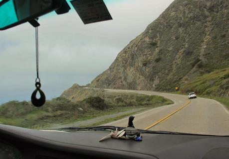
Driving on charnockitic tonalite -- massive, very hard, and super scenic ...
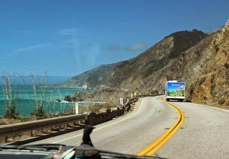
... especially when the fog clears.
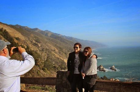
A sunny day along the Big Sur coast brings out smiles ...
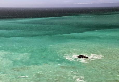
... and gorgeous colors in the ocean.
About 29 million years ago, a large piece of Southern California began shifting northwest along various faults (e.g. the famous San Andreas), causing earthquakes, landslides and other “destruction” along the way. It's shifting very slowly, but it's been doing so for such a long time that it has manged to travel hundreds of miles. This is an incredible story that I never get tired of pondering. But it far exceeds my geologic understanding (and perhaps everyone's) so I won’t try to explain further; you can read more via the sources at the end of this post. Geotripper provides a short account in the first part of Where the Sierra Nevada Rises from the Sea: Point Reyes National Seashore.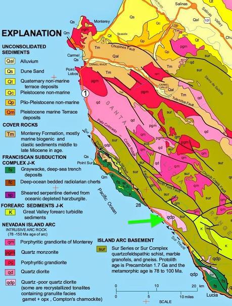
Source
This map shows the results of the crazy geologic history of coastal California -- a puzzling patchwork of rock units. Click on the image to see details. Even if you’re not into geologic maps, note the pink unit next to the ocean (green arrow).The traveling chunk of continental crust is carrying along a large mass of very hard rock with the impressive name of charnockitic tonalite, part of the pink unit indicated on the map. It resides on the Big Sur coast. Because the rock is so hard, the slopes are steep (50-65%) and the scenery is spectacular -- perfect for a scenic drive. And there is one, California State Route 1. This segment has been open since the 1930s. When we drove it last month, I was struck by its improbability.
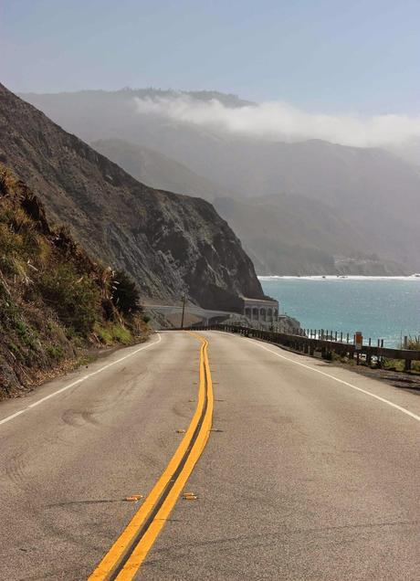 Even though charnockitic tonalite slopes are steep, they're relatively stable compared with other parts of Highway 1. Landslides are less common, and are mostly smaller rock and debris slides (see p 33 in this PDF). However ...
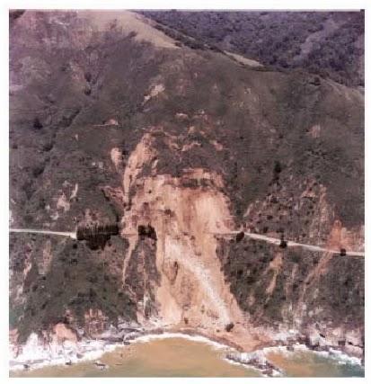
McWay slide ca 1983. Source
... there are occasional zones of weakness, including just north of McWay Falls. In 1983 the slope gave way, closing Highway 1 for almost a year. Several factors may have contributed -- vegetation burned off by fire, heavy rain that season, and probably the highway itself. Whatever the causes, the amount of earth that moved was huge. The California Department of Transportation had to push eight million cubic yards of it further downhill to stabilize the slope and make a new road bed.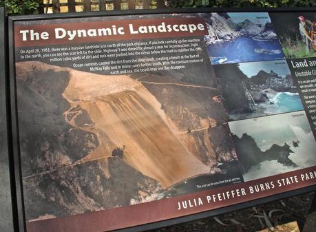 I guess eight million cubic yards is a lot, but when I read the interpretive sign at the end of the McWay Falls Trail, the figure didn’t make much of an impression. It’s just a really big number. On the other hand, the photo on the sign really struck me when I looked close:
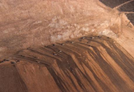
Zooming in on the interpretive sign.
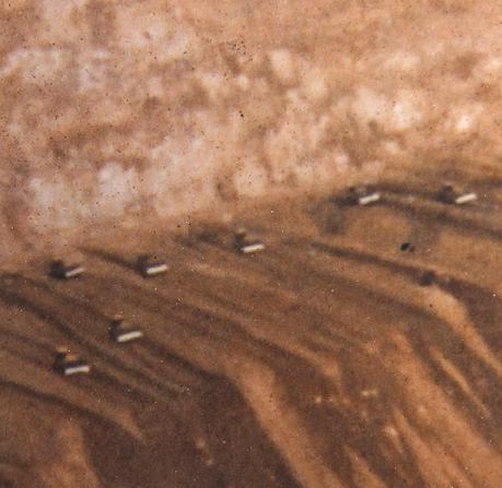
Looking really close -- oh my!
That’s a phalanx of large bulldozers! That's what they did day after day for almost a year.Thanks to the slide and CalTrans, a lot of debris was moved to within reach of the ocean, and rains periodically add more. The debris plumes are obvious. A current carries the material south, and has deposited sand in what used to be a water-filled cove with a falls. Now McWay Falls lands on a beach much of the time. See Geotripper’s Geologic Change Along the Big Sur Coastline: Julia Pfeiffer Burns State Park.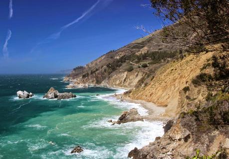
Debris plume at base of slide (yellowish-green water).
There was hope that plants could help stabilize the slopes near the highway, and various revegetation schemes were tried. Results were disappointing:
“The McWay landslide project contained elements of the worst case site conditions for stabilizing surface soil erosion, establishing vegetation and controlling weedy exotic plants. ... The primary lesson of the study is that vegetation alone cannot stabilize materials on steep slopes. ... It is not cost effective to invest in and implement a native perennial revegetation plan on unstable sites prone to large-scale land movement. The unstable sites are cost effectively treated with an annual native vegetative cover along with sterile straw or other surface erosion control methods.” [after first consolidating and stabilizing slopes]
“The primary conclusion of this report is that re-vegetation and erosion control work conducted on Highway One may offset and mitigate highway related erosion impacts but cannot be expected to deal with natural erosion” Source
Now 31 years later, the slide is somewhat more vegetated but still obvious:
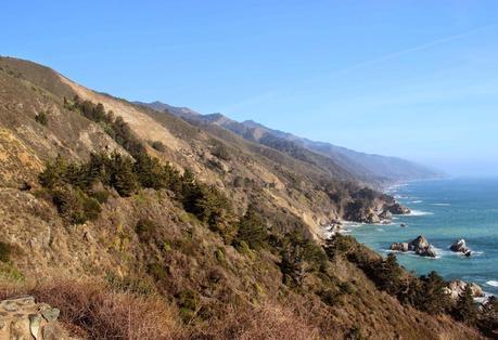
McWay Slide is still visible in 2014 (bare spot on upper slope). Note debris plume below.
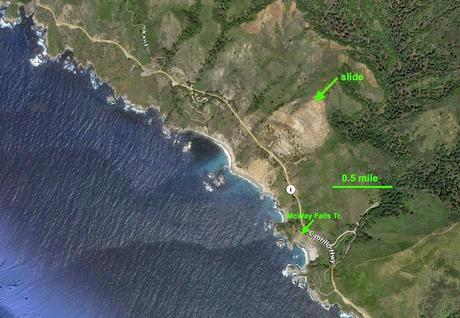
Google Earth view, 2012; click on image to see more detail.
Sources (in addition to links in post)
Cal Poly Pomona Geology Club Spring 2003. Field Trip Big Sur (PDF).
UCSC. Geology of the Point Sur-Lopez Point region, Coast Ranges, California (PDF).SFSU. Geology of the California Central Coast (PDF).
Watershed Institute, CSUMB. 2000. Big Sur Coast Highway One erosion and revegetation management (PDF).
