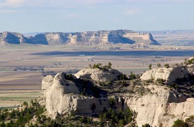
Scotts Bluff mid-distance, viewed from the Wildcat Hills in northwest Nebraska.
Between 1914 and 1918, concerned citizens of Nebraska contacted the Department of the Interior in Washington DC four times—twice by inquiry and twice by petition. They wanted the president to make Scotts Bluff a National Monument, to honor its importance as a landmark on the Oregon Trail. Their wish was granted by President Woodrow Wilson, who created Scotts Bluff National Monument on December 12, 1919.
History buffs weren’t the only beneficiaries. The rocks are full of geological evidence from 25-30 million years ago—when little horses, tiny camels, rhinos, ruminating hogs, and other mammalian beasts roamed the vast savannas, and volcanic ash rained from the sky. And there are treats for plant lovers too. When I visited, I found beautiful rock gardens with colorful spring wildflowers growing in soft pale rock.
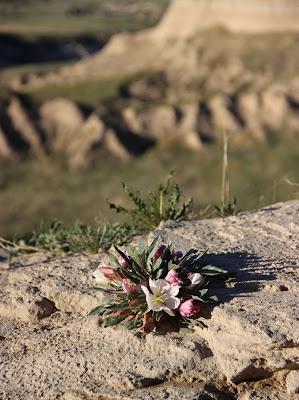
Evening primrose in an erosional landscape (Oenothera caespitosa).
The summit of Scotts Bluff stands 800 feet above the North Platte River—its maker. The river has taken advantage of the soft rocks to carve this landmark and others nearby. But there are downsides to the Sculptor’s hand. For example, part of the trail from the Visitor Center to the summit is closed due to rock fall. The most alluring section—where a tunnel goes though Saddle Back Rock—was inaccessible. Bummer!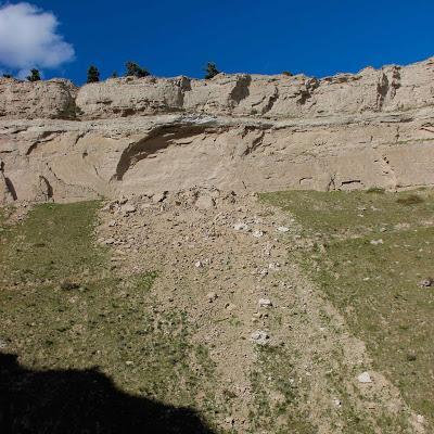
The Master’s work is never done.
After hiking the open sections of the trail, I chatted with park staff who recommended walking the park road when it’s closed to traffic—before 8 am or after 5:30 pm (7:30 in summer). This is a greater opportunity than you might think. There's plenty to see, but when driving it’s impossible to look at anything as there’s no place to stop. Sauntering is a much better way to enjoy the scenery, plants and rocks along the road.Rock gardens were common, but unfortunately it was quite windy, and only a few of my plant photos were in focus. The rocks were more cooperative.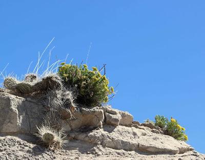
Narrow-leaved musineon (Musineon tenuifolium) with prickly pear cactus (Opuntia sp.).
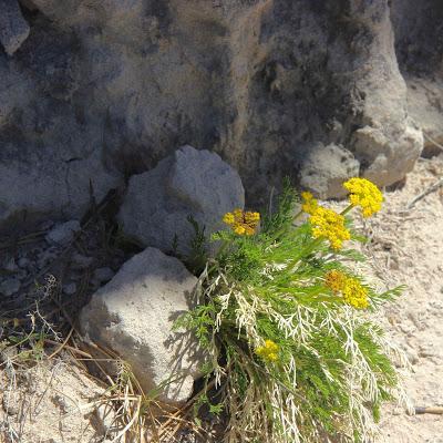
The musineon (also called slender wild parsley) was common in the rocks at the summit.
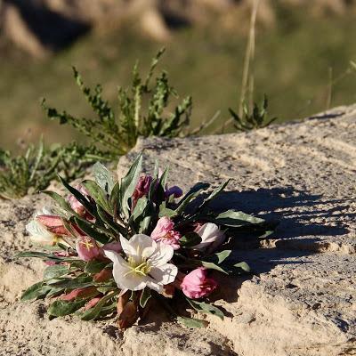
Evening primrose in the evening. The closed pink flowers have already bloomed.
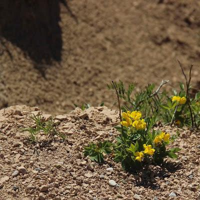
Prairie golden peas (Thermopsis rhombifolia) were a bit stunted, but not much considering their habitat.
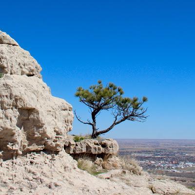
Bonsai ponderosa pine—hardly ponderous (Pinus ponderosa).
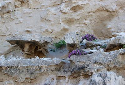
Locoweed (Astragalus sp.) on calcareous concretions! (more on this below) At least thirty species of Astragalus grow in Nebraska. Only a few are true “loco” weeds, i.e. toxic.
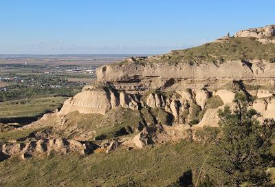
The Sculptor is visible in the distance—the North Platte River. Pine Ridge forms the horizon.
Near the summit, road cuts and erosion have exposed hard pipy (pipe-shaped) concretions in rocks of the Monroe Formation. They formed after sediments were deposited, “by precipitation of calcium carbonate from groundwater” (Maher’s Roadside Geology of Nebraska). The elongate concretions all are oriented northeast-southwest, both at Scotts Bluff and north of the river at Pine Ridge. Why? … apparently it's still a mystery.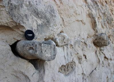
Concretions stick out because they're harder than the surrounding rock and resist erosion.
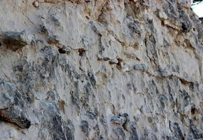
Pipy concretions all in a row.
It was Will Maupin who first suggested a paved road to the summit of Scotts Bluff. This was sometime between 1920 and 1924, when he was serving as the first Monument Custodian at a salary of $1 per month (he also was editor of the local newspaper). Road construction began in 1932, and continued off and on until September 19, 1937, when the paved road was opened to the public (source).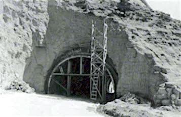
Boring the lower tunnel in the 1930s (NPS; no source given).
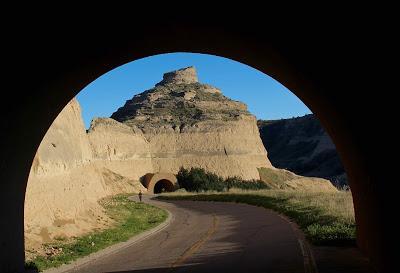
Lower tunnel today, from middle tunnel.
The closed road is popular with runners and walkers, both human and canine. Distance is three miles round trip. The steepest slopes have been plastered over, but rocks still fall.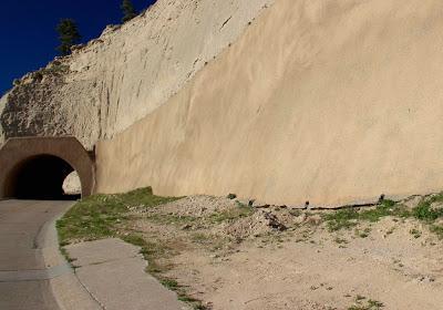
"Plastered" slope (my term), with drain pipes at base.
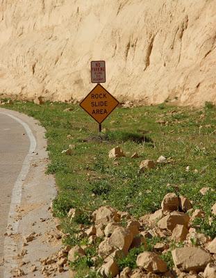
Looks like Park staff have to clear rocks from the road on a regular basis.
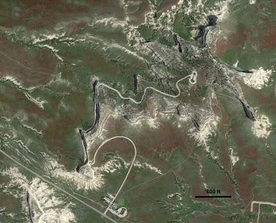
Scotts Bluff from the air, courtesy Google Earth. Click on image to view road and trails.
