The province of Prince Edward Island has always been pretty good and open about making their aerial photography available. They have an in house library in Charlottetown where prints and copies can be ordered as well as an online interactive web map service allowing users to search and download lower resolution versions of their aerial photography.
The online initiative began shortly after the 2000/02 Corporate Land Use Inventory Project had completed. This extensive project involved creating orthophoto maps from over 16 thousand 1:17.5k false color infrared images.


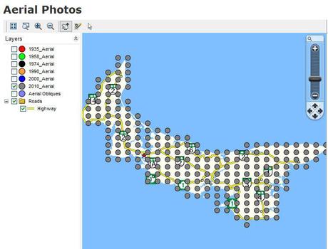
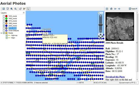
The PEI online map application displays the collection of aerial photos that are available from a set as points on the interactive map. Then users can view a thumb-nail of any photo simply by double clicking on one of the map points. Larger version of the file can then be downloaded, images are in JPEG format (reduced in size by 25% from the in house scans), with download file sizes ranging from 2 to up to 10 mb.
Aerial photographs of Prince Edward Island are available for download from surveys of 1935, 1958, 1974 and 1990, 2000 & 2010. The type of imagery available depends on the aerial photo survey of that particular year, thus you will find that there are color images, false color infrared and black and white images.
The department has also gone ahead and generated some quick-search pages allowing users to browse Aerial Photographs by community if they do not wish to use the interactive map tool. So users can pick a community from the provided preset short-cut list to see a list of photographs available in that area.

For example you can click on Charlottetown and it will open up a page containing thumb nails with relevant photos for the Charlottetown area with links to download the corresponding image or open it up larger into your browser.
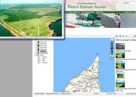
There is also a set of images on their interactive map tool of oblique aerial images of select places across the island that can be viewed similar to the way the traditional air photos are with the map tool.
The province of Prince Edward Island continues to do a great job at making their aerial photography available to the public and this interactive map tool is your key to finding aerial photography for anywhere in Prince Edward island that you can then use with ArcMap, MapInfo, Google Earth or any other GIS based software as well as other non GIS uses.
Prince Edward Island Interactive Map Tool can be found by following this link: http://www.gov.pe.ca/maps/aerialphotos.php3

