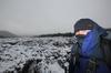
Staring down a hundred year old tunnel in Fort Nepean
Batten down the hatches, as unlike my last few entries this is actually a 'walking' post. Well, it's a 'walking/tourism/get-there-while-you-can-in-case-the-joint-gets-humped-by-developers' post. I guess anyone from outside Melbourne would have little idea what the old military complex of Point Nepean consists of? Then again, there's plenty of people I've met locally over the years who wouldn't know their arse is on fire, so they've probably never heard of it either. Anyway, do I give you a quick history lesson or go for the easy option?
You'll be pleased to know I'm going for the easy way out. I'm sliding in a quick Wikipedia link so you can get all the Point Nepean guff you may need. Essentially, it sits at the end of the Mornington Peninsula and consists of a number of historic buildings and fortifications from an era when Melburnians were scared of marauders from Russia.
Yeah yeah, I know. In the 1870's did we really think the Russians would come sailing into Port Phillip Bay looking for our alluvial gold and koalas? Yes, apparently so. Doesn't it seem like a long way to go though? Especially when hammered on Stolichnaya? Sailing to England, I was seasick within hours of the ship leaving the harbor and all I was drinking was American champagne (Coca-Cola). Can you imagine what it'd be like in 1870, rolling through the Indian Ocean with a kilo of potatoes and a liter of Vodka in your stomach?
Anyway, I've been to Point Nepean a few times and it's always a worthwhile trip. Plenty of decaying military history, a relatively undeveloped peninsula and a chance to participate in the world's longest 'hide and seek' with former Australian Prime Minister, Harold Holt. More on him later. There was an important reason to go this time though.
The area contains the Quarantine Station which has a number of 'ye olde' buildings in it. No problem, right? Well, not until you hear the dreaded word 'development' pop up. Yes, there's plans to turn part of the historic area into an accommodation and dining shindig. The official spiel is in this link from Department of Environment and Primary Industries, but the online world is full of articles giving some troubling suggestions about what this 'development' may entail.
So there you go. I was off for a wander whilst no one has their mitts on it just yet. Mind you, I think I'd go there more often if it wasn't such a hell of a drive to get to. Living out west meant a long motoring expedition was in order, so I was out the door early in order to spend a full day down there. A new freeway that's been successfully plowed through native grasslands helped and before long I was passing the beachside suburbs of Dromana, Rye and Sourdough.
Finally, there was a quick pit-stop for coffee and a lemon tart to wake me up and then I was entering the park. It's definitely changed since I was last there about ten years ago. A jazzed up entrance, smoothed out paths and an information office which I couldn't find were just some of the improvements.
Now, there's no way I can do this place justice in the one post, as there's a fair bit to see. So, I'll just smother you in photos with the odd spiel, without going into too much detail. If I told you everything, you'd have no reason to visit. Right?
I remember the first part of strolling in the park was along a rough track following an old telegraph line and feeling quite excited upon finding the remains of the supports within the bush. Well, things have changed a bit since then. Here's the rough track I remember, but it's had a bit of a spruce up...

...into highway status. It's definitely 'easy walking' and the old telegraph poles are no longer hiding in the bush.

Oh well, it makes the place more accessible I suppose. Continuing on the open path, I was soon passing gnarled trees...

...and some bright green new foliage growing.

The peninsula narrows quite dramatically, so at certain points there's a choice of either calmer waters in Port Phillip Bay to look at, or the ocean side which is always a little bit more dramatic. Initially I was walking near the bay, whilst passing the marker for Observatory Point...

...and then wandering out onto the sand for a perusal of some large trees smoothed by water over the years.

The place is full of old, concrete observation posts. Some are now hidden amongst the trees. Such as this one.

In order to see everything, there was a bit of criss-crossing between the bay-side to the ocean-side of the peninsula. A mandatory place on the to-do list is the highest point of the park. Cheviot Hill which ascends through the clouds was a peak to be bagged, but without supplemental oxygen I was apprehensive as I faced the 55 meter summit.
I needn't have worried though, as I reached the peak in about 17 seconds with no loss of consciousness in the rarefied air. Cheviot Hill overlooks Cheviot Beach and of course the whole place is named after the SS Cheviot (how many Cheviot's can I fit in the one sentence?) which was a ship which wrecked here in 1887.
That's not all though, as the place is more renowned for where Prime Minister Harold Holt went missing whilst swimming in 1967. Talk about a balls up. What were you thinking Harold? Cheviot Beach is an absolute shocker to look at regarding 'going for a swim'. It's predominantly rocky with a small sandy beach at the end of the cove, but in the water it's all rock shelves, which drop off into foaming water. You'd want to be really, really, really keen to go for a swim here...

That's of course if he did drown, as he's the king of all urban myths. Getting picked up by a Chinese submarine is a good one, but I've got my own theories. Participating in the incredibly gruelling, 40 year freestyle 'hide and seek' with Lord Lucan is a possibility, but what I'm actually waiting for is the day he walks ashore in South Africa, covered in seaweed and proclaims he's the World's Underwater Walking Champion (WUWC).
The one thing about these lofty heights is the view. Compared to the rest of the Mornington Peninsula, this is as undeveloped as it gets. Here's the north-east view...

...and this is looking towards the very end of the peninsula with the 'Rip' in the distance.

There were also some old military fortifications here. This is an old turret...

...and observation post. Having spent some time in the military, I'm well aware of how depressing it would have been to be staring out towards the horizon for hours on end during a freezing night in winter. Talk about mind-numbing.

There are many sections fenced off at Point Nepean due to unexploded ordnance lying around in the scrub. It's a pity I didn't see any old mortars poking out the ground, as I'd love to take one home and put it on the mantelpiece. Nothing beats having a bomb in your living room.
Here's one of the older warning signs...

...before moving on and following a sandy track towards the end of the peninsula.

Along the way there were more lookouts...

...old turrets...

...and the only road within the park.

There's coastline to look as well and whilst casually looking at one of the ocean beaches, I spotted something large and yellow washed up...

What's that big yellow thing?
...until I repositioned myself and realised it was an escaped navigation buoy. What? As a collector of 'treasures from the deep', this could possibly be the greatest washed up item I've ever seen. It has a flashing light on top and I imagined getting hold of it and setting it up in the loungeroom. How cool would that be? The only hiccup in my plan is it was at least ten feet tall, probably weighed about 200 kg and it sat on a beach...

...which had the following warning signs.

Is it worth getting blown up for a piece of incredible flotsam? Hell yes. How would I recover it though, as it's too big for my car? I guess I could roll it into some bushes and collect it in a truck? So many theories, but it's probably long gone after the next high tide.
Anyway, leaving that behind was traumatic, but I continued on, walking down the peninsula which narrows and luckily for me it's called 'the Narrows', as I couldn't think of a name for it.

Fort Nepean is near here and I was soon strolling through old bunkers dug into hillsides and surrounded by thick concrete. Numerous tunnels branch off underground. Some are more lit...

...than others.

Before popping out onto and old parade ground, which now handily has tables for relaxing in the sun and having a late lunch. At this spot there's a couple of old gun barrels from the fort, but these aren't any old barrels.

Apparently each barrel (obviously they weren't set up like this in the middle of the parade ground. I think) fired the first allied shots in both World War One and Two. If you're interested, I'll let you read about that in this Fort Nepean link. All you need to know is both guns fired one shell as warning shots at ships. One was a German freighter 'getting the hell out of Dromana' after war was declared in World War One and the other was a ship sailing along happily, but neglected to identify itself in World War Two.

Detail from one of the guns.
Moving on after inhaling some Vegemite sandwiches, I continued to the end of the peninsula. The Rip was quite calm, but have a look what's on the other side? Yes, there's Point Lonsdale Lighthouse which was the subject of my last post.

There were more old buildings, which I spent some time strolling through before deciding to slowly make my way back to the start. Now at sea level, there used to be an old jetty here which was used to supply the base during both Wars. I walked along a path...

...before reaching a set of stairs which got the heart pumping. If you really want to know, there's 113 steps.

As I reached the top I was a little perturbed to see my heart was beating approximately one foot outwards from the center of my chest. So, I elected to recover by strolling slowly through some more tunnels...

...and checking out old signs and notices inside the bunkers.

This had been a big day and it was late afternoon, so I was moving a bit quicker than my traditional sloth-pace.
I was hoping to combine some old photos in this post, but the ones I've found online are pretty small and of low-resolution. Unfortunately the images from the Point Nepean forts are property of the Australian War Memorial and they only supply a small photo online. I can get large ones, but there's a cost and with TIFF files priced at $39.60 each (plus a turnaround time of three weeks for an order), I decided to save my money for food. If I was getting paid to write this crap I'd get the images, but instead you'll have to look for them yourself.
On my way back I passed the old location of Fort Pearce Barracks, in which I've included a link as to how they used to look. The buildings have since been removed, but items have been set up in their previous positions. There's a bit of a sculpture feel about the table and chairs, as that chair is secured to the ground askew...

...and the bed is a winner. Give me a pillow and I reckon I could sleep on it.

Strolling on, I passed more gnarly trees...

...and beaches were beginning to glow, as the sun was low in the sky.

You know what? There's still plenty to see. Anyway, I found the old cemetery which has a number of graves from deaths that occurred on ships arriving when the Quarantine Station was operating. Notably the clipper ship, the Ticonderoga arrived with over 100 passengers having died due to typhus on the voyage from Liverpool. There are few graves from the ship...

...but I had to move a bit quicker now as the sun was setting. The weather had been perfect and with a glowing horizon developing, I headed back to the beaches.

The rising moon, coupled with a dusky pink sky, looked fantastic. If only the moment translated to photographs though. At this time the air was crisp and cold with winter only days away.


Light was low, so my chances of looking around the Quarantine Station properly were slim. Hang on. Wasn't that the whole point of the trip and this post? Wasn't I meant to be checking out the area, which is earmarked for development? Mm...
Well, I did make it to the buildings, but they were all closed at this late stage. This is the old bathing and disinfectant building.

It was around this point where I realised I'd missed out on a few things here, so had already planned a re-visit. I'm sorry to say, but this is a case of 'Tourism Fiasco'. Oh well, my career as a tour guide is looking a little shaky.

The light was lovely at this time, but I knew I had to call it quits when it was officially dark.

So, that's it. It had been a big day and if you don't believe me, here's the GPS link of my wanderings. Yes, I did take the GPS, just to prove to you I'm still getting some walking in and there was a surprising amount as well. I think 15 km is quite good for a day-trip.
You know what? I considered heading back to look through the Quarantine Station properly, but I knew I definitely had to come back, as I'd missed a few other things. Namely the official Harold Holt memorial (how did I miss that?) and another lookout called the 'Monash Light Tower'. What? There's heaps to still see and guess what? Yes, within days I was driving back down to check out those missing pieces, which as you may have guessed, is my next post.
Until next time...