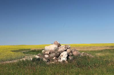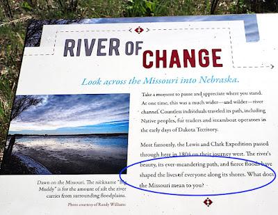
"What does the Missouri mean to you?" I was asked.
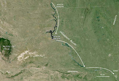
South Dakota is one of those roughly rectangular states in the heartland of the USA. The Missouri River runs through it north to south, dividing it into two nearly equal but very different halves. To the west landscapes are mostly rugged and sparsely vegetated. To the east they're subdued and covered in plants. So after pondering the sign's question, I decided that was what the Missouri meant to me—South Dakota's Great Divide.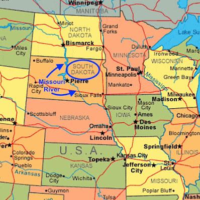
Modified from this map; original source not given.
The difference can be seen even from afar: brown west of the river, green to the east (Google Earth, modified).
The contrast west and east of the Missouri has long intrigued those travelers who pay attention. In 1839 Joseph Nicollet, surveyor with the US Corps of Topographic Engineers, led an expedition up the river as far as Fort Pierre, and then northeast by land. They experienced a dramatic change in landscape almost immediately. The "Great American Desert" west of the river was gone. Instead ..."... the vast spaces opening to your gaze, the astonishingly richer vegetation, the smoother undulations breaking the monotony, the purity of the water in the streams and rivers flowing into the Missouri, the nature of the woods shading them—everything proclaims a favorable change in the physical aspects of the country." (Nicollet 1843)
Why the sudden change? It can't be moisture. Precipitation does increase going east but only gradually. And there's no significant change in elevation, nothing to disrupt South Dakota's gentle downward slope from the Rocky Mountains eastward. But there is a huge difference in substrate, as Nicollet noted:
[Land east of the river] "is covered by a species of deposite of the kind for a long time known by the name of diluvium; but as this word implies a theoretic idea as regards the accumulation of such deposites, the cause of which is still open to controversy, it is now very generally abandoned, and the designation of erratic deposites, among others, adopted in its stead. I have, therefore, used the latter expression, as comprehending a vast deposite of sand, gravel, pebbles, and clays, ... and masses of rocks transported to a distance from their original position, usually called erratic blocks."
Nicollet's "vast deposite" east of the Missouri is fine ground-up material rich in plant nutrients, with "erratic blocks". Farmers call it "boulder clay". Photo courtesy Dave Rintoul.
In the above description, Nicollet alluded to the controversy surrounding these deposits. In fact, it was a raging debate. Similar material in Europe had long been attributed to the Biblical Flood, but some geologists were pushing a radical new idea—glaciers! After all, these kinds of deposits were associated with modern-day glaciers in the Alps. Even so, most geologists considered the "glacial theory" complete nonsense. Ice sheets at lower elevations in Europe? or on the plains east of the Missouri River? Ridiculous! Nearly three decades would pass before climate change, ice ages and continental glaciers were widely accepted (1).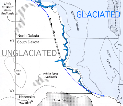
The Missouri is the west boundary of land once glaciated. But why? (modified from Johnson & Knight 2022).
It's very hard to imagine massive sheets of ice covering eastern South Dakota, especially on a torrid summer day. But they did, and multiple times. Starting about 2.6 million years ago, glaciers advanced south from the Arctic six or seven times, sometimes reaching as far as Kansas and Missouri. Advances alternated with interglacial periods, when the ice melted back. In South Dakota the last ice melted just 11,000 years ago (Gries 1996; Johnson & Knight 2022).As it flows, a glacier grinds and planes the land and carries off the fragments in its base, making it even more abrasive. When it melts, it leaves behind thick deposits of ground-up material—Nicollet's "erratic deposites", now called ground moraine. After multiple advances and melting during interglacials, eastern South Dakota was covered in ground moraine—the source of the fertile soils east of the Missouri River.
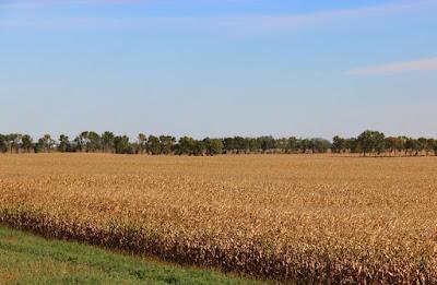
Nicollet's "astonishingly richer vegetation" east of the Missouri River was mostly tall grass prairie. But now it's largely gone, replaced with crops.
Some readers may be wondering, as I did: Why are there glacial deposits east of the Missouri but not to the west? Did the river block the ice? That explanation is tempting, but there's a better one. Look at the map below for clues. Note that the Missouri flows roughly north to south, even though regional elevation drops west to east. Also note the lopsided distribution of major tributaries—all flow in from the west.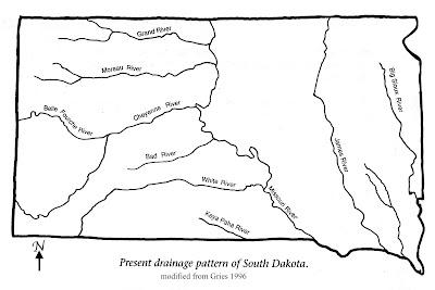
Major streams of South Dakota; modified from Gries 1996.
In the late 1850s and again in the late 1860s (before and after the Civil War), Gouverneur K. Warren of the US Army Corps of Engineers studied the Missouri River and its tributaries. In his 1869 report he described the extensive glacial deposits and explained why they stopped at the Missouri, why there were none farther west."I have determined the south western limit of the glacial drift action to be the Missouri river ... From the Missouri river to the Rocky mountains, over a space varying from 300 to 500 miles in width, no drift is found ... There, then, on that limit a river must have been formed to carry away the melting water from the glacier, and this limit was the Missouri river, and that was the river formed thereby. It cut along this glacial limit because all the streams west of it came from the mountains toward it, down the inclined plain, and there their old course was terminated" [italics mine].
Many years later, USGS geologist Richard Foster Flint agreed with Warren. "The belief, advanced as early as 1869, that an ice sheet flowing southwestward blocked these valleys and detoured the drainage so as to form the Missouri River is confirmed." As evidence, Flint described three anomalous features of the Missouri (two can be seen in the map above). First, it doesn't follow the gradual decrease in elevation west to the east. In fact it flows mostly south, perpendicular to regional slope. Second, its valley generally is steeper-walled than those of its tributaries, indicating youthfulness. Finally, distribution of its tributaries is very lopsided—all major streams enter from the west (Flint 1955).
In summary, the glacial deposits covering eastern South Dakota end at the Missouri River because that was the limit of glacial advance. But glaciers didn't stop there because of the river. In fact there was no river until ice blocked east-flowing streams, sending them south along the margin of the ice sheet to become part of the longest river in North America—the great Missouri, 2546 miles in length from its headwaters in the Rocky Mountains to its confluence with the Mississippi (2).

President Thomas Jefferson by Rembrandt Peale, 1800 (source).
The Louisiana Purchase was one of Jefferson's greatest accomplishments.
Travel up the swift-flowing river was terribly slow and arduous. The men paddled, sailed and too often pushed or pulled their boats, including a heavy metal-framed keelboat. (It was sent back down the river from their winter camp, with collections, reports and a map.) It's thought that each boatman ate on the order of nine pounds of meat per day! Fortunately game was abundant (Johnson 2022).
The Corps of Discovery reached the Pacific Ocean in November of 1805, but only after leaving the headwaters of the Missouri, crossing the continental divide, and traveling months by foot and canoe to the Columbia River and on to the coast. Clearly the Missouri did not offer a water route to the Pacific. Even so, it would be an important transportation corridor ... in spite of its treachery.

Navigating Old Misery; from exhibit at USACE Lewis and Clark Visitor Center.
The Missouri, or "Old Misery", was notorious for its unpredictability and lurking hazards. Here's how Joseph Nicollet described his trip on the steamboat Antelope."But, notwithstanding the great skill with which the navigation of our boat was managed, and the high power that propelled it, our voyage was sometimes interrupted for weeks, owing to the numerous obstacles presented by the river. It would seem that a Missouri pilot ought to possess not only a quick sight, but an intuitive perception to discover through its turbid waters the channel which yesterday had no existence, presents itself today, and will most probably change tomorrow." (Nicollet 1843)
Hazards included sand bars, snags, and wrecked boats. An estimated 400 boats were sunk or otherwise destroyed on the Missouri; the average lifespan of a steamboat was five to seven years (Johnson 2022).
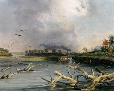
Snags (sunken trees) on the Missouri; by Karl Bodmer c. 1839–1840 (source).
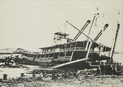
Wrecked steamboat on the Missouri; USACE.
Even after trains and trucks largely replaced boats for transport, the Missouri remained a dangerous river. Large floods were common, causing widespread damage to communities and farmland. But times have changed; the Missouri has been tamed. Between 1933 and 1963, six large dams were built on the river in South Dakota, North Dakota and eastern Montana, providing flood control, irrigation water, hydroelectric power and recreation. About 75% of the river's length in the Dakotas is now reservoir water (Johnson 2022).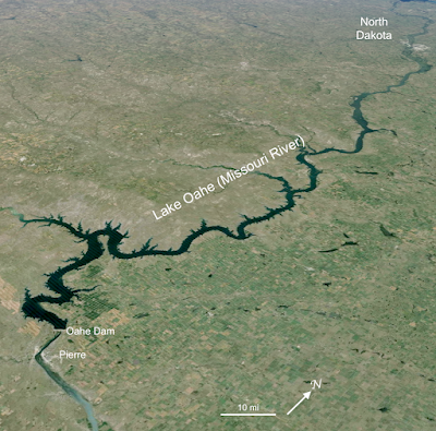
In terms of storage capacity Lake Oahe is the largest reservoir on the Missouri. From Oahe Dam near Pierre, SD it extends upstream 100+ miles as the crow flies (modified from Google Earth).
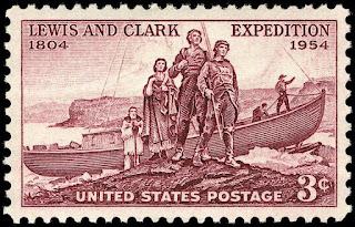
Lewis and Clark Expedition, 150th anniversary issue, 1954 (source).
On a hot day near the end of my trip, I walked four miles sometimes shaded by cottonwoods but usually not and often accompanied by dust and flies, and stood on the bank of a free-flowing stretch of the Missouri River. Why? Because the Missouri means more to me than I first thought.Memories had been surfacing of a little girl and her younger brother playing Lewis and Clark long ago. Those legendary explorers had struggled up the Missouri, enduring summer heat and mosquitos, surviving winter cold and food shortages, all the while not knowing what lay ahead, what discoveries awaited! Lewis and Clark captured our imaginations, and for me they still do. We lived far from the Missouri then, but now I had a chance to travel where they had traveled, to see the great river flowing as they had.
I started from the parking lot of the Adams Homestead and Nature Preserve north of the Missouri River in the southeast corner of South Dakota. The route followed dirt roads and was well signed. You can tag along on this aerial photo (modified from Google Earth).
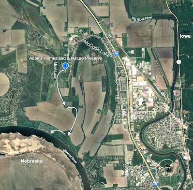 Early on we passed Mud Lake, the remains of a meander in the Missouri River before it was tamed (3), and continued past fields being tilled. Then there was a handy rest stop, with a water tub that my field assistant enjoyed in spite of all the flies on her ears (a photo would have been rude). I tried rubbing mosquito repellant on her head—it worked!
A short distance further we reached a viewing platform on the bank of the mighty Missouri.
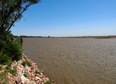
View downstream. One of the Missouri's nicknames is Big Muddy because its sediment load is huge! (4)
As directed, I looked across the Missouri into Nebraska. Much of the river's broad valley bottom is cultivated but this area looked abandoned, in both the photo below and the previous Google Earth view.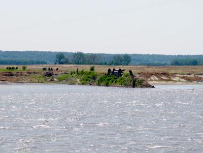
Looking south into Nebraska. The forest in the distance is the valley wall.
Artsy abstract photo for my memory collection :)
Once home I opened the Map of Lewis and Clark's Track, Across the Western Portion of North America to locate the spot where I had visited the free-flowing Missouri. The Corps of Discovery traveled this stretch in late August 1804 after burying Sergeant Charles Floyd, the only death on the expedition (perhaps due to a ruptured appendix). His grave is labeled on the map—Floyds Grave.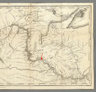
From Map of Lewis and Clark's Track. Floyds Grave is right of arrow tip marking my visit (click image to enlarge). Courtesy David Rumsey Map Collection.
Notes
(1) For more about the raging flood vs. glaciers debate and Nicollet's involvement, see Mssr. Nicollet & I consider Glacial Theory and Glacial Beauty in South Dakota.
(2) At their confluence, the Missouri River is longer than the Mississippi River (upstream). By convention the longer river retains its name. Why did the Missouri lose out to the Mississippi? See discussion here.
(3) Nearby McCook Lake also is an abandoned meander but is older, being shown on a map dated 1895. Perhaps it's a natural one.
(4) Construction of dams and levees drastically reduced the amount of sediment carried by the Missouri River, to 1% of what it had been (Johnson 2022). Even so, it continues to deliver more than half the silt emptied into the Gulf of Mexico! (more here)
Sources (in addition to links in post)
Flint, RF. 1955. Pleistocene geology of eastern South Dakota. Geol. Surv. Prof. Paper 262.
Gries, JP. 1996. Roadside Geology of South Dakota. Mountain Press Publ. Co.
Johnson, WC. 2022. The Missouri River. Chapter 10 in Johnson & Knight 2022.
Johnson, WC, and Knight, DH. 2022. Ecology of Dakota Landscapes; past, present, and future. Yale University Press.
Nelson, Mike. 2014, Jan 29. Geology: eastern South Dakota in CSMS Geology Post. I also thank Mike for directing me to Flint's 1955 paper.
Nicolett, JN. 1843. Report intended to illustrate a map of the hydrographical basin of the upper Mississippi river. US Senate, 28th Congress, 2nd session, no. 237. BHL
Warren, GK. 1869. General considerations regarding the physical features of these rivers: US Army, Corps of Engineers, Rept. Chief of Engineers, 1868, p. 307-314. Full report online. (Conflicting years are puzzling but real.)
