MAIN VISITS
SAN SEBASTIAN DE LA GOMERA
Plaza of the Americas
Constitution Square
Casa de la Aguada (traditional Canarian house, Mon-Sat 9-13:30, 15:30-18, Sun 10-13)
Church of Our Lady of the Assumption
Ermita de San Sebastian
Columbus House (pre-Columbian ceramics, Mon-Fri 10-13, 16-18:30, Sat 10-13)
Earl's Tower (military architecture, Mon-Fri 10-13)
Hermigua
Church and convent of Santo Domingo
Church of the Incarnation
 El Cedro (around Hermigua)
Boca del Chorro (waterfall)
Shrine of Our Lady of Lourdes
Agulo & Lepe Church of San Marcos
Vallehermoso Constitution Square
Church of San Juan Bautista
Around Vallehermoso Roque Cano
Castillo del Mar (old banana plantation, Tue-Sun 11-dusk)
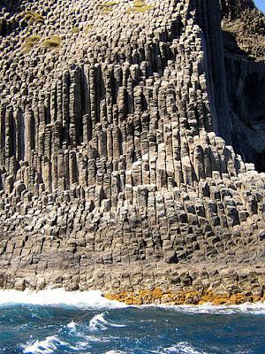
Los Órganos (cliff of basalt columns, by boat from Valle Gran Rey and Playa Santiago)
Panoramic road between Vallehermoso and Alojera
Tazo & Argamul Tazo: palm plantations
Argamul: village
Garajonay National Park
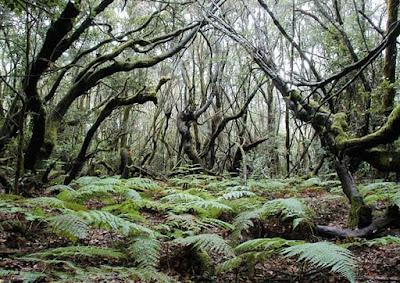 Alto de Garajonay (mountain pass, cross winds, horizontal rain)
Visitor Center Juego de Bolas (9:30 to 16:30)
The Laguna Verde (picnic area)
Chipude (Church of the Candelaria)
El Cercado (ceramic)
Road to San Sebastian from Playa Santiago through Las Toscas
Alajeró Church of the Savior
Drago
Valle Gran Rey Mirador César Manrique
Ermita de San Antonio
TREKKING ROUTES
LAGUNA GRANDE I
- Difficulty: Easy
- Duration: 20 minutes
- Length: 0.9 Km
- Elevation: 20 m.
- Self-guided: With panels
- Connections: track at the Fence
This comfortable and short circular route is suitable for all visitors. This is one of the most frequented paths due to its location on the main recreational area of the Park, La Laguna Grande. In this short trip you can visit a forest type called fayalbrezal characteristic of the south drier side of Park with the ground covered with moss.
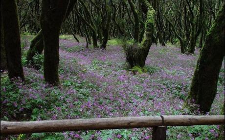
In late April and early May, precious tapestries of flowers brighten the way. It has a balcony to enjoy the Cherelepi Fortress, volcanic dome covered with vegetation. This route is equipped with interpretive panels that explain some of the values found in the course.
- Difficulty: Easy
- Duration: 20 minutes
- Length: 0.8 km
- Elevation: 20 m.
- Self-guided: Yes
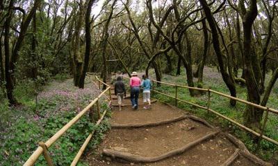
This short route enables us to get into the fayalbrezal, forest type characteristic of the southern slopes of the park less favored by the fog. On his way areas are noted in varying degrees of conservation, which can help us to understand the effects of different human activities in the forest, grazing, charcoal burning. Reaches the edge of the central plateau of the island from where you can see a nice view of its west coast, highly recommended, especially before sunset.
LAS CRECES
- Difficulty: Easy
- Duration: 1 hour 30 min.
- Length: 4.2 km
- Elevation: 100 m
- Self-guided: Yes
- Connections: paths to Arure, Las Hayas, Raso de la Bruma and Vallehermoso
This is a delicious recommended route for all types of visitors that allows us to visit a fayalbrezal with precious tapestries highlighting the canary geranium in spring. It is also possible to see laurel in the south of the Park, located at the bottom of the stream. In the very bottom of the gorge still keeps a small section of old stresm leading a small trickle of water from its source to the next villages and shows us the importance of forests as a producer of water. The area has a small recreational area that is frequented by locals on weekends and during the summer.
BEACHES
San Sebastian de la Gomera:
Guancha Beach
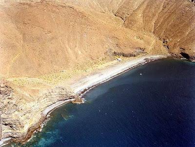
Cabrito Beach Secluded beach, virgin, 450 x 40 m. stones, moderate swell, low occupation, surrounded by a farm with cultivation in terraces and steep hills with little vegetation, away from people, does not have any services. Access: By boat from the port of San Sebastian relatively near or more away from Playa de Santiago. GPS Coordinates: 28 º3'45 .61 "N - 17 ° 8'38 .08" W
Red Beach Secluded beach, virgin, 350 x 10 m. stones, moderate swell, low occupation, surrounded by steep mountains with little vegetation, away from people, does not have any services. Access: By boat from the port of SanSebastian relatively near Playa de Santiago or more away. GPS Coordinates: 28 º 3'20 .88 "N - 17 ° 9'1 .76" W
Guincho beach Secluded beach, virgin, 150 x 45 m. stones, moderate swell, low occupation, surrounded by steep mountainswith little vegetation, away from people, does not have any services. Access: By boat from the port of SanSebastian relatively near Playa de Santiago or more away. GPS Coordinates: 28 º 2'56 .00 "N - 17 ° 9'33 .84" W
Laguna de Santiago:
Suarez Beach
Secluded beach, virgin, 100 x 20 m. gravel and stones, moderate swell, low occupation, surrounded by steep mountains with little vegetation, away from people, does not have any services. Access: By boat from the relatively nearby Playa de Santiago or the Port of San Sebastián something further away. GPS Coordinates: 28 º 2'35 .12 "N - 17 º 10'0 .88" W
Chinguarime Beach Secluded beach, virgin, 570 x 25 m. stones, moderate swell, low occupation, surrounded by steep mountains with little vegetation, away from people, does not have any services. Access: Difficult terrain type drive from the town of Laguna de Santiago take a dirt road, 3.5 km. approximately Tapahuga signposted and Middle Beach, near the latter there is a path to walk 2 km. rugged terrain to reach the beach. GPS Coordinates: 28 º 2'19 .28 "N - 17 º 10'37 .16" W Middle Beach
Secluded beach, virgin, 250 x 30 m. stones, moderate swell, average occupancy, surrounded by steep mountains with little vegetation, away from people, does not have any services. Access: Difficult terrain type drive from the town of Laguna de Santiago take a dirt road, 3.5 km. approximately Tapahuga signposted and Middle Beaches, follow the signs until you reach near the beach. GPS Coordinates: 28 º 2'15 .14 "N - 17 º 10'51 .74" W
Tapahuga Beach Unspoiled beach, 250 x 40 m. gravel and stones, moderate swell, average occupancy, surrounded by fields of crops and mountains with little vegetation, away from people, does not have any services. Access: Difficult terrain type drive from the town of Laguna de Santiago take a dirt road, 3.5 km. approximately Tapahuga signposted and Middle Beach, passing through the orchards towards the sea will reach the beach. GPS Coordinates: 28 ° 2'5 .93 "N - 17 º 10'59 .99" W
Valle Gran Rey:
Argaga Beach
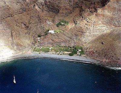
Semi-urbanized beach, 150 x 10 m. medium grain black sand, moderate waves, average occupancy, located at the mouth of the Barranco del Valle Gran Rey, surrounded by high and steep basalt cliffs with little vegetation, close to Puerto Spins, features restaurants, telephones, beach cleaning and paper . Access: To get from San Sebastian is to take the road that crosses the centre of the National Park and take a deflection Garajonay well marked that leads to the ravine of Valle Gran Rey, pass by small towns, to access the canyon is to descend its north side by a road with a significant slope, once down can be accessed Argaga Beaches, Round, La Calera and English with relative ease parking in close proximity to them. GPS Coordinates: 28 º 4'56 .71 "N - 17 º 19'57 .07" W
La Calera Beach Semi-urbanized beach, 1,000 x 22 m. medium grain black sand and stones, moderate swell, high occupancy, located at the mouth of the Barranco del Valle Gran Rey, surrounded by high and steep basalt cliffs with little vegetation, relatively close to the tourist resorts La Puntilla and La Playa, has restaurants , telephone, beach cleaning and paper. Access: To get from San Sebastian is to take the road that crosses the centre of the National Park and take a deflection Garajonay well marked that leads to the Barranco del Valle Gran Rey, pass by small towns, to access the canyon is to descend its north side by a road with a significant slope, once down can be accessed Argaga Beaches, Round, La Calera and English with relative ease parking in close proximity to them. Del Ingles Beach
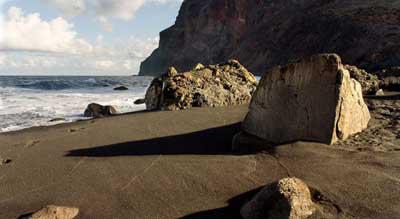
La Caleta de Hermigua
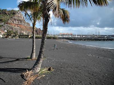
The Arena Playa de la Arena is located south of the municipality of Vallehermoso, in southwestern island of La Gomera, right next to beach and port Argaga Turns on the border with the municipality of Valle Gran Rey.Playa of Arenaslocated in a somewhat rustic and secluded. The sand on this beach is black volcanic in origin, usually has a moderate swell. How to go: If you rent a car we can go to the Port of turns, and from there we walk to the beach itself is just Sands Beach Argaga below.
ACCOMMODATION San Sebastián de La Gomera
- Hotel Garajonay 2* www.hotelgarajonay.es
- Hotel Villa Gomera 2* www.hotelvillagomera.com
- Hotel Torre del Conde 3* www.hoteltorredelconde.com
- Villa El Liriazo 75€ www.vallehermoso.de/en/liriazo
- Parador Nacional Conde de la Gomera 4* 103€ www.parador.es
- Hotel El Cabrito 2* 86€ www.elcabrito.es
- Apartamentos Bellavista Apt. 41€ www.bellavistagomera.com
- Apartamentos Chijere Apt. 52€ www.chijere.com
Hermigua
- Hotel Villa de Hermigua 46€ www.gomeraturismo.com
- Ibo Alfaro 56€ www.ecoturismocanarias.com/iboalfaro
- Apartamentos Jardín La Punta www.residencial-la-punta.com
- Apartamentos Los Telares Apt. 37€ www.apartamentosgomera.com
- Hotel Rural Tamahuche 54€ www.hoteltamahuche.com
- Hotel Triana 42€ www.trianahotel.com
- Apartamentos Tapahuga Apt. 43€ www.tapahuga.com
- Apartamentos Santa Ana Apt. 42€ www.gomerarural.com
- El Paso Suites Hotel 4* www.elpasohs.com
- Hotel Jardín Tecina 4* 105 € www.jardin-tecina.com
- Hotel Gran Rey 3* 79€ www.hotel-granrey.com
- Apartamentos Las Mozas apartamentoslasmozas.com
- Apartamentos Laurisilva 73€ www.solvasa.com
- Apartamentos Tres Palmeras 68€ www.trespalmeras.com
- Apartamentos Baja del Secreto 56€ www.bajadelsecreto.com
- Hotel Jardín Concha 1* www.hotelconcha.net
- Apartamentos Jardín del Conde www.jardindelconde.com
- Apartamentos Paraíso del Conde www.paraisodelconde.com
- Apartamentos Los Tarajales www.tarajales.net
- Apartamentos Charco del Conde 40€ www.charcodelconde.com
- Apartamentos Chijere 65€ www.chijere.com
- Jardín Las Hayas 52€ www.efigenianatural.com
