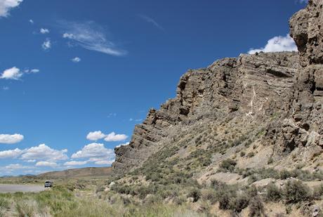
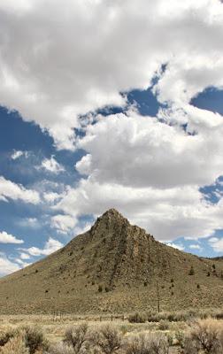
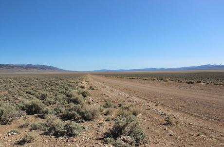
 "I begin to think the Great Basin, like many other great things in this world, a great humbug ... very interesting to the geologist and geographer, but dreadfully wearisome to the traveler, as we can attest." Cornelia Ferris, 1853
In his wonderful book, The Broken Land, geologist Frank DeCourten begins Chapter 1 by asking why and where we find beauty in nature. Why do the "vistas of sagebrush and mahogany-colored mountains" of the Great Basin that he finds so "thrilling" bore or even repel most travelers? Perhaps it is as Thoreau says—there is only "as much beauty visible in the landscape as we are prepared to appreciate ...".
DeCourten goes further, asserting that beauty and its appreciation will increase with a deeper understanding of the landscape. I agree. With each visit to the Great Basin, the landscape becomes more engaging and grand as my "geological enlightenment" grows.
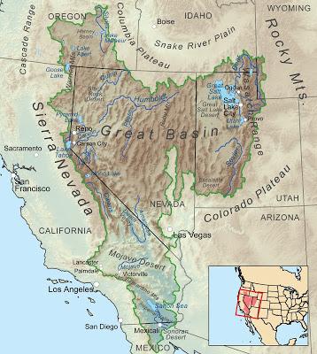
The Great Basin; note the many "caterpillars" lined up southwest to northeast (by Kmusser).
It was a more recent DeCourten book that inspired my latest trip to the Great Basin—Roadside Geology of Nevada, coauthored with Norma Biggar (2017). Actually this was a second try, after a trip two years ago was aborted due to snow and more snow. This time the weather cooperated marvelously, and I spent two weeks in a geological wonderland with much that was beautiful. Just look!
The Devils Gate Limestone, beautifully exposed along Highway 50, formed from sediments deposited 370 million years ago in shallow water just off Laurentia (North America). At that time the continent was smaller, the west coast located in today's Utah. Millions of years later, the horizontal beds were tilted and then revealed by erosion ... lucky for us!
Devils Gate west of Eureka.
About ten miles north of Devils Gate, near Tyrone Gap, I was stopped in my tracks by more tilted beds, these approaching vertical! The rock is silicified conglomerate dating from 300 million years ago—once-horizontal beds of sediment eroded off the Antler highlands (mountains now long gone).
Steeply-tilted conglomerate of the Garden Valley Formation.
Nevada's accreted terranes were a new experience for me—further enlightenment :) These are chunks of crust that rafted in from somewhere and were plastered onto the continent, extending North America west by hundreds of miles. Chalk Mountain (not chalk but dolomite) was carried here on the Paradise terrane, which arrived sometime in the Mesozoic (the dolomite has been dated as late Triassic).
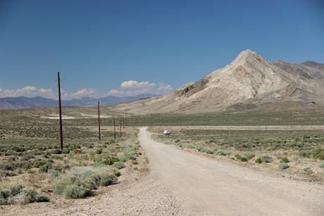
Chalk Mountain (actually dolomite) ended up here from parts unknown.
On the heels of the Paradise terrane came the Sand Springs terrane, mostly deep water sedimentary rock (shale) that was metamorphosed to slate and phyllite. The platy rocks shone and sparkled in the sunshine, which I enjoyed immensely! But my camera had trouble capturing their darkness. It did better with my souvenir.
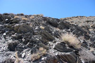
Phyllite outcrops just west of Sand Springs Pass on Highway 50.
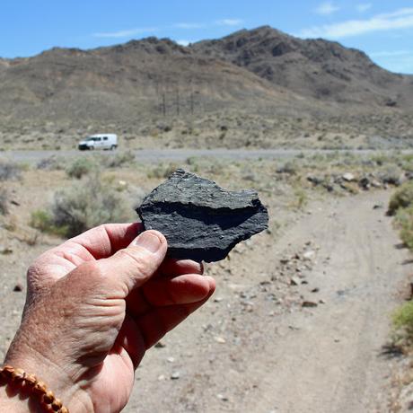
The Pine Nut terrane is easily accessed via Highway 338—a bit out of the way but worth the trip! At Milepost 6, it squeezes between two large Pine Nut outcrops. There's room to park and not much traffic. These were once volcanic rocks of a marine island arc, metamorphosed during accretion probably. Among my souvenirs is a beautiful rock whose contortions testify to its mysterious but exciting past.
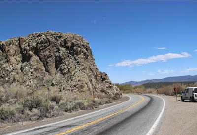
Pine Nut terrane 6 miles east of California.
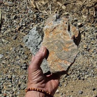
The rock on the right is my favorite currently.
Many of the outcrops I saw were volcanic, products of huge violent eruptions that took place during an episode of volcanism lasting 25 million years. Viscous magma exploded from giant calderas, covering the land in thousands of feet of ash so hot that it was welded into rock. It was Hell, right here on Earth!
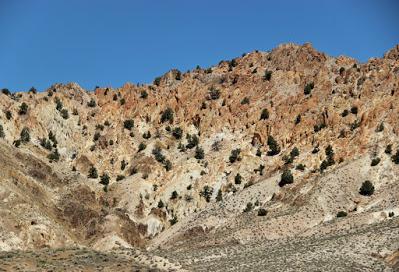
Tuff erupted 28-25 million years ago; now beautifully eroded and exposed in Gabbs Valley Range.
On top of all this craziness, the continent here is undergoing extension. For reasons still debated, the Great Basin is being stretched, and Nevada is now nearly twice as wide as it was 30 million years ago. In the process, basins drop and mountain ranges rise (creating the caterpillars in the Great Basin map above).
This stretching and buckling hasn't stopped. Just 67 years ago, a magnitude 7.2 earthquake boosted Fairview Peak 7–20 vertical ft; the ground moved 3–13 ft horizontally as well. A beautiful fault scarp is clearly visible from the gravel road along the base.
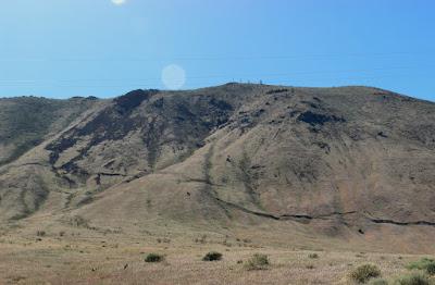
Fairview Peak earthquake fault scarp.
As a summary, I offer this final photo. Ash flow tuff exploded from a caldera 32 million years ago now frames the distant Toiyabe Mountains, where Paleozoic metamorphosed marine sediments intruded by Mesozoic granitics are rising as the land continues to stretch. Yes, there is beauty in Great Basin ... lots of it!
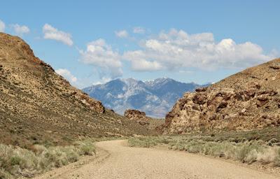
View west across the Big Smoky Valley, from the mouth of Northumberland Canyon.
Sources
DeCourten, F. 2003. The Broken Land; adventures in Great Basin geology.
DeCourten, F. and Biggar, N. 2017. Roadside Geology of Nevada.
Ferris, Cornelia. 1853. From Ferris & Ferris 1856, The Mormons at Home: With Some Incidents of Travel from Missouri to California, 1852-3. In a series of letters.
