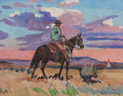
On the Outlaws Trail by Sharon Bodily. Available at Western Art Association Auction Art.
“I tell ya Tom ... there was a time when these hills were all in grass, rich and lush and filled with flowers in the summer. Deer and cattle grew fat, there was plenty for all. Then came the farmers. They fenced, they plowed, they built houses, roads and towns. I miss the old times. They were wild, there were outlaws, a man had to fend for himself ... but at least he was free.”There’s a kind of grassland in eastern Washington and adjacent Idaho called Palouse Prairie, growing on rolling hills of windblown silt called loess. Where the loess came from is debated. Perhaps it was deposited by dust storms during an arid windy interglacial period (Allen et al. 2012). In any case, the loess forms a thick blanket up to 250 feet thick on top of basalt bedrock (Bjornstad 2006) over an area of many hundreds of square miles.
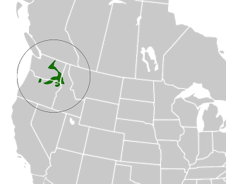
The Palouse (pah-LOOS); from Wikimedia Commons.
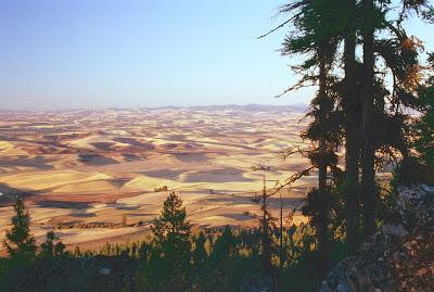
Today's Palouse Prairie in the fall. Source.
Loess soils are deep and fertile and ideal for grasses. That’s why the Palouse has largely disappeared -- most of it was plowed and planted with domestic grass (wheat) in the late 1800s. Like so many North American grasslands on fertile soils, Palouse Prairie is now an endangered ecosystem (Looney and Eigenbrode 2012).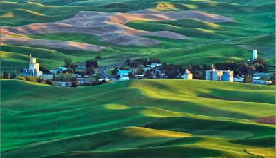
Photo by Anne McKinnell from her 8 types of Light ebook (recommended!); used with permission.
But farmers were not the only factor in destruction of the Palouse. There was a time even further back when not only grassland was destroyed but the loess as well. It was a different time, colder, snowier, with herds of giant beasts roaming the prairie -- caribou, mammoths, long-haired bison, camels. The rolling grasslands extended uninterrupted for as far as a mammoth or perhaps a hunter could see. This was during the last glacial advance, at the time of the great floods.If you’ve been following this series of posts, you know that 15,000 to 18,000 years ago 1) a lobe of the Cordilleran ice sheet extended as far south as Sand Point, Idaho; 2) it impounded a lake of gigantic proportions -- Glacial Lake Missoula; 3) it repeatedly failed; 4) some of the resulting floods were massive, swift and destructive at a scale hard to imagine. Water hundreds of feet deep roared across eastern Washington at speeds of up to 60 or even 80 miles per hour, traveling some 500 miles to the Pacific coast in only two or three days!This much water traveling at these speeds is powerful enough to scrape, scour and carry away plants, soil and dirt all the way down to bedrock. An estimated 16,000 square miles were ravaged, producing mosaics of grassland and scabland, best appreciated from the air.
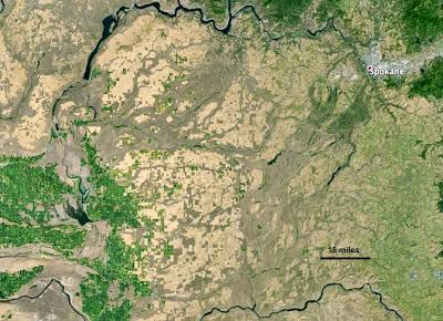
Anastomosing channels of the scablands; from Google Earth, click photo for better view.
The braided, anastomosing patterns of exposed basalt are highly suggestive of flooding. Channels split then reunite, very different from familiar drainages where smaller streams consistently join to make larger ones flowing downstream. The pattern of scabland channels looks very much like “water seeking its way over fresh terrain” in the absence of established drainages (Allen et al. 2012), for example when a creek flows across constantly refreshed sand to the sea. These patterns are easy to see from the air, but they were first recognized as flood topography before aerial photos were available, by geologist J Harlan Bretz (1923). At that time, a catastrophe at such a scale was quite a conceptual leap, and many years passed before others accepted his explanation.You can experience the mosaic of loess and basalt by driving across eastern Washington. At first the wheat fields seem unending, but then dark objects appear low on the horizon, becoming scattered pines on rough black rock. Then it’s back to wheat fields -- the Palouse of today.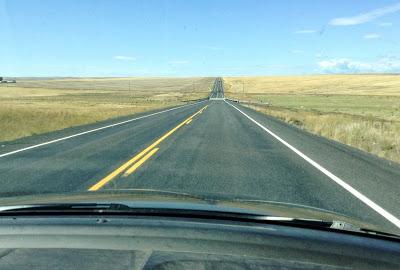 After all the wheat, we were excited by our first scabland experience, though it was pretty tame compared with what came later!
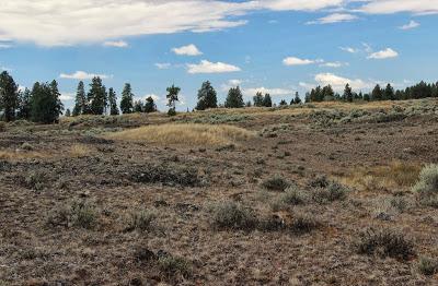
Scabland in the Telford tract off Interstate 90. Once/if our government shutdown ends, you can google Telford Washington BLM for more information.
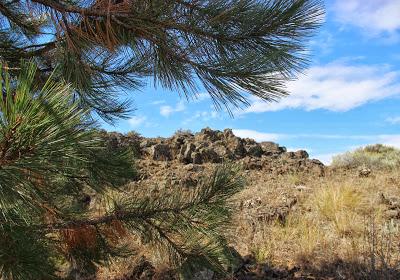
Ponderosa pine in scabland.
Sources
Allen, JE, Burns, M, and Burns, S. 2009. Cataclysms on the Columbia. Portland State University, Ooligan Press.
Bjornstad, B. 2006. On the trail of the ice age floods. Sandpoint, ID: Keokee Books.Bretz, JH. 1923. The Channeled Scabland of the Columbia Plateau. J Geol 31:617-649.
Looney, C, and Eigenbrode, SD. 2012. Characteristics and distribution of Palouse Prairie remnants. Nat Areas J 32:75-84.