'I swayed my leaves and flowers in the sun; Now may I wither into the truth'
I must say, it's quite nice to finally be free of the Great Ocean Walk. Talk about a long haul. Let it be said, it's always easier to hike these things than write about them. The problem with spending two stinkin' months collating a saga is time has stopped on the blog, but the walking has continued at full throttle with a resultant literary logjam. Actually, when I come to think of it, there have been so many strolls lately, I've no idea what happened. Mentally, they've all melded into one long sweat/lost things- fest and it will take a perusal of photos to differentiate between any of them.
Anyway, where do we go from here? What unique and fantastic place will I bang on about now the coast has been left behind? Well, that's easy. I'm turning my attention to a brand new area, which isn't, as I've visited and written about the place approximately 75 times. Lerderderg Gorge.
I must say, getting down and 'dergy (I just made that up. Any good?) can be quite traumatic. As a bushwalking location, I classify it as grim. Being a gorge, all the crap from the top ends up at the bottom, so a nice, casual jaunt along the river usually involves praying to your imaginary Jesus you're not going to give yourself a compound fracture of the ankle. If not on the river, there are steep hills and stuff. Hills I can handle, but it's the stuff, which can be problematic.
At home I've got a half-baked map (actually it's a fully baked, black and white A4 print out) in which I've been diligently marking off all the tracks I've walked within the gorge. Most seem to be done, but there was a bit of a monster, which was un-highlighted. Byers Back Track. Supposedly it's one of the most popular walks in the place. I can understand why, as for the most part it's flat and anything level in that hellish place is a rarity. I had a reason for putting it on the back burner. It's a one way job and I'm definitely a circuit bloke.
What happens if I walk 10 km from O'Briens Crossing to the sleepy hamlet of Blackwood? Do I just turn around and walk back like a chump? Should I make some friends, just so they can pick me up at the end and taxi me back to the starting point? Do I hitchhike from Blackwood and hope Ivan Milat's stunt double doesn't pick me up? Do I just buy a house at the destination, so essentially I'm walking home? Do I bring a ·38 and conclude the stroll with a bang? Do I bring the ·38 and when the serial killer picks me up, I turn the tables by knocking him off? I bet you didn't see that one coming, did you?
Damn, as they were all good ideas, choosing the right one was hard. In the end, I put them all into a sweat stained hat and drew one out. Luckily for the serial killer, the one I chose was 'walk back like a chump'. Mind you, it wasn't going to be too horrific (yeah right) as I could follow a few other unexplored tracks back to the start. How was I going to do this? Well, help was at hand, as all I had to do was turn to Glenn 'Earl of Exhaustion' Tempest's book, Daywalks Around Victoria. All the answers to my feeble questions were there in a day hike with the mind melting name of 'Blackwood Walk'. Surely there hasn't been a more succinct title?
Unfortunately, it meant at least a 21 km day and with the short winter hours, an early start was required. Not unless I wanted to walk in the dark, along an ankle-snapping river, risking head injuries if I fell, not to mention something a lot more serious. A svelte figure like me would be really hungry once the sun has gone down.
So, I set the alarm, bounded out of bed and enabled full Hoover mode for breakfast, before smashing through the back door, as I had no time to be stuffing around opening it. Overnight though, a strange event had happened. It'd rained. If you're like me, you'd wonder what this strange wet stuff is, as it's rarely sighted these days.
In relation to the walk, what would be the consequences of this rare event? Umm... None. What it did mean was when I hit the unsealed O'Briens Road, it had been turned into a bit of a muddy, slick mess. I must admit, it's just not the same, sliding a front wheel drive car compared to a rear wheel drive one. I mean, getting the hands all crossed over, but with the back not sliding, is just no fun at all.
Anyway, I gave it a good go, by shouting 'yeehaa', whilst channelling my inner Ari Vatanen and arrived at O'Briens Crossing in reasonable time. I was also glad of the early start, as I looked at my watch. 11.40 am. After staring at the ticking dial, I turned to the sky and began performing a series of mental calculations with my internal abacus. "Right... 22 km... probably 3 km per hour... sunset just after 5... following this... pitch black in quick time... FUCK ME SWINGING (FMS)... I'M GOING TO HAVE TO SPRINT".
Donning the pack, I arrived at the starting point, which just so happened to be half a meter from my parked car. In fact, I don't think I could have parked any closer, as upon opening the door and stepping out, I was on the track, which happened to be a staircase.
Really, all great walks start with a set of stairs. Gripping the graffiti covered handrail, I looked up into the heavens and at the end of wet, slippery timber steps sat the universal shrine to the desperate. A comfort station.

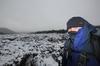
Putting my head down, I ascended at a rapid pace and after about 10 feet found myself gasping for air. It wasn't a good start. Dying due to oxygen debt was the least of my worries though. The main thing was, how in such a grim environment can I make my photos look nice?
An overcast sky wasn't helping, as it left the landscape quite featureless and drab. Not to mention the whole landscape is a little... umm... featureless and drab. I would have to pull out all my photographic stops and the best way to start was spend an inordinate amount of time looking for fungi. Really, summer can get stuffed, as winter usually provides the best fungi amongst the trees. From the start it was promising.

Once past the starting summit, I found myself stretching out into a decent stride. Motoring along the old, flat water-race, I felt like I needed a moniker. You know, something like 'Scott of the Antarctic'. How about, 'Wide Load of the Back Track'? Yeah okay, it's not great, but it's only a first draft. Let me work on it a bit.
Anyway, amongst all this wandering wondering, some strange things were happening. First of all, a whistle was sighted in the middle of the track. It made me think. If lost, a whistle is used to summon help, but what happens if the whistle itself is lost? How can it be found if there are no lips to puff the pea? Mentally, I wasn't sure if this thought process was existential or just plain annoying.
Upon examination, it looked like a reasonable model. Normally, a find like this would be transferred into the stores department for future use under the fiasco umbrella of equipment. The trouble is it's a whistle and who knows whose diseased, bubonic plagued lips have been attached to it over the years. I'm not sure I could put it to my mouth and take the risk, so if it's yours, get in touch.

As I walked and engaged in whistle whimsy, suddenly something more disturbing was sighted on the track. An abandoned naked baby. Right, it may have been bright yellow and made of jelly, but it was a baby nonetheless. That's not all. It was the first of about a dozen mixed jellies spaced along the track.

Did some punter have a dodgy pocket and their sugary delights were slowly being leaked whilst walking, or were they were being left at intervals for backtracking later in the day on the Back Track? Maybe they were vital for energy and without them, they would now hit the wall? If so, would they need a whistle to sing for help? Thanks baby. I now had the lollies and the distress signal, so I was right.
Striding out again (Lard Arse of the Lerderderg? Mm... I'll keep at it) I was soon passing classic Australian bush. Huge eucalypt trees hugged the track...

...whilst banksia flowers were a little more discreet.

Not so this sizeable grass tree...

...or the long strips of bark strewn across the track.

Also, surely within a forest there's not a more traditional sight than a destroyed information sign? I shouldn't complain. At least it wasn't full of bullet holes.

On some fungi, the overnight rain had created small pools of water.

Oh yeah, these places also have evocative names. I strolled through Break Neck Gully and passed Deadmans Track. I didn't want to spend too long at Head on a Stick Valley and finally Jack Kevorkian Ravine was not the place to stop whilst feeling weary.
Speaking of gruesome, quite a few fallen trees lay about. I really, really think something like this landing on your head would hurt.

You know what? Everything said about Byers Back Track was correct. It's probably the easiest few hours I'd walked in months. Flat as a tack, although this is not exactly correct. It's gradually downhill all the way to Blackwood and the easy going gave me a chance to examine, not just the fungi, but signs.
Come to think of it, I may a sign fetish. Yeah, unlike my spray-on lederhosen, signs are not the most kinky of things. Maybe. Anyway, I seem to have gone nuts documenting the ones along the way. Maybe it's the weathered, moss covered look, which is the attraction? It's certainly not the information on them, as it appeared the distances were randomly made up...

...although maybe there was a mix-up between metric and imperial?

A piece of draped bark made this one quite photogenic...

...but don't panic, it wasn't all about the signs. There was more fungi. Of course.

I may have been ruing enormous branches landing on my head and the resultant change of my name from 'Big Greg' to 'Flat Greg', but others had attended to more important jobs. This large, fallen tree was no match for Leatherface and his trusty chainsaw, plus the track was now a breeze to negotiate.

The smooth sailing has to end sooner or later though, otherwise what's the point of this entire post? It's hard to keep interest when there's no pain or anguish. The change began when I hit a road at some place on the outskirts of Blackwood called Golden Point. A brief glance around and I decided it was beyond sleepy. Comatose is a better word for an outpost where the glory days of the gold rush had passed. By around 150 years.
The road wasn't too bad, especially when it dished up the best hairpin I'd seen for some time.

Oh yeah, don't forget, an area like this always seems to provide the following recipe. Rural road + isolated = abandoned car. It didn't take me long to find it.

Wandering along, I thought I'd take some notice of the real estate for sale. I must say, John the agent, might have had good intentions, but I assume he'd long given up trying to get a sale. This damp, dingy piece of overgrown land would be a tough sell. The worn, faded sign was purely for show, as no bastard is going to buy this one.

The locals were nowhere to be seen, but I took note of their plea. They like to keep their wishes simple.

After the initial steep climb at O'Briens Crossing, Byers Back Track had been one, long casual descent from the very start, but now I was back to river level. A large rock pool was of interest, but I didn't think I could get a decent photo on the day, so I went ahead into the future to take the next picture. Last weekend, it looked far better than a few weeks back. Except for the power lines.

It was quite peaceful, but I was only half-way, so there was no chance to stop and ponder. I began the slow climb up to Blackwood...

...and arrived to find it no different to the hustle and bustle of Golden Point. I must say, I don't think I saw anyone? From hitting the bitumen, I felt like I was in a Twilight Zone episode.
There's a pub in Blackwood, which apparently is popular, but I didn't stop. Wandering past this car, I wondered if this was the official Blackwood leaf collector? Then again, maybe he was just unlucky in parking under a particularly, vigorous leaf shedding tree. Mind you, if he was alive of course and hadn't been taken away by aliens.

Leaving the leaf mobile behind, I strolled on...

...before turning into another deserted thoroughfare.

I passed the Whitehouse...

...before reaching an old water race, where the roads were to be left behind and bushwalking would begin again. Oh, it appears to be shut.

I eyed off the sign for about 0.8 seconds, which I believe is my new record, before promptly ignoring it and walking on past. It's pretty rare to walk in Victoria on a track which is actually open, so I've long given up obeying these signs.
I'm not sure what the problem was either, but I was soon making my way downhill to the Mineral Springs Reserve. Naturally, there's a spring to drink from, but the niceties of a well groomed park was not what I wanted. I was there to do a bushwalk. Luckily for me, they keep things simple in Blackwood, as a fairly direct sign pointed me in the right direction.

What was next? Well, it was actually getting a bit late in the afternoon and I was trying to get my speed up again. The fungi kept distracting me though, as I noted this one with a fallen friend...

...and another attached to a rock...

...whilst this one had a reasonable swimming pool on its lid.

Oh, I almost forgot. My next target was Shaws Lake, which was only a short distance away, but there was a bit of decision making with the signs. One arrow pointed to the lake via the 'Hard Hills' and the other by following 'Sweets Lookout'. Mm... 'Hard Hills'? Well, that doesn't sound very nice, does it? Luckily for me, GT's walk notes sent me via Sweets Lookout and with such a lovely name, I'm sure it would be a more leisurely stroll. Right? Wrong.
After a bit of walking, I realised what was in store when I came across an arrow, which pointed to the stratosphere and commenced a sharp climb to Not So Sweet Lookout...

...following a ridge, which continued to open out in front of me...

...whilst I marvelled at its vertical-ness...

...before arriving at the Piss Off You're Definitely Not Sweet Lookout. I celebrated the climb, by admiring the open patch of dirt, where the lookout had once stood, but had long been dismantled.

Why would they do this? I'll tell you why. It's because all the trees have grown around it and your view is of precisely nothing. Unless it's trees you want to look at and really, you don't have to climb a hill to see those.
Oh well, on I marched and in quick time I was at the remarkably reflective Shaws Lake...

...where some late afternoon sun and deep blue skies were giving me the chance to slip into 'arty-wanker' mode with the camera.

There's no rest for the larger gent though, as now it was getting to, 'better get running or will be dark along the river' time. Powering past the lake, I was soon heading up another North Blackwood Road...

...before reaching my route home. Tunnel Point Track would lead me all the way back down to Lerderderg River, so off I raced. Did anyone feel a mild earth tremor a few weeks back? If you did, I know the cause. It was me, as the wide, slightly descending track caused me to do something I haven't done in decades. I jogged. It was quite a sight and although I wasn't moving as freely as Abebe Biklia, I did motor along at a respectable clip.
There was not much to see either, so keeping the camera under wraps helped my pace. Okay, I admit I took some photos. This blocked off piece of track had some of the blackest water in it I'd ever seen...

...and I quite liked the new growth on this tree.

The rare ramshead branched eucalypt was interesting...

...before I made a rapid, steep descent to the river.
Wow. I'd been to the Tunnel before...

The Tunnel, Lerderderg River
...but the surrounds were looking a lot different on this occasion. Actually, the last time I really explored the Lerderderg river, it was late winter and the water was flowing nicely. I lost count of the times I walked down or across in thigh deep water. On this occasion, the vast expanse of dry riverbed took me by surprise. It's probably like this every year, but I must say I prefer its watery look.
Oh, what's the Tunnel? Ye olde miners blasted a hole through a rocky wall in order to reroute the river. It's no big deal, just an example of mining changing a natural landscape.
Anyway, light was fading fast, as I considered my options. Head back up to Byers Back Track and retrace my steps from earlier in the day for a few kilometres or tackle the river, which was shorter, but potentially fraught with difficulty? There may have been no water, but the possibility of going arse up onto rocks was still a consideration.

Lerderderg River. Minus the river bit.
I pondered for a moment before deciding the river was worth a go, as I was prepared to risk compound fractures instead of walking on a track I'd already strolled on earlier.
Heading off, it was reasonably easy going, with sections of sandy riverbed...

...before I turned a few bends and came across the odd rock pool.

The black rocks along the river are lethally slippery, so my progress was slow and I needed to make a decision.
I'd reached Ambler Lane and from the previous trip to the Tunnel, I seem to remember the way ahead was on a rough track heading off up a hillside, before plummeting back to the river and O'Briens Crossing. The trouble is, I couldn't remember if I needed to climb up the gorge. Was the riverbed too hard to negotiate through this next section, even with little water? I can't recall what I did last week, let alone a couple of years ago, so I elected to call it quits and make for Byers Back Track.
Heading up Amblers Lane...

...I made a mental note never to walk it again. It's quite steep and by the end of the day, I'd had a gutful. Light was more or less gone and by the time I reached Byers Back Track, it was headlamp time. Except I couldn't be bothered getting it out, so I gingerly continued on until finally the descent back to the car. I must say, that little downhill section nearly killed me, as I slipped and slid on wet rocks and leaves. Don't even mention the stairs.
So, that's it. Talk about a day of running around. You know what's funny? The walk notes suggest six hours and it took me 20 minutes more. I've no idea how one keeps to those time limits, as I didn't even stop for lunch.
Anyway, another series of Lerderderg tracks walked and duly have been highlighted on my piss-poor map. I'm also giving the new Garmin Connect bizzo a go again. They changed the look and generally corrupted all the stuff I'd previously uploaded. As a lifelong user of Garmin though, I was prepared for this and always back up GPX files. If you leave them solely for Garmin to look after, you've got no chance. Here's my route of the day. Let's display it for the time being as a bit of a test...
I've no idea why it creates such an enormous block of whiteness around the file? Look at it. It's as if I've tabbed down a hundred lines to begin this sentence, but when looking at the HTML, I'm actually writing directly after the embedded map. Hey Garmin, have you ever tested any of this crap or are you using blokes like me as beta crash test dummies?
Before leaving, have you noticed how the writing style in the one post can vary? This is because I started writing on Monday and have only finished now, late on Friday night. I've picked up a cold in the meantime and frankly, I've had it with this entry.
Until next time...