Hiking apps help you find your way as you walk through the wilderness. If you happen to hike in an unfamiliar area, you don’t have to feel lost and confused when you use one of the best hiking apps available. Thanks to the rapid advancement in technology, there are many hiking apps that allow you to locate unfamiliar destinations.
You are able to make the most of your hiking trip when you have an app installed on your smartphone. These apps come with different helpful features. Some of them also work well without the data. They track your workout and let you know how much distance you have covered.
We have compiled for you a list of the best hiking apps, which will add to your experience of adventurous hiking trip without the worry of getting lost on your way.
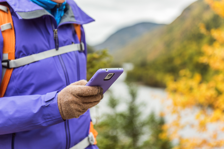
1. Gaia GPS (iOS, Android)
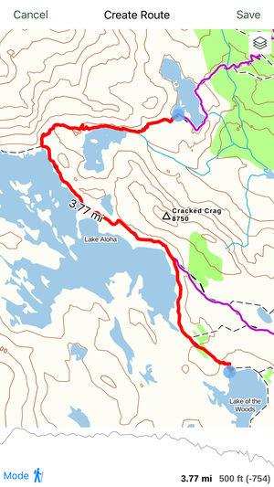
No matter where you plan to go for your hiking trip, GAIA GPS is your companion. You can search for different hiking parks and explore different areas while you are traveling in an unfamiliar place. Whether you are climbing the mountains or walking in the woods, GAIA GPS tracks your hiking activity. You can also share your hiking photos with your friends.
This app allows you to effortlessly keep a backup of your hiking data and memorable photos that you take on the trip. This app is free for you to download, however, the best features of the app can only be used if you upgrade to the premium level membership.
2. Map My Hike GPS Hiking (iOS, Android)

MAPMYHIKE GPS Hiking is an amazing navigation app. This app not only makes it possible for you to discover new and exciting hiking routes, but it also allows you to track your food intake.
This is a perfect app for android and IOS users who want an app to track their weight loss.
This app also comes with the feature of letting you share your hiking experience with your friends and other hikers. In this way, you are able to keep yourself motivated and active.
3. AllTrails (iOS, Android)
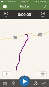
Moreover, for your comfort and convenience, it comes with amazing features which let you find your way while hiking in a new place. ALL TRIALS comes with the ability to map and track around 50,000 trails. You need to have a strong internet connection to take full advantage of this app.
Furthermore, it allows you to get connected with new hikers and share your hiking experiences. You can also view pictures of hurdles on the trial taken by other users. You can give trail tips to new hikers to make hiking more enjoyable for them.
4. ViewRanger (iOS, Android)
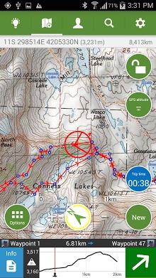
This application offers you live statistics of distance and time. You can track your hiking route. This app allows you to track around 9 million lakes, peaks, and locations worldwide. You don’t need conventional paper maps when you have the VIEWRANGER app on your smartphone.
When it comes to connecting with your friends, VIEWRANGER serves your purpose effectively. You can even share your location with your friends and family privately.
5. Weather Live (iOS, Android)

One of the best things about this app is the live weather scenes that show in the background. The app provides highly functional and important information regarding the wind direction and speed, along with humidity, visibility, precipitation, and pressure. All of this information is extremely important when it comes to planning a hiking trip because being well prepared can mean the difference between life and death out on unknown terrain. The app further provides information about rain patterns all over the globe.
Its best feature perhaps is the animated weather radar. This radar is remarkable and allows the user to gain precise information and then to prepare for the changing weather conditions that are approaching.
6. OS MapFinder (iOS, Android)
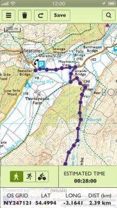
The app allows its users to access the Landranger maps brought about by Ordnance Survey. These maps are of the highest quality and have the highest available resolution. Through this app, the user can purchase and then download these maps and then plan out their trip down to the smallest detail.
The app allows you to download the maps so that you can use them offline. In addition to all these features, the app further provides the trail marking and tracking features that other apps provide as well. The maps, however, are incredible.
7. National Parks by Chimani (iOS, Android)
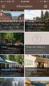
What’s more is that it produces a very immersive experience and is something of an exploratory game. You get points for every unit you visit and you can even earn different badges for every park you visit. It makes outdoor exploration fun and challenging. The app includes a gallery of pictures that are beautiful and provide remarkable information about potential places to explore.
The units include memorials, national parks, monuments, historic sites, seashores, parkways, old battlefields, and much more. The app allows access to a GPS-enabled map that works perfectly without a cell or WiFi connection. The app also provides a professionally voiced 45-minute automated tour.
8. Peak Finder (iOS, Android)

Peak finder is an app developed for mountaineers and people who want to explore. The app holds information on over 350,000 peaks in the world. You just need to hold your camera up to the view and the app gives you information about the landscapes. If you are near a mountain you don’t know, the app will give you all the information about it.
With the inclusion of panoramic technology, the app is able to show a 360-degree view of the landscape. The app itself is a great way to learn and explore as it gives hikers and mountaineers easy access to many mountains. The app can be used offline too so if you’re in the middle of the mountains or in a valley or just sitting home planning to make the next trip you can look up different mountains and start exploring.
The app can also provide images of peaks in the range of 300km/200mil. It uses a compass and motion sensors, and there are weekly updates on the peak directory. The app costs $3.99.
9. Google Maps Offline (iOS, Android)

Google map offers mapping system, satellite imagery, 360-degree panoramic views of streets, route planning and even tells you the traffic condition.
Google Maps is available for Android and IOS operating systems. With an extensive list of features, Google Maps stands as the most prominent navigation app in the business. It has a lot of features that help users in their everyday task like giving easy audio directions. After the offline feature becomes available to people, Google Maps will give other navigation apps a run for their money.
10. First Aid (iOS, Android)
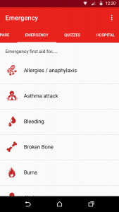
Different emergencies like bleeding, concussions, asthma attacks and others that require quick medical care and it can take time for professional help to arrive so this app helps give quick answers and directions on how to take care of the situation. You’ll also get safety tips for the whole thing, from hurricane to earthquakes, tornadoes and other weather conditions. It provides advice on what precautions need to be taken in natural disasters.
All the content and information on the app is preloaded so this app works offline. With interactive quizzes, you can enhance your knowledge and earn bandages and learn life-saving information. The app provides easy access to 911 and poison control.
Conclusion
Hiking Apps are quite helpful in planning an adventure. You can use their free versions before deciding to buy these apps to enjoy their full features. You can see how far you have hiked your route and track your route easily.
These apps also give you effective offline features. You can see the maps downloaded even when you don’t have access to the internet. They give you accurate terrain information with great attention to detail. You can see the mountains, hills, and valleys clearly.
What are you waiting for? Download the app that best suits your needs and begin exploring the hiking trails with your friends and family.

