We actually have yet to experience a named storm aboard Totem. That could change soon.
How do you avoid hurricanes?
Our primary tactic has been “don’t be there” in a very big picture way, by avoiding the zone of risk for hurricanes during the active season. In the South Pacific, that meant getting to a higher (more southerly) latitude as the season began: we sailed to Australia. In Southeast Asia, like most cruisers we remained equatorial, plus/minus a few degrees; this region is not subject to any cyclones. Crossing the Indian Ocean, we choose a route and timing that worked with the seasons, starting in the northern hemisphere in February (the risk diminishes in December) and arriving in the southern hemisphere later in the year (months before the regional season starts in December).
But here in the Caribbean, which doesn’t seem as scary as, say, launching out into the Pacific or Indian Oceans, we have actually placed ourselves at greater risk of severe weather than any time in the last nine years of cruising.
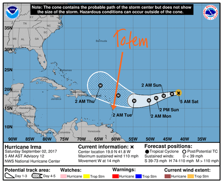
Latest in the series of “here we are near the hurricane” images – this morning’s NOAA update
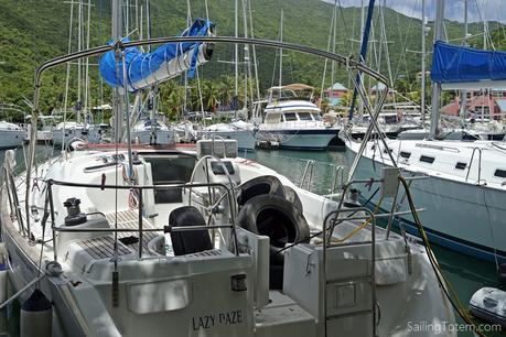
Tortola, BVIs: car tires, aka hurricane fenders, grace the cockpit of a few boats in Nanny Cay
Only been upon return to North America, where we’ve now been for over a year, has experiencing a hurricane presented a meaningful (probable) risk. For all the well-meaning folks who worry about our exposure to storms at sea, I wonder if knowing that the bigger danger for us is closer to “home” in North America.

NOAA data for monthly incidence of tropical storms and hurricanes. It’s peak season NOW.
Staying on top of changes in the weather is always a priority: weather rules our lives. It could be perceived as hubris to be out playing chicken with hurricanes. Against nature, we are the chicken! But WE have resources, truly amazing resources, to help make better decisions. A system forms in the Atlantic, as it did when we were in the BVIs. Our first instinct was to dash south. Taking measure of timing and options lead to a different decision. We stayed put, suffered through 20 knots gusts and almost enough rain rinse the decks.
Here’s a rundown of our go-to resources, and a number of others to check out.
Primary resources
National Hurricane Center / NOAA. NHC is the place to start. They have the resources, the staff, the historical data. They offer depth of tools, from visual snapshots of hurricane advisories to regionalized text forecasts. While we tend to start the day with a look at the Atlantic page, it’s useful for text forecasts.
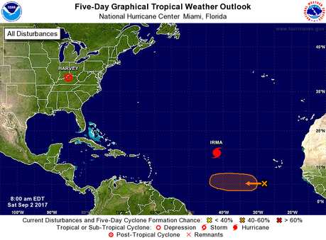
NOAA outlook for this morning – Saturday 2 Sept
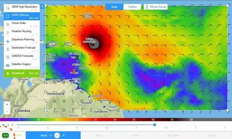
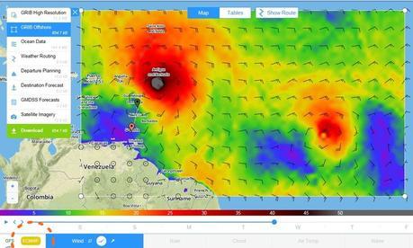
PredictWind. Our go-to choice for weather information around the world, not just in the Caribbean. It’s PredictWind’s Offshore app on a laptop that’s currently helping us compare models for the as-yet-unnamed system following Irma; one which sometimes looks to be a bigger risk, depending on the model. It’s very helpful to readily compare four different models (including GFS and ECMWF, and two additional with PredictWind algorithms layered on top) to see how a path is being projected.
It can be significant: below are snapshots of the same time, with Irma’s projected position. Totem’s current location, in Martinique, is the green pin; the red pin is Grenada.We can sail there overnight if necessary. The GFS model (top image) shows nothing following, but European model (bottom) shows a worrisome tag-along-maybe-named-Jose forming.
Meteorologists / hobbyists
When bigger picture shows a system is brewing, we start looking for details; deeper analysis and information. These sites organize information from a variety of sources and present them in a digestible matter.
Mike’s Weather Page. Mike aggregates a lot of information into a single view. The graphical nature of the page makes it easy to scan to see the latest in model formation and direction. His website name, spaghettimodels.com, reflects the “spaghetti” look from multiple tracks modeled for the path of a weather system – humor always appreciated! OF course, the graphical nature means the website can a little tough to load if you have a sub-par internet connection. Thankfully, we usually have “good enough” internet in the Caribbean… or if we don’t, it’s within close range. His Facebook page often has a good snapshot combining multiple models into one more downloadable graphic, like today’s:
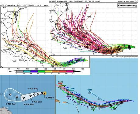
Mike’s Weather Page aggregate image sample from 1 September.
Tropical Tidbits. Levi is a graduate meteorology student at Florida State, and shares Atlantic tropical forecast tracks and discussion on his site. If you use Twitter, he offers more prolific and sometimes entertaining commentary—like this two-part tweet yesterday morning:
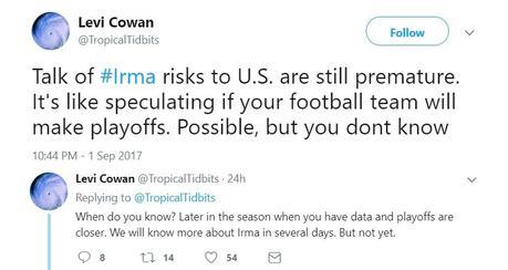
This made me giggle-snort.
Professional weather services
It’s nuts how cruisers will spiral into weather analysis. Paying for professional weather information is affordable, smart, and the safest choice you can make when you’re not expert. Relying on the interpretation of the boat next to you isn’t! These two get a nod.
Chris Parker. Justifiably famous in the cruising community, Chris Parker truly understands both the weather AND cruisers. He’s focused on North America/ Atlantic, delivering analysis and guidance over the SSB (free) via newsletter updates (paid). Beyond just weather, he provides weather-based routing services via 1:1 email or text to InReach.
Crown Weather. Rob Lightroom’s service aggregates multi-source information for free on his site, like others listed here; he also offers comprehensive analysis for paying subscribers by email. The summaries of conditions and forecast are impressive, and interesting to read as he shares details that help make your own capabilities better by discussing known behaviors or biases in different models.
We’re not regular subscribers of these—the prior sources are our go-to. But these are the pros we’d recommend, and have had enough exposure to their paid services to appreciate the quality of what they provide, and this summary would feel remiss without a mention.
Meanwhile, here in Martinique, we are busy having a reunion with our good friends: Utopia II last seen in Cape Town, South Africa.
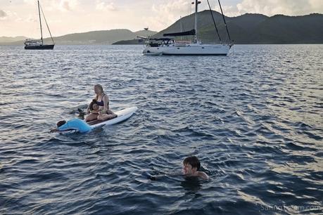
Sweet reunion with Utopia II
Other resources
I took a quick poll from other cruising friends in the Caribbean to see what’s useful for them, since everyone gravitates differently.
My friend Carolyn from The Boat Galley has spent many seasons cruising Florida and the Bahamas “in the zone” during hurricane season. Her post on favorite weather apps is a good reference for mobile options and more. Favorites include two I didn’t know, Storm (free), and Hurricane Tracker (paid) – her discussion on those, two others, and why she likes them is an interesting and worthwhile read.
Windy comes up a lot: it’s very pretty, but usually seems to use juuuuust a little bit better bandwidth than beach-bar-quality-wifi provides. Better from the armchair or marina! Several people mentioned Marv’s Weather Service, and the Louisiana Hurricane Center, via Facebook page and www.trackthetropics.com. Friends brought up a couple of sites based on French Antilles islands: I wouldn’t have naturally gravitated to non-English resources but updates on Facebook are conveniently translated automatically! Guadeloupe-based Meteo des Cyclones is quick to post system updates; from Martinique, Météo Tropicale has analysis. Good text forecasts are gold (you’re getting the meteorologist’s interpretation!), and my friend Sue—who is aboard her boat in Puerto Rico—reminded me that the National Weather Service staff in San Juan offer good analysis for PR and the region. (Thank you to Sophie, Wendy, Kimberliegh, Sue and Katia!)
We’re generally spoiled with ‘good enough’ internet service in the Caribbean, but occasionally are limited to our IridiumGO (with SSB/Pactor as backup). Bonniw from Planes, boats and bicycles (SV & RV Odin) has a good post called Tracking Hurricanes that’s all about, well, tracking hurricanes – with a focus on low-bandwidth means. Her Tracking Hurricanes post is both a primer to the approach and a reference to weather products for Caribbean storms to request through Sailmail and Saildocs.
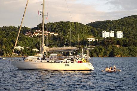
Kids busy playing How Many Teens Can Fit on a SUP? behind Totem
Watching and waiting
Remember the tweet from Levi near the top of the post? It cracked me up, because of course on Sept. 1 who knows which football team will make the playoffs! And of course a hurricane track which looks awfully convincing when splashed out in deep angry colors on a forecast is tempting to internalize as gospel. But there is one sure thing about the weather: it will change. Even now, what’s looming with Irma varies depending on still-disagreeing models. Expressions of concern are appreciated, truly. So is faith that just because we don’t immediately run from our current position means that we’re stuck in the known path of a major storm: we’re not.
Weather decisions are made cautiously and conservatively, and staying stationary doesn’t mean we’re gambling. It would be safer for us to be in Panama, or back in Saint Helena. Be assured though, this chicken likes to cross the road without risk of getting flattened. Imperfect, and amazingly insightful weather forecasts provided by meteorologist geeks get taken for granted. To the meteorologists and weather geeks of the world, we thank you for showing us when to cross the road.
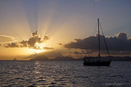
Sunset from St Anne, Martinique

