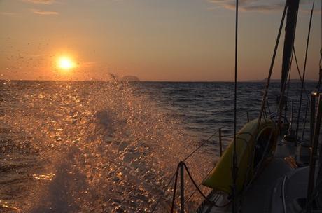

If you’re following along, you know we left Ascension Island a few day ago. Now, most of passages over time seem to top out around five days. We’ve had a few longer ones (especially in the Indian Ocean), but that’s pretty typical at the high end, and mostly they range closer to about three days.
This passage, from Ascension to Barbados, will take around three weeks. It’s about 3,000 nautical miles: slightly longer than our longest passage to date, from Puerto Vallarta, Mexico to Hiva Oa, French Polynesia, six years ago this month (time flies!).
Food: check. Books: check. Movies/podcasts: check. Weather: a little more involved than just scaling up! Why that duration matters in terms of weather in particular is that forecasts generally aren’t all that reliable after a few days out. With longer passages like this- well, there’s a reason they’re called weather “forecasts” and not “predictions” – because circumstances change! When you’re on a long stretch like this, of course, it’s pretty much guaranteed.

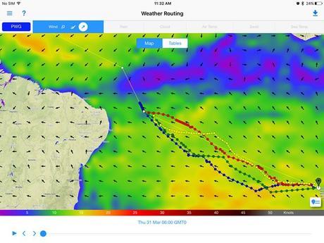
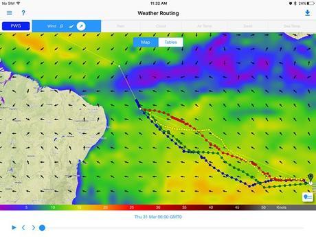
I really have no interest in tempting fate by being out of tune with weather. “Misery is optional” (or as my friend Lorraine would say “no pain, no pain”!) — why be uncomfortable if you can avoid it? Why take unnecessary risks? So we stay fastidiously in tune with the weather. Historically we’ve relied a lot on our HF radio for at-sea comms, from basic email and for weather info. But for more than a year now– since January 2014– we’ve relied increasingly on an Iridium GO. And as we left the African continent, we switched to rely almost completely on the Iridium and PredictWind (that’s PW’s Offshore app screenshot on an iPad at the top of this post). The latter switch has been partly by circumstance, because our Pactor modem packed it in and no longer allows us to send/receive mail via HF – the primary method we used the HF for weather.
You know what? We don’t miss it.
We’re getting everything via the GO instead. The last two passages– to St Helena, and then to Ascension–were downwind rhumb line passages where the main weather watch was just to be aware of bigger trends. Along the way, Offshore is fast and easy to incrementally updated weather information and routing recommendations–this app, on our iPad, is now the weather source we rely upon by far the most for passagemaking.
It’s going to be an interesting one, that takes more thinking than the “point and go” dead downwind runs in recent memory. See that big band of purply-blue in the top picture? That’s the ITCZ, where there’s pretty much NO wind. It moves and wiggles and meanders, and we want to get across it at the narrowest possible point. Traditionally, cruisers pick a waypoint to aim for based on historical information. but that could mean going through something like six degrees of latitude in the ITCZ, where you either have no wind (HOT, motoring, ick) or too much wind (squall city!). While we have a point in mind for crossing this zone, which will almost certainly be a dive to the north with the engine on, watching the trends will help us keep that motoring time to a minimum, and have a more comfortable and faster passage.
We’ll also use the GO for tasks previously relegated to the HF, like getting ocean current data via Saildocs (there’s a lot of current at play to make smart routing decisions between Ascension and Barbados). The routing function, which is especially helpful on passages like the one we’re embarked on, where the most efficient path is actually serpentine thanks to a mix of the equator / doldrums, ITCZ, and different currents and tradewinds.
We do still use the SSB for nets, and enjoy touching base with other cruisers. There’a a twice-daily informal net where we do a roll call for participating boats in the vicinity…”vicinity” being a thousand mile or so stretch, but who’s counting?! And it’s nice to have a live chat with friends off net times, too, where we can relay messages for a singlehander (who doesn’t have the ability to post his position) with his his loved ones at home.
While the nets are a welcome part of our day, there less useful for weather, except to see what the real-time conditions are for boats around us and think about how that differs from the forecast in terms of any weather shifts we should anticipate. But generally, the weather data is just repeating info we can get for ourselves, and in much more detail, via PW Offshore. In the South Atlantic, South Africa’s land-based SAMM net has been a great resource providing weather to cruisers on their roll call. Their biggest value to us, and a reason I hope ever to be without HF radio RX/TX, is support in the event of an emergency.
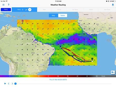
A bigger view of our passage ahead, showing start/end points. We’ve got a long way to go!

Totem is at sea! We’re headed for Barbados; you can see our current position and speed here. We will get comments while we’re underway, so add yours and consider it a welcome distraction to our day out in the South Atlantic. We’ll be able to respond after we reach the Caribbean and find real interwebs again.

