What are the best apps for sailing? What apps do cruisers actually use on their ipad / android to make life easier, safer, or more fun?
There are a lot of “best apps for sailing” type lists out there (I just looked. Trust me). Honestly? The first thing that strikes me after scanning a few is what the h*&# are those and who is actually using them?! And then I wonder, am I out of touch? (my nagging worry as a former gadget geek, tenured in the digital world). Or are most of those lists promotional placements (my cynical/marketing side kicking in)?
A lot of the gap between apps hyped in the top ten lists and what we use as active cruisers can be chalked up to how different our lives are than many who cruise closer to home. Our internet access is often poor quality or expensive, or simply not even available. We’re “out there”: crowdsourced apps that rely on volumes of submissions for data often won’t cover the corners that distance cruisers need.
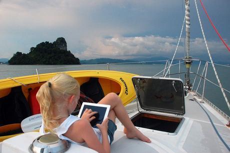
My intention here really isn’t to say what’s “best,” but to apply the cruiser filter and share what’s worked for us in three years of ipad use on board. To broaden the view from our personal favorites, I polled a few tech oriented cruising friends and got some great input from my tribe over at Women Who Sail. This post has focuses on nautical tools- the next post will cover more general tools that make life easier on a cruising boat.
Navigation
iNavx (with Navionics charts). This isn’t our primary navigation system- we rely first on OpenCPN, with CM93 charts, running on a computer down below. But iNavx is more than just a nice backup. Sometimes we’d rather have eyes on the charts from the cockpit, instead of ducking below deck. Other times we’ll find discrepancies in the charts: having two sources is handy…one is not consistenly better than the other. And iNavx connects to the NMEA 2000 network on board, the better to displays AIS data, uses our ship’s GPS and weather station data. Honeslty, we don’t begin to use the features of iNavx (grib file overlays!) …probably like a lot of other users.
Google Earth. GE has been extremely valuable for us for atoll navigation this year, and often had more useful nav data than what was on our charts. For real time navigation I prefer to overlay it in OpenCPN, but the app is still useful to scope out anchorage or snorkeling spots remotely or watch our live progress through an atoll pass.
We don’t have OvitalMap yet but this is top of my list of apps to try, thanks to a tip from Tucker of S/V Convivia. Tucker sets up a route in iNavx (you could use anything that exports a GPX file), exports the .gpx to Ovitalmap, then asks the app to grab every satellite image along that route at a specified range of zoom level. The app then caches these sat images so you can refer to it offline later. THIS IS HUGE. The process to get Google Earth views into KAP files we can overlay on OpenCPN is ridiculously time consuming. It requires a solid (and affordable) internet connection for an extended time. OvitalMap is a game changer, because it takes those hours (or days) of effort and turns it into a push-button activity. I see ‘inadequately surveyed’ or even just ‘unsurveyed’ on a number of spots in our African destinations coming up…this will help.
The nav apps I hear other cruisers using most are Navionics (primarily) and Garmin BlueCharts (distant second); a couple of others get mentions. The fundamentals of nav apps aren’t very different, so what’s important is that it’s comfortable for you to use: on the yacht Emerald, Nicola likes Plan2Nav because it’s easy for her to share route files with her Furuno system. For taking a hard look at the options, I like this article in Sail by Donald McLennan. It will get dated (this is from June 2014) in a space with change, but the criteria he uses to compare different nav apps holds true…just check with what the latest functionality is in the apps that feel right to you.

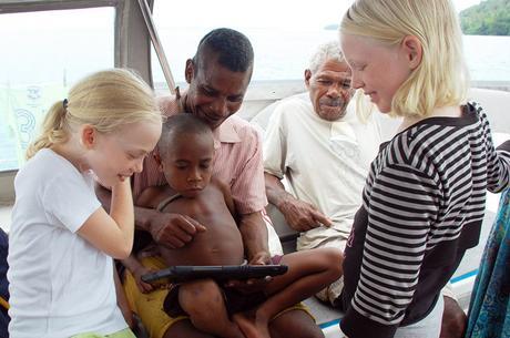
Best unexpected app? We used games like Fruit Ninja to make friends across languages.
Weather
Honestly- we use our laptop for weather info FAR more than we use our ipad, because the PC connects to our offshore communications tools (HF and Iridium GO!), and also because it offers more user control to analyze and interpret the information. But sometimes…a tablet is handy. And for some people, a tablet IS their onboard computer.
PredictWind – although you’ll more often find us using PW’s Offshore program on our laptop for serious weather watch or route planning.
RainAlarm – this is really useful in areas with frequent squalls IF (big if) there’s a local meterological service that the app can tap into. It was great in Malaysia and Thailand; it’s been useless since. But hearing from my tribe on Women Who Sail, some regional apps got raves- like MedeoConsult for European waters.
A popular weather watch tools used by cruising mates like Kim on Britican is PocketGrib, which reads grib files you can have sent through saildocs. Something we’d probably do on PC, but devices are nice. Living earth takes the prize for visually stunning display of weather information, but those gorgeous graphics come at a data cost, so we haven’t used it. Yet. I hear data is cheap in Madagascar…
Naughty stuff
That’s for nautical, silly!
Celestial – it is very, very ironic but we use an app to turn a sextant sights into a lat/long position. Yes. I know. But hey- it means still getting in practice with the sextant, right?
Star Walk – passage nights underway or in remote anchorages with stars so bright you can nearly read by them are one of the great joys of cruising. This app costs a few bucks but it’s stunning, easy to use (point your iPad at the sky!); learn about constellations, track satellites, or just pass time on night watch (Aimee and her girls on Terrapin like Night Sky).
Others are using:
Active Captain Companion. I love the concept of an interactive guide book- ESPECIALLY one that caches dt for offline ccess (win!). The problem is it’s very regional. If YOUR region has good data, awesome! That’s more than just the US/Carib; Mediterranean users commented that it’s useful in well-trafficked cruising grounds like the Balearics, but less helpful in others (like Greece).I’d pioneer entries in our area, but it’s hard to get motivated when internet access is expensive.
Animated Knots HD- the developer for this app is called Grog, so yes, I love it already. Sue uses it to learn new knots or practice what she already knows. Also mentioned: Knot Guide HD, which has a free version to try.
There are a number of anchor dragging utilities; on Banyan, Alexandra likes Anchor Alert; others use Drag Queen and Anchor Watch. We use an alert built into iNavx, when we feel it’s necessary, but conditions rarely tempt us to leave the ipad on all night…
Coming up in Part II: Marine science, communications, offline entertainment, and a smattering of other apps useful while cruising. Meanwhile, if you know a glaring omission that belongs here, let me know in the comments here or on our Facebook page!

