Society has exponentially become increasingly data driven, and modern technology combined with the rise of Internet use, has provided an increased capability to distribute large volumes of information on a vast array of subjects through many different platforms. All around us everyday, data is being collected and analyzed more and more as technology continues to advance and organizations realize the potential that data can provide.
Many Canadians make use of open data every day, without even realizing that they are, from using the GPS functionality on smartphones, to getting directions on a website that uses mapping software like Google Maps.
This new data driven society has pressured Governments to become more transparent, increase community engagement, enhance research and innovation, and facilitate opportunities for new businesses and services. As a result, Governments, and many independent organizations and agencies have started to provide free open access to their data sets. This method of sharing structured data that is machine-readable freely and republish as they wish without restrictions is known as open data. Open data can encompass a diverse range of information, including maps, traffic data, real estate listings, building permits, health data, and many other types.
In 2011, the Federal Government of Canada launched its Open Data Portal, to support the delivery of their data in machine-readable formats. Then in 2013, they launched a second-generation open data portal with improved functionality. After this many Provinces and Municipalities have gotten on-board with the open concept and now have their own data portals.
These days there are thousands of free data sets available on the Internet, however it can often be tricky to find the data that you are looking for, so we have dedicated part of our website with information to help the people locate Canadian Geographic information.
This page contains a dynamic growing list of place where you can download Nova Scotia related geospatial data (that either we have used / come across, or people have shared with us). If you know of freely available data sets that we have not included, then we would love for you to contact us and let us know about it, so that we can include it in the list.
The Province of Nova Scotia's Open Data Portal was launched in 2016 with an aim to make government data more publicly accessible to support transparency and openness, spur social and economic benefits of government data, and empower citizens and businesses to innovate and create with government data.
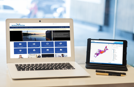
The Province of Nova Scotia's Open Data Portal is powered by the Socrata Open Data & Citizen Engagement Cloud application. This online application provides the geospatial community access to a wealth of data from a variety of different Government Departments, all accessible from one central location. https://data.NovaScotia.ca
The Nova Scotia open data portal contains several user guides and help videos for those that need a little assistance and a developers section with API tools, to help encourage people to create their own apps for the Nova Scotia geospatial community.
Open Data Contests in conjunction with International Open Data Day have also been held annually since the launch of the portal to help encourage people to develop innovative applications, visualizations, predictive models, or any creative solution using Nova Scotia open data.
The Nova Scotia data catalogue contains over 500 data sets, provided in a variety of different formats that can be downloaded directly from the data catalogue to use with GIS software or accessed directly within the online web mapping application (that can also be used to download data from). It also includes maps, charts, documents and links to data managed by other departments (but not served with the Socrata application).
LiDAR Data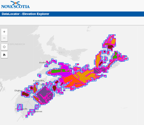

Among the data offered users can discover all kinds of data, from various statistical based data to the more traditional geospatial data. The Nova Scotia data catalogue even includes some LiDAR data sets. The Province provides public access to LiDAR covering most of the Province but you need to use another online tool to access it.
The application is called the Elevation Explorer provides the ability to download freely available LIDAR data and elevation derived products. Coverage includes more then half the Province, and continues to increase each year.
https://nsgi.novascotia.ca/datalocator/elevation/Top 5 Accessed Data Sets are (as of July 1, 2019):
- Municipal Property Tax Rates (10,229 views)
- Nova Scotia Government Pay Scales (8,984 views)
- Nova Scotia Government Employee Absenteeism (8,781 views)
- Birth Registrations (7,763 views as of July 1, 2019)
- Crime Statistics - Crime Severity Index (7,638 views)
Some of the more Traditional Geospatial Data available include:
Nova Scotia Road NetworkNova Scotia Road Network (NSRN) is a digital representation of all the roadways in Nova Scotia. The NSRN has several descriptive attributes to define a roadway such as number of lanes, surface type, and road class.
The NSRN is a networked data set complete with linear entities such as roadways as well as point entities such as junctions and blocked passages. The NSRN data conforms to the federal government's National Road Network (NRN) and is regularly uploaded as a contribution to the NRN.
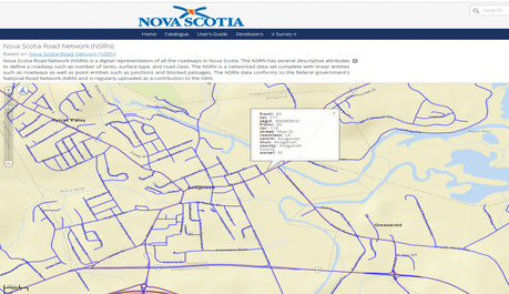
also available from https://open.canada.ca/data/en/dataset/caba16f1-0dd8-4db1-813b-c7bdd67122ef
Nova Scotia Hydrographic NetworkHydrographic Network (Water Features) is updated and maintained from aerial photography. Lakes, Rivers, Islands and many other features are collected and networked into a seamless relation data base. Toponyms are included in the attribute table for named hydrographic features. Hydrographic feature codes and their descriptions are provided with the download in a NSTDB feature code table.
https://data.novascotia.ca/Lands-Forests-and-Wildlife/Nova-Scotia-Topographic-Database-Water-Features/fpca-jrmt Nova Scotia Civic Address File - Civic PointsProvince wide data set of all physical locations which have been assigned a civic number by Municipalities and First Nations Communities.
https://data.novascotia.ca/Municipalities/Nova-Scotia-Civic-Address-File-Civic-Points/tntn-er5g Municipality, Town and Village BoundariesThis data set delineates the municipal boundaries for towns and district, county and regional municipalities, as well the village boundaries for Nova Scotia.
https://data.novascotia.ca/Municipalities/Municipality-and-Village-Boundaries/7bqh-hssn Nova Scotia GeoNAMESThe Nova Scotia GeoNAMES data set contains all current approved and official geographic names for the Province of Nova Scotia. The named features in the data set include Populated Places, Administrative Areas, Water and Terrain Features, Vegetation Areas, some Man-made Features, and Undersea Features.
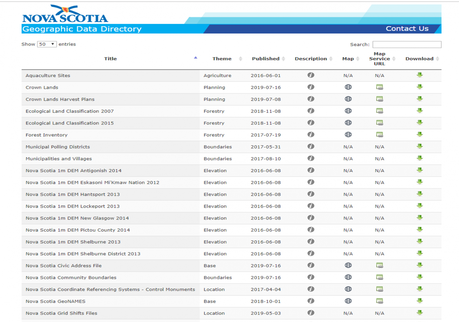
Geographic names in the Province of Nova Scotia are approved by the province's representative on the Geographical Names Board of Canada.
https://data.novascotia.ca/Internal-Government-Services/Nova-Scotia-GeoNAMES/xf3i-vxcb Crown LandA spatial data set of all Crown lands in Nova Scotia. Crown lands are all or any part of the land under the administration and control of the Minister of Natural Resources as per the Crown Lands Act.
https://data.novascotia.ca/Lands-Forests-and-Wildlife/Crown-Land/3nka-59nzNova Scotia Geospatial data sets can also be downloaded from this Provincial Government Geographic Data Directory Page (all listed within the open data portal) https://nsgi.novascotia.ca/gdd/ which also includes Web Map Service (WMS) links to various sets that have that option available.
Several data sets from a variety of niches featuring Nova Scotia geographies can be found within the Federal Government's Open Data Portal including the National Road Network, the National Hydro Network, and any data related to Federal Government Departments. For example Parks Canada provides statistics on Moose Abundance in the Cape Breton Highlands
The Federal Government's Open Data Portal also includes online mapping application to help view and print data, as well as APIs and several apps.
https://open.canada.ca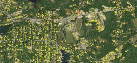
LiDAR Extracted Building Footprints
Natural Resources Canada provides LiDAR Extracted building footprints data sets for a variety of places across Canada to help support Government priorities such as emergency management, particularly for flood and earthquake risk analysis. WMS, Web Application and prepackaged FGDB and Shapefiles are available. Current coverage in Nova Scotia includes Lunenburg County.
https://open.canada.ca/data/en/dataset/7a5cda52-c7df-427f-9ced-26f19a8a64d6Canada Lands Data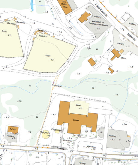

The Survey General Branch of Natural Resources Canada provides First Nations with orthophotography and topographic data to help land management of Canada Land s. Resolution of the orthophotography is 15cm, and topographic data sets are mapped at scales of 1:2000
All Reserves in MTM zone 4 were acquired in 2017, half the Reserves located in MTM zone 5 were acquired in 2019 with plans to fly the remaining ones.
Data can be found in compressed files in folders under the name of each Reserve ftp://ftp.nrcan.gc.ca/ess/sgb_pub/sgb_datasets/ns/
Topographic Data
Topographic Information used to create NTS topo maps can be downloaded either through the Geospatial Data Extraction tool (an interactive tool that allows you download data based on your specified AOI) or a direct link if you know what map sheet you are looking for. Data is provided in both vector and raster formats.
CanVec (vector format) contains more than 60 topographic features classes including: transport features, administrative features, hydrographic features, land features, manmade features, elevation, resource management features and toponymic features. CanVec can be used as a Web Map Service (WMS) with GIS applications to produce thematic maps.
geospatial data extraction tool https://maps.canada.ca/czs/index-en.html
http://ftp.geogratis.gc.ca/pub/nrcan_rncan/vector/canvec/ https://open.canada.ca/data/en/dataset/8ba2aa2a-7bb9-4448-b4d7-f164409fe056NTS Index https://open.canada.ca/data/en/dataset/055919c2-101e-4329-bfd7-1d0c333c0e62
CanMatrix and CanTopo collections (raster format) https://open.canada.ca/data/en/dataset/d248b5be-5887-4cfb-942f-d425d82e6ea9 or http://ftp.geogratis.gc.ca/pub/nrcan_rncan/raster/
Municipality of the County of Annapolis
The Municipality of the County of Annapolis has started using the thedatazone.ca website which uses the Socrata application to offer a similar open data portal as the Province is using. So far they only have a limited selection of municipal data sets available such as zoning areas, street lights and fire hydrants.
https://www.thedatazone.ca/browse?Municipal-Information_Municipality-Name=Municipality+of+the+County+of+AnnapolisCape Breton Regional Municipality (CBRM)
CBRM data sets are also available on thedatazone.ca website and have started to provide a limited selection of municipal data sets available such as Building Footprints, Electoral District Boundaries, and operating budgets.
https://www.thedatazone.ca/browse?Municipal-Information_Municipality-Name=Cape+Breton+Regional+Municipality+%28CBRM%29Cumberland County
The Municipality of Cumberland County is using the ArcGIS Open Data hub to provide access to a variety of various story maps, web apps, and raw geographic data available
https://data-cumberlandns.opendata.arcgis.com/Municipality of East Hants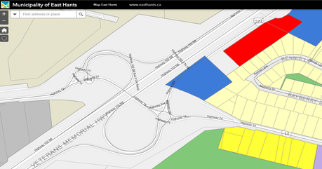

The Municipality of East Hants have developed an online portal to provide free access to help the public explore their growing geospatial data sets, as a commitment to improving citizen engagement and enhancing transparency.
http://newdata-easthants.opendata.arcgis.comThey also provide some of their data sets on the thedatazone.ca website.
https://www.thedatazone.ca/browse?Municipal-Information_Municipality-Name=District+of+East+HantsThe Municipality of East Hants also provide Interactive East Hants, an online mapping application that provides the public with an efficient and useful way to explore the geospatial data from the Municipality of East Hants (for people without access to GIS software).
http://easthants.maps.arcgis.com/home/index.htmlHalifax Regional Municipality (HRM)
The HRM open data Catalogue is powered by Esri's ArcGIS open data platform with enhanced API functionality for some geospatial data sets. It contains geospatial data related to civic addresses, buildings, streets, parks and recreation, LiDAR DEMS and much more. Using the API option, data from this site can be interfaced in other applications using the GeoServices REST or the GeoJSON specifications.
https://www.halifax.ca/home/open-dataThey also provide some of their data sets on the thedatazone.ca website.
https://www.thedatazone.ca/browse?Municipal-Information_Municipality-Name=Halifax+Regional+Municipality+%28HRM%29
Historic Nova Scotia from Above
Scanned Aerial Photographs from the 1931 Richard McCully Collection
https://novascotia.ca/archives/mccully/Historical Maps of Nova Scotia
Historical Maps of Nova Scotia contains hundreds of scanned historical maps of Nova Scotia stored within the Nova Scotia Archives collection dating back to the 1700s. https://novascotia.ca/archives/maps/
Ortho Imagery for Central Nova Scotia
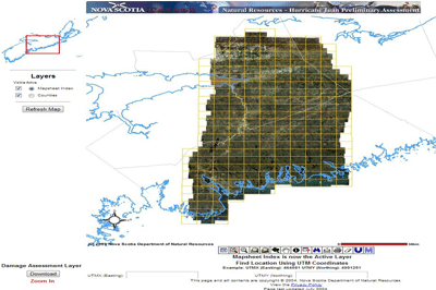
They also provide most of their data for public use https://novascotia.ca/natr/forestry/gis/downloads.asp)
https://novascotia.ca/natr/forestry/maps-and-forest-info.aspThe Nova Scotia Geoscience and Mines Branch provides a wide range of geoscience Data
https://novascotia.ca/natr/meb/download/gis-data-maps.aspRADARSAT Data
The Canadian Space Agency and the Canada Centre for Mapping and Earth Observation (CCMEO) have made RADARSAT-1 synthetic aperture radar images available to researchers, industry and the public at no cost. The 36,500 images are available through the Government of Canada's Earth Observation Data Management System (You do need to sign-up for a free account to get access).
https://www.eodms-sgdot.nrcan-rncan.gc.ca/index_en.jspSPOT
Spot 4/5 Orthoimages from 2005-2010 comprised of 5 spectral bands (1panchromatic with a pixel size of 10m, and 4 multispectral with a pixel size of 20m are available through the GeoBase program.
The main objective of the project was to produce a complete set of orthoimages covering all of Canada's landmass. Data can be downloaded through the Federal Government's Open Data Portal or through the ftp access link
http://ftp.geogratis.gc.ca/pub/nrcan_rncan/image/spot/geobase_orthoimages/Landsat 7 Images
Landsat 7 orthoimages comprised of 9 spectral bands (a panchromatic band with a pixel size of 15m, 6 multispectral bands with a pixel size of 30m and 2 thermal infrared bands with a ground resolution of 60m) are available.
http://ftp.geogratis.gc.ca/pub/nrcan_rncan/image/landsat_7/geobase_ortho/CanImage raster data files derived from Landsat 7 ortho-images composed of the 3 visible bands (bands 3, 2 and 1) are available.
http://ftp.geogratis.gc.ca/pub/nrcan_rncan/image/canimage/Nova Scotia Museum
Nova Scotia Museum provides access to their marine database that includes marine organisms, birds, mammals, and fish http://ipt.iobis.org/obiscanada/resource?r=nsm
Nova Scotia Soil Survey Data
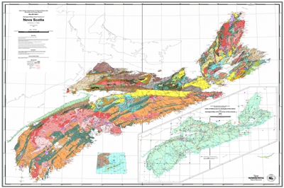
The detailed soil survey dataset series consists of geo-referenced soil polygons with links to attribute data
Statistics Canada
GeoSuite is a powerful search tool based on the 2016 Census standard geographic areas. With GeoSuite, users may retrieve and query data, explore the links between geographic areas, obtain information on those areas and output data in tabular format. The data available include the 2016 Census population counts, the 2016 Census dwelling counts, representative point coordinates, land area, geographic codes, names and, in some cases, the 2011 Census population counts (both final and adjusted).
https://www12.statcan.gc.ca/census-recensement/2011/geo/ref/geosuite-eng.cfm https://www150.statcan.gc.ca/n1/en/type/data?MM=1Atlantic Data Stream
The Atlantic DataStream is an open access platform for sharing information on freshwater health. It provides users access, visualize, and download full water quality datasets collected by various monitoring groups. https://atlanticdatastream.ca/#/search?sort=modified&active=false&zoom=7&lat=45.06576083729183&lng=-63.37450646535529
e.g. Pictou County Rivers Water Quality Monitoring https://atlanticdatastream.ca/#/dataset/a2ac7b8b-88cd-4d57-b691-30b04e13344d/
Higher Education
The Maritime Provinces Higher Education Commission provides access to aggregated data sets of enrolment and credentials granted data about Maritime Universities generated from the MPHEC Postsecondary Student Information Sytem database.
http://www.mphec.ca/research/maritimeuniversitystatistics/opendatadownloads.aspxPotential for Radon
Potential for Radon in Indoor Air - download digital Data Set used to create interactive map
https://novascotia.ca/natr/meb/download/dp486.aspHistorical Climate Database
The Canadian Centre for Climate Services provides access to historical weather, climate data, and related information. Temperature, precipitation, degree days, relative humidity, wind speed and direction, monthly summaries, averages, extremes and Climate Normals, are some of the information you will find here. http://climate.weather.gc.ca/index_e.html
National Water Data Archive: HYDAT
Hydrometric data are collected and compiled by Water Survey of Canada's eight regional offices. The information is housed in two centrally-managed databases: HYDEX and HYDAT. HYDEX is the relational database that contains inventory information on the various streamflow, water level, and sediment stations (both active and discontinued) in Canada. This database contains information about the stations themselves such as; location, equipment, and type(s) of data collected. HYDAT is a relational database that contains the actual computed data for the stations listed in HYDEX. These data include: daily and monthly means of flow, water levels and sediment concentrations (for sediment sites
https://www.canada.ca/en/environment-climate-change/services/water-overview/quantity/monitoring/survey/data-products-services/national-archive-hydat.htmlMapCruzin
MapCruzin website provides ArcGIS shapefiles of data derived from OpenStreetMap. OpenStreetMap is open data, licensed under the Open Data Commons Open Database License.
https://mapcruzin.com/free-canada-nova-scotia-arcgis-maps-shapefiles.htm