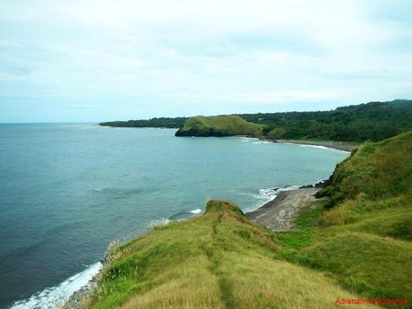
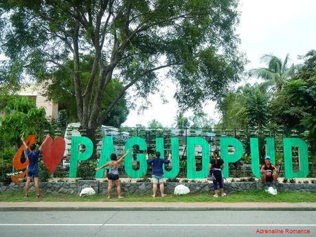
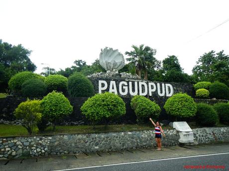
We love hushed, charming faraway towns. Their rustic charm and the pristine natural vistas around them never fail to reinvigorate our bodies, minds, and souls. The townsfolk’s way of life, practiced for generations and relatively uncontaminated by the complexities of city life, gives us a glimpse of rich tradition and simple grace. Their culture is a proof that simplicity and a relaxed pace of living can bring as much happiness as power and riches. One such place is the quiet coastal resort town of Pagudpud, Ilocos Norte, the northernmost settlement in the island of Luzon.
After a few hours of going around the stunning Kapurpurawan Rock Formation and looking up at the technological monoliths of the Burgos Wind Farm, we headed north to our last stop for the day, a sleepy resort town called Pagudpud. We reached the town at 5PM where we met Rain, our pretty guide.
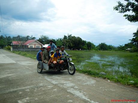
Rain’s place involved a short walk into the backroads to the coast. Flooded marshes, quiet homes, a group of farmers hitching a ride on a tricycle—these were all pleasant introductory scenes in Pagudpud. We long for places like Pagudpud, far away from city-laden noise, chaos, traffic, and pollution.
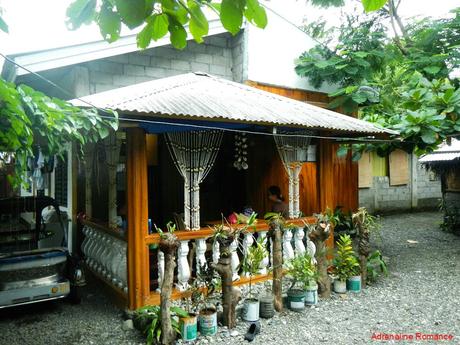
We arrived at Rain’s humble home where we will be staying for the night.
Staying in homestays is a must if you want to have a great travel experience. Rather than wallowing in uneasiness in the commercial-like atmosphere of a hotel or resort, spending a night or two in a local residence enables us to enjoy a warm and comfortable homey atmosphere. We listen to interesting tales, feast ourselves on cheap but delicious home-cooked meals, make friends with locals, and more.
Just in front of Rain’s home is a humble expanse of beach that faces the open sea. Check that out; we have a panoramic beach, a blissful atmosphere, and a comfortable bed for a very reasonable price.
The presence of small boats parked in the beach apparently suggests that this beach is a docking area for a fishing community.
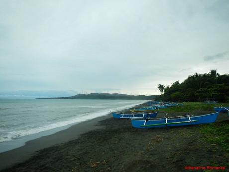
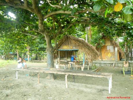
We felt our stress rapidly melt away, replaced with a soothing, refreshing, lazy feeling. Who wouldn’t feel that way? Just check out the photo below. Wouldn’t you be temped to just relax on those wooden benches or lie down in that open-air cottage while you listen to the song of the ocean? Breathe the salty sea breeze? Dig your feet in the sand?
Rain is quite lucky to be living here! Hehehe!
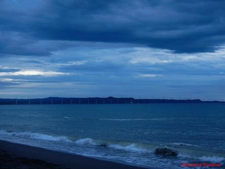
South of where we were, we could clearly see the famous Bangui Wind Farm, the first wind farm established in the Philippines. Many beautiful photos are taken there.
The turbines may look near, but Rain said, with much amusement at the thought of us hiking to the Bangui Wind farm, that it will take half a day to reach the shore of Bangui from where we were.
After discussing our itinerary for the next day, we decided to head out to the public market to buy some fresh fish, spices, vegetables, and other ingredients for our home-cooked dinner.
On the way back, we stopped by an unnamed but highly recommended place by our guide. Their specialty is a deliciously hot and spicy batchoy-based soup that both set fire and soothed our throats.

Early the next day a little after 6AM, we were off to our tour around Pagudpud. The day was a little bit overcast, and light rainfall poured the night before. But that didn’t dampen our spirits.
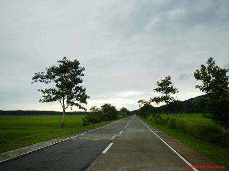
It is easy to see that, like many rural towns around the Philippines, agriculture is the lifeblood of Pagudpud. On our way to our first destination, we passed by large tracts of rice farms and several dragon fruit plantations.
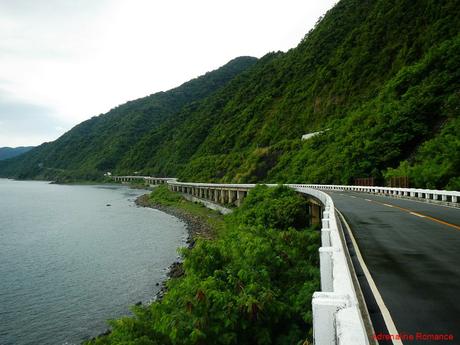
Patapat Viaduct
After a 20-minute tricycle ride, we arrived at our first destination—the Patapat Viaduct. Rising up 31 meters above sea level and snaking at a length of 1.3 kilometers, it is the fourth longest bridge in the country.
Opened to traffic in October 1986, the viaduct links Maharlika Highway in Laoag and the Cagayan Valley Region. And of course, it is a cool structure that offers visitors a picturesque vista of the surrounding areas.
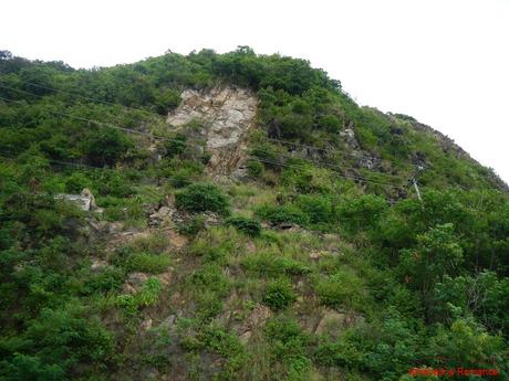
Before the Patapat Viaduct was built, buses, trucks, cars, and other vehicles had to cross a dangerous section of the Maharlika Highway on the high cliff above us. The danger of the cliff collapsing prompted the government to construct the Patapat Viaduct, which offers a much safer passage.
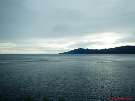
Northeast of the viaduct is Pasaleng Bay and beyond that is the Babuyan Channel. Aside from a barely perceptible small island in the distance, the immensity of this sea is simply overwhelming.
Pasaleng Bay and the Babuyan Channel are rich fishing grounds for the communities surrounding it. The bay is also known to be a migratory path for humpback whales that travel away from the cold waters of the northern Pacific Ocean during winter to the warmer waters of the south. Locals believe that the presence of these magnificent, giant marine mammals ushers a good catch. Thus, they mention the whales in their folk songs.
Bagong Lipunan Lodge Ruins
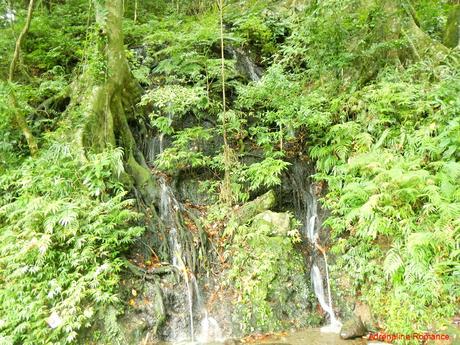
After having our fill of photos and selfies, we proceeded to our next destination, which is just a little bit beyond the south end of the Patapat Viaduct. But first, we re-filled our water bottles and washed our faces with cold, fresh, spring water that flows from a small waterfall by the roadside.
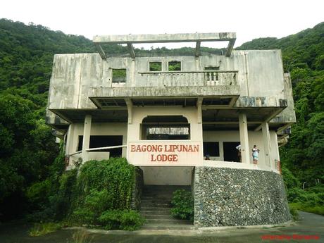
A short walk across the spring water is the ruins of the Bagong Lipunan Lodge. This was supposedly an opulent guest and rest house of the late president and dictator Ferdinand Marcos who also happened to be an Ilocano. We’re not sure what exactly happened, but the rest house was never completed. Today, it’s a rotting, ghostly ruin that is vandalized by local kids who used the area as a makeshift lover’s lane.
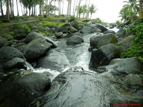
After visiting Pagudpud’s easternmost attractions, we turned back west. We stopped by a viewing deck that adds as an entrance to a popular resort. While the others enjoyed the view of the sea, I went down a very steep, slippery staircase that ended at the exit of a flowing river.
Check out that fresh, clear water! Its clarity and cleanliness means that the thick forest high up Ilocos Norte’s lofty mountains where the water flows from is undamaged and untouched. No wonder why the spring water in our bottles taste so good.
Bantay Abot Cave
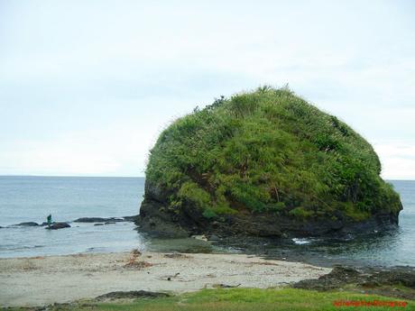
As we headed northwest, skirting along the coast, we saw this large dome jutting out of the water. Use your imagination, but for me, with the local wading beside it, it looked like the foliage-encrusted carapace of Morla, the Ancient One. Don’t know who he is? He is the humongous all-knowing talking monster turtle in one of my favorite childhood movies, The NeverEnding Story.
From the domed rock, we could see a peculiar rock formation a mile away. A cliff with a hole? What could it be?
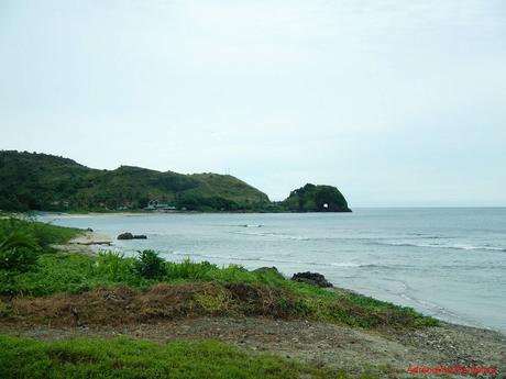
A short ride after, we were at the edge of a natural embankment that serves as the gateway to that weird rock formation we saw earlier. At the top of the embankment, we have an uninterrupted view of Pagudpud’s thickly forested mountains, all of which likely first-generation forests.
It is totally safe to say that Pagudpud is truly one of the most scenic places we’ve ever visited.
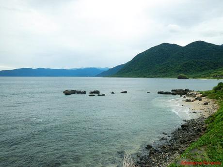
We carefully made our way down the embankment towards a small patch of rocky, slippery shore. The tide was coming in, which had us a little bit worried.
Look at the lush, grassy shrubs that cover the reddish hill.
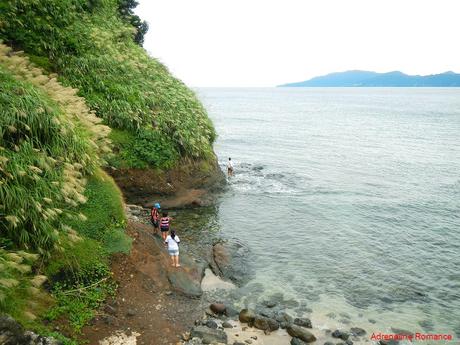
After rounding a corner, we came face-to-face with the mouth of the Bantay Abot Cave—an opening indeed but not a true cave. The reddish sandstone cliff appears to be composed of gigantic stacked boulders, all ready to topple down at the slightest force.
The Bantay Abot Cave is a favorite stopover for tourists and a favorite hangout of the locals due to the striking surroundings.
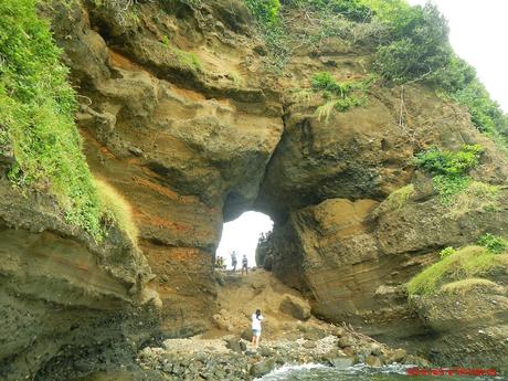
That’s the other side of the Bantay Abot Cave. The water looked so inviting that we simply want to dive in. However, we forgot to bring our swimwear back in our tricycles up the embankment. Huhuhu!
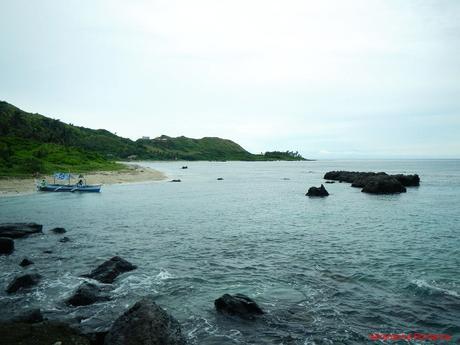
Isn’t this an amazing cliff for rock climbing? Unfortunately, no. The sandstone is simply too loose and soft for any weight-bearing climbing equipment.
However, this could definitely be of interest for a geologist. The forces of nature cleaved a sizable chunk of the cliff, revealing layers of different types of subsoil. These layers tell a lot about the geological history of Pagudpud.
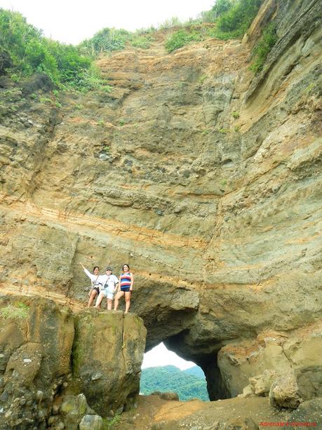
Whoops, be careful ladies! Those rocks look pretty soft. The red color of the rock face and the soil is suggestive of rich iron deposits.
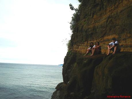
Hannah’s Beach Resort and Blue Lagoon
Continuing northwest, we arrived at Hannah’s Beach Resort in Barangay Malingay, one of the most popular beaches in Pagudpud. It is also the biggest one in Ilocos and probably one of the largest in the entire country. In fact, it is so expansive that it qualifies as a medium-sized village than a resort. It has rooms, open-air cottages, playgrounds (with garishly painted statues of cartoon and pop culture characters), shops, restaurants, and more. They even have a long zip line, with the starting point on a high hill across the resort.
Rain said that many Filipino celebrities, politicians, and VIPs consider Hannah’s Beach Resort as their preferred summer hangout.
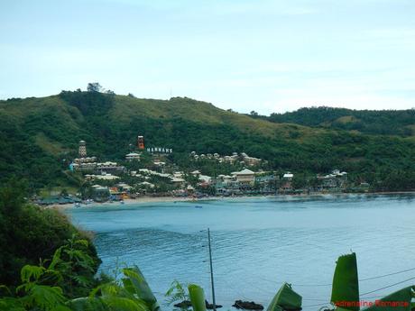
The Blue Lagoon, a small deep-water cove, gives Hannah’s Beach Resort its bright, glowing star. The warm, sparkling aquamarine water looks awesomely magical. Coupled with a shore made of talcum-fine sand, it is easy to understand why this particular patch of water is a favorite place to swim and have fun.
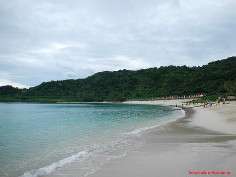
Apparently, the Blue Lagoon is not just a place for recreation but also a resource for livelihood and survival. Fishing is a thriving industry. Locals head out to sea, whether in small outriggers or giant fishing trawlers, to harvest the bounty of the sea.
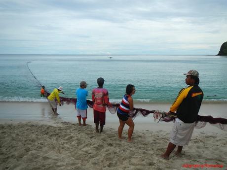
When we visited the Blue Lagoon, a large group of villagers were steadily pulling a huge fishing net to shore. They were busily signalling some swimmers who were at the far end of the net. From what we gleaned of their conversation, it seemed that something snagged the net.
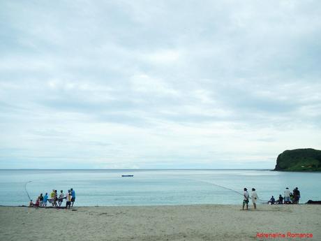
We thought we might as well give a helping hand. Sweetie and I helped the locals pull the net. Boy, this was hard work! Counteracting the net’s drag with all our strength didn’t help at all; the drag was just too strong. No wonder it takes an entire village to pull the net back to shore.
I asked a local why they don’t simply rig the fishing net to a machine or a couple of vehicles to pull it. He explained that the net has to be pulled slowly and gently to avoid ripping it. He said that sometimes, the task takes half a day to complete! Whew!
An Unnamed Paradise
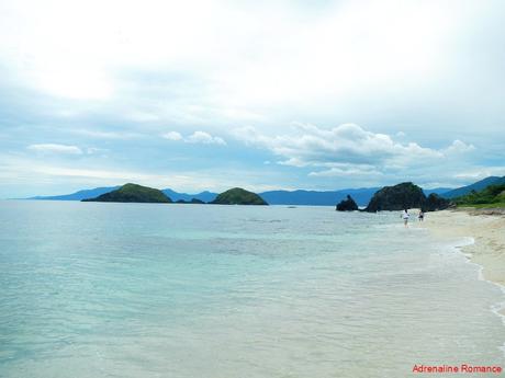
If we swim in the Blue Lagoon at that moment, we would have been in the way of those hardworking fishermen. Thus, Rain took us to a secluded beach a few kilometers north of Hannah’s Beach Resort. What a paradise it was! It was so untouched and so unique that we felt it deserved a short, separate blog post. Stay tuned!
Secret Green Hills
It must have shown in our faces that we love the less trodden path. Thus, Rain happily took us to another of her beautiful secret sites. For almost an hour, we traveled along rough, unpaved roads and fertile farmlands until we came to a grass-covered hill. Time to check this out.
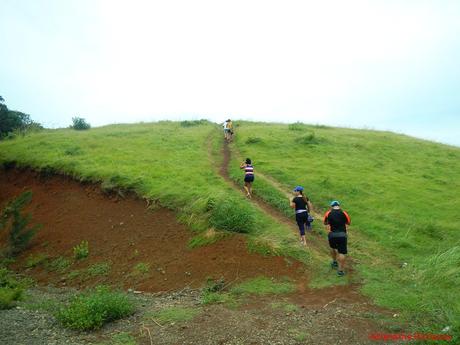
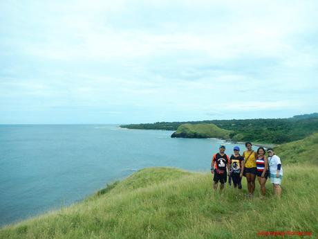
“Total freedom! Goodbye, stress!” Sweetie exclaimed happily. The crest of the hill served as a perfect viewpoint to the dazzling northern coastline of Pagudpud.
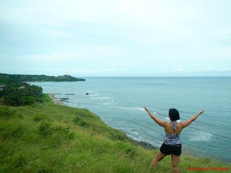
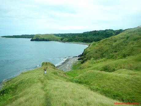
“This is our own version of Batanes,” Rain explained when we got mesmerized by the beauty of the green and blue scenery. No nature-loving person in his or her right mind wouldn’t be amazed at seeing this. Even the nearby cows who were cheerily chewing their cud laid down and basked in the beauty of the grassy hills.
Rain said that she doesn’t usually take her guests here because this is out of the way of the other attractions.
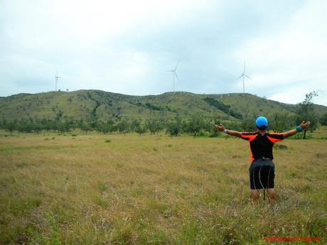
On our way back, we stopped by another of Rain’s hidden sites, an expansive savanna-like grassland. We half expected to see tigers and lions chasing antelopes and zebras for their lunch. Hehehe!
The white turbines of the Caparispisan Wind Farm can be clearly seen, watching over Pagudpud.
Saud Beach
After a filling lunch in a local carenderia, we headed to our last stop, a pretty beach called Saud Beach.
Although there are ubiquitous open-air cottages all around the place, the trees and palms provide adequate shelter from the burning sun.
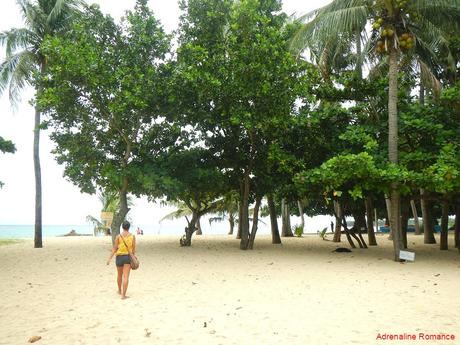
A small grassy hill naturally divides Saud Beach and the adjacent property. The hill also serves as a perfect lookout and vantage point for those who want to take photos of the vista.
To preserve the scenery and sanctity of Saud Beach, no hotel or private resort is erected in the immediate vicinity of the beach. The accommodations, restaurants, and commercial establishments are constructed across the street behind the coast.
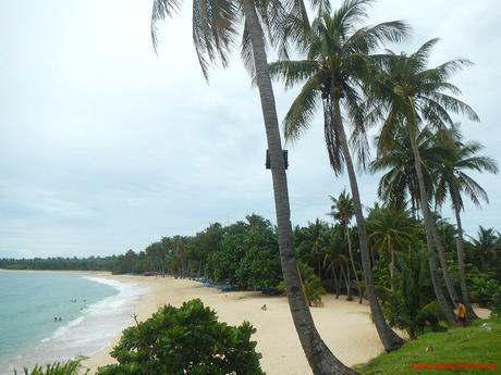
We miss public beaches like this; the ones we once enjoyed in our home island of Mactan are already swallowed by private resorts and real estate developments.
Saud Beach boasts of fine white sand that rivals that of the finest beaches in the Philippines. The shore is one of the longest we’ve ever seen. And because it faces west, Saud Beach must be blessed with the most magical and incredible sunsets.
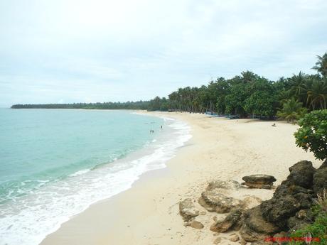
Except for these bikini-clad ladies, we had the beach to ourselves. Lorraine, Sweetie, and I decided to join them, having fun in the water and trying to body-surf the large, strong waves that raced to the shore.
Check out the Bangui Wind Farm in the background.
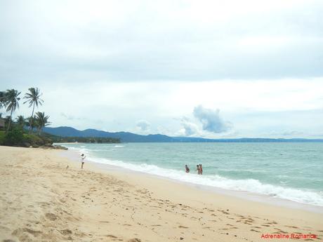
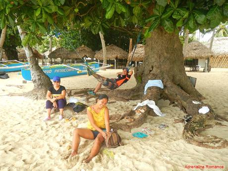
While we had fun swimming in the water, Halourd, Ann, and Rain decided to have a nap. Ah, this is the life!
The Ilocos region is a beautiful pearl, a place rich in history, culture, and natural wonders. The Ilocanos—the heart and soul of the region—are a helpful, friendly, and proud bunch. Whether you are looking for rejuvenation, relaxation, cultural enrichment, or adrenaline rush, Ilocos has something special for you.
Tips, budgets, and other information to follow
Save
