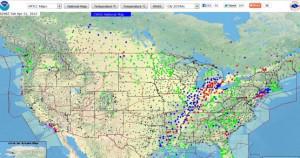
 This link to an online web map was emailed to me recently and although it contains mainly American weather stations there are a good number of Canadian ones on there as well so I thought I would share it. NOAA (National Oceanic and Atmospheric Administration) is an an Operating Unit of the U.S. Department of Commerce that provides a National Weather Service.
The Weather Service provides weather, hydrologic, and climate forecasts and warnings for the United States, its territories, adjacent waters and ocean areas, for the protection of life and property and the enhancement of the national economy.
Their operational server maintains a current database of meteorological and hydrological data, historical data, and written information generated by the NWS or other official sources.
In addition, their server accesses in real-time a selection of current weather observations, forecasts, and warnings from U.S. government sources for use by the national and international community. They also offer many other Weather services on their website such as storm watch, alerts, local and regional information and much more.

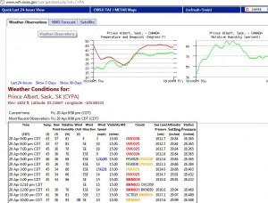
Moving the cursor over one of the symbols on the map will reveal data for the weather station of that area and is usually clickable, opening another web page with more information, details and measurements. It would be nice if they could expand a little further north to include all of Canada but in the mean time if you are located in Ontario, the Prairies or the Southern Rockies then maybe you can make use of this interactive weather mapping tool.


