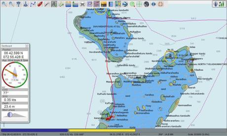
Moving south from Uligan, we used Google Earth in conjunction with our primary chart plotter (OpenCPN) to help navigate to our second anchorage in the Maldives. Google Earth a great tool for cruisers, helping when chart accuracy is in question, or to benefit from the different kind of information provided by satellite images. The big picture route was set up shown above.
Some places don’t have dependable nautical charts. We don’t assume ours are correct and always look go compare data from multiple sources- not least of which is our eyeballs, especially around these atolls and reefs. It’s not a question of one or the other set of digi charts we’re using being “better” than the other, but which one happens to be more accurate for the place we find ourselves- it’s not consistent.
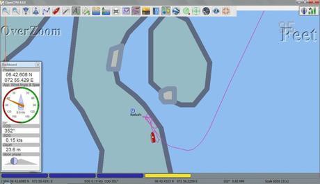
Our first destination south from Uligan was a reef that promised some stunning snorkeling. Here’s how the spot looked on our CM93 charts in OpenCPN:

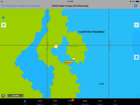
The Navionics chart wasn’t all that different.

The charts aren’t really all that bad. If you were aiming to avoid this spot, you’re covered. Of course, we’re not looking to go around this reef- we want to snuggle up close and make friends with it!
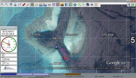
Layering a Google Earth image in OpenCPN, we get a more accurate sense of the spot. It’s not about charted depths, of course, but the visual cue to both how accurate our charts are the profile of reefs and shallow areas. This gives us some really valuable information about the depths and profile that the charts are lacking. It shows that the channel runs all the way through. We can see from the color there’s depth for the full length of the channel (no soundings for that part of the charts). And, it looks to be bang on with regard to our position.

Although it seems like there’s an internet signal just about everywhere in Maldives, this is all offline. These GE images are saved as KAP files to layer in OpenCPN- there’s no reliance on an internet connection. Just how we like it!
Getting the KAP files is a data intensive, time consuming process. We lucked out and were able to get extensive files for the Indian Ocean (everything we’re likely to need) from another cruiser, saving a bucketload of work (and internet expense)- thank you SY Geramar!
If you want to try it yourself, there are a few tools to convert GE to KAP files you can layer in OpenCPN. You can get conversion software (Jamie played with GE2KAP), instructions, and tips via forums and blogs from a quick search online; this kind of thing changes, but there are write-ups of various vintages from the boats Soggy Paws, Valhalla, and Ocelot. For a myriad of additional ways to use GE as a sailor, check out Tahina’s site.
It seems likely KAP files be passed around on memory sticks like cruiser candy. Some helpful soul will surely soon build a library for all (like the awesome track library on Bluesipp). I’ll put ours out on Dropbox where anyone can reach them at some point, when it’s practical to upload a half gig of data.
Navigatin’ fools know we love it when you read this on the Sailfeed website- thanks for kicking some change in our cruising kitty!

