If you’re seeking a great escape into the hills; something that feels like a proper adventure into the wilderness (but still accessible), then Mullaghcleevaun is a great option! At 849 metres, it is Wicklow’s second highest peak & the 15th highest peak in Ireland. Despite its’ high ranking in terms of mountain height for Ireland, it’s definitely not well documented, and is much less trafficked than any other mountains in the region.
Mullaghcleevaun isn’t an easy one by any means, and much of this is down to the heavy peat crags & gullies which cover the peak, creating a tough slog from most angles. There are quite a few routes to the summit, but I chose the route from the Sally Gap, which is just off the road past the Glenmacnass waterfall. There is no trail, so this was definitely a test of my recently acquired MS1 skills course & the OSI 56 map was definitely well utilized!
The route:
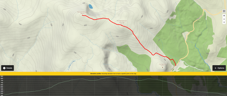
I parked along the road (no carpark per say but there is some wide pull-in spots) and set off towards my 1st peak of the day which was Carrigshouk. This stands at 571m and is surrounded by forestry on two sides but wasn’t the worst hike up as there is a rough path to follow. You can see lovely views of Lough Dan from just off the summit which is pretty nice alongside magnificent scenery from across the Wicklow Mountains.
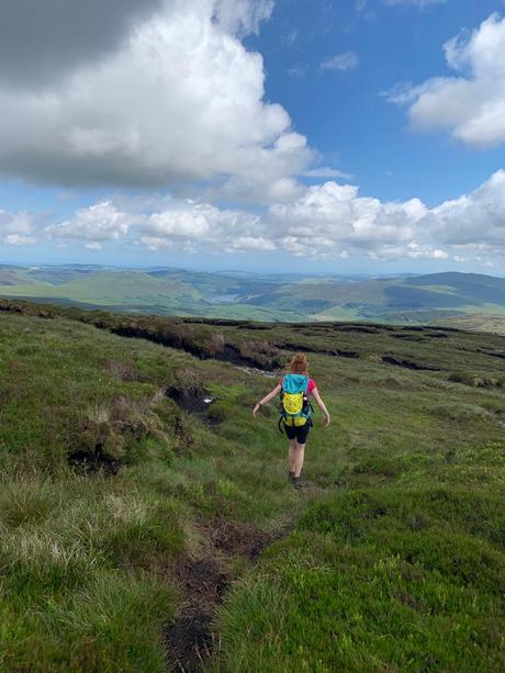
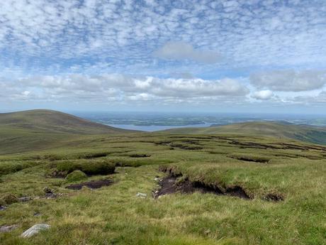
My next peak was Mullaghcleevaun East Top and from there onto Mullaghcleevaun itself. The hike from Carrigshouk onwards is the toughest part of the hike in my opinion but I was blessed with clear skies, so navigation was relatively straightforward & it wasn’t too boggy underfoot. Views from the top were really good, with clear vision towards the Blessington Reservoir, Dublin mountains, Kildare countryside and remaining Wicklow peaks creating many amazing photo opportunities.
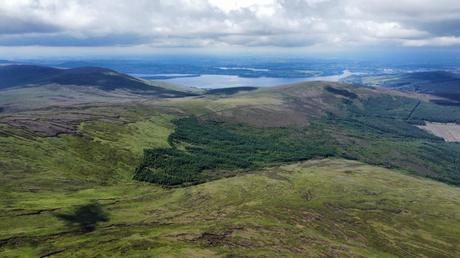
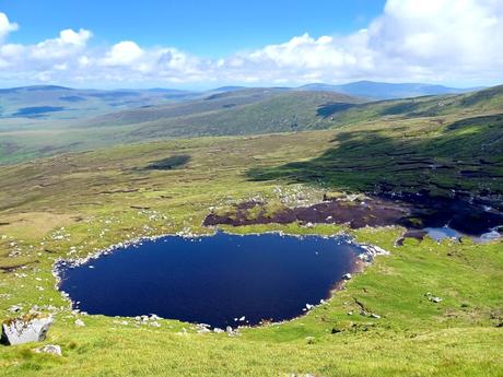
The real magic… who doesn’t love a good mountain lake?!
With the summit of Mullaghcleevaun finally reached, I still hadn’t found the remote Lough Cleevaun which I really wanted to visit (was also my lunch stop-off which added to the urgency!). The Lough is listed as Wicklow’s most remote lake online (and also the highest natural lake in the county) so I wasn’t expecting it to be an obvious find but it actually wasn’t too difficult since I had my map with me. I had to veer slightly in the opposite direction of my journey back and it was a steep descent but well worth it in my opinion.
The lake is surrounded by cliffs on one side and acres of peaty ground on the other, creating a truly unique feel – it was such a peaceful place to enjoy lunch & take a well-earned rest before the trek back the way I had come. The lake’s waters are dark & clear, but I wasn’t quite brave enough for a wild swim although I’m sure it’d be so refreshing on a hot day!
Some things to note:
- Overall, I’d say this hike would be doable for most regular hikers (so long as you’ve got decent navigation). However the boggy terrain & peat crags can make for arduous and difficult enough conditions so relatively good fitness levels would be required.
- I have hiked the mountain in Winter when there’s been dustings of snow across the bogs which has been pretty cool, as well as in quite rainy weather when it hasn’t been so nice, but I’d recommend attempting in Summer (or after a dry spell) for ease of movement. Just be careful of the sunburn if it’s a sunny day… such an open mountain takes no prisoners in the heat

- Good hiking boots & gaiters would almost definitely be a pre-requisite regardless of the season.
- There are quite a few routes up (there’s a looped hike from Blessington or others come across Tonelagee hitting Wicklow’s 2nd & 3rd highest at once) but I did enjoy the route from the Sallygap even though it was an out and back trail.
- I did the route on a weekend day during the Summer and the mountain was extremely quiet (I think we spotted a few others near the summit) but it’s definitely much less frequented than other peaks around Wicklow. There were some sheep on the mountain so definitely keep dogs on a leash if you’re taking a four-legged companion.
