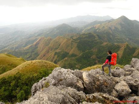
Thanks to thorough planning, organization, and preparation (and a little bit of luck), we safely and successfully reached the summits of all the mountains we plan to climb. All except one. That’s the sacred Nipple Rock of Mt. Napulak in Igbaras, Iloilo. It seemed that the first time we tried to reach its sacred pinnacle, the mountain shooed us away, deeming us not worthy to step on her bosom. Five years after our first attempt, we decided to persuade Mt. Napulak that we were truly deserving guests on her slopes.
Why weren’t we able to reach the peak of Igbaras’ most famous mountain? Well, during our previous ascent via Barangay Tigbanaba, a strong storm unexpectedly threatened to blow us off the mountain’s shoulder. Safety always comes first, thus we decided to abort our summit bid and established an emergency camp at a clearing at the side of the forest. While we were able to return home safely, it took us five long years to prepare ourselves before we finally returned to Mt. Napulak. But will the mountain spirits, who can see through the hearts of those who visit her, finally grant us passage and permission to step on their realm’s most sacred place?
We arrived early at the Igbaras police station to register our names and secure habal-habals for our transportation to Barangay Bagay, our jump-off point. On the way, one of our drivers stopped to fetch his cell phone, which he left at home. During the break, we took an opportunity to take a photo of beautiful Mt. Napulak from afar.
When we first climbed this mountain, it was all green due to the rainy season. Now, the intense summer heat has burned off the vegetation, leaving large splotches of brown and exposed rock.
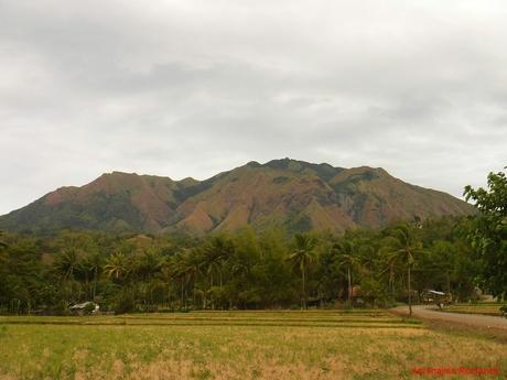
After a short 20-minute ride, we arrived at the seemingly deserted Barangay Bagay where we logged in, did a few last-minute preparations, and secured a guide. A young, bubbly fellow named Bong was assigned to take us up the mountain. Without wasting any time, we started our trek to its summit.
The first part of the trek took us to parched farmlands. Rice, corn, and assorted root crops and vegetables are the main agricultural products in Igbaras.
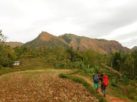
Where there are farms, there are also homes. We passed by small communities of no more than half a dozen houses. During the day, most of these dwellings are empty save for a few children and, perhaps, their nannies, older siblings, or moms. The fathers and brothers are usually somewhere, tending to the their farms.
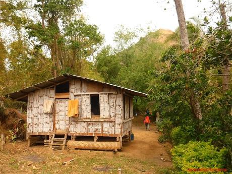
We left the farmlands and communities behind and started the ascent. The trail to Mt. Napulak via Barangay Bagay is not exactly difficult since the incline is gradually. However, the ascent is consistent, with only small swatches of descending, plain, or rolling terrain. The gradual but consistent ascent takes a toll on your leg muscles sooner or later.
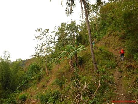
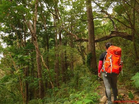
Soon, we entered a thick forest at the foot of the mountain. Even though it was overcast, the air, warmed from the farmlands, was uncomfortably hot, humid, and oppressive. We were relieved as we entered the woods, the trees filtering out the hot air. We felt refreshed as cool air, supplied by the thick vegetation, wash over us.
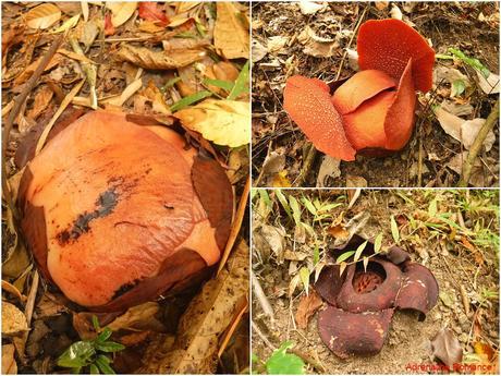
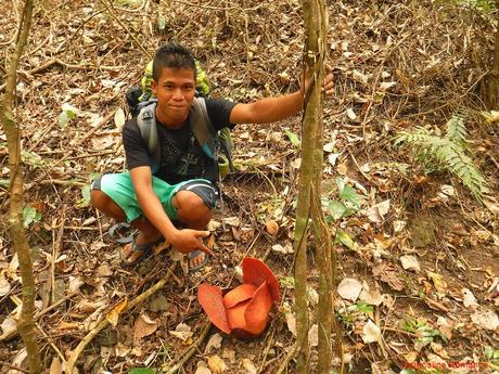
Along the way, Bong showed us several Rafflesia Speciosa flowers in varying stages of life on the slopes just besides the trail. The Speciosa is a medium-sized parasitic Rafflesia flower that is endemic in Panay Island. It is considered as the provincial flower of Antique, but because Igbaras is right at the province’s border, it is not surprising that these majestic flowers also exist here.
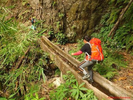
Even though we were deep in the jungle and far from civilization, there were still man-made structures, designed to exploit the bounty of the forest. These canals are vital farming conduits, feeding fresh spring water to the farmlands below. But because of the hot season, the canal only accommodated a thin flow. We had fun balancing on these canals though. Hehehe!
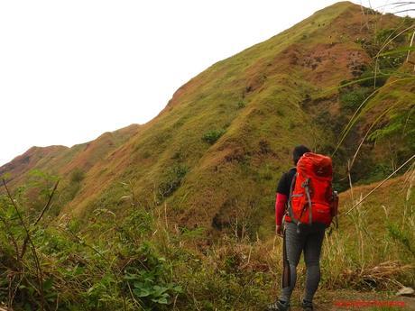
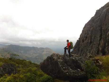
Clear spaces along the forest allowed us to enjoy uninterrupted views of the steep and impressive slopes of Mt. Napulak up close. The wilted vegetation gave the slopes a nice shade of autumn tan. These are rarely seen sights, and we felt honored to have seen such vistas.
Our brand-new Deuter ACT Trails kept our stuff safe and conveniently within reach. They are also light and comfortable.
There are three reliable water sources along the trail. All of them are channeled in bamboo sprouts that are connected to hidden mountain springs. Spring water is healthy as they contain mineral salts, alkalies, calcium, and other nutrients that the body needs. Sadly, modern society now prefers filtered or the so-called mineral water in which these nutrients are removed during the artificial filtration process.
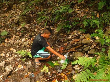
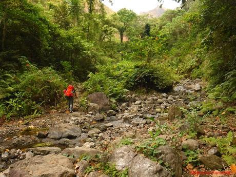
After a short water break at the second water source, we crossed a stony creek that emitted a noisy, cheerful chuckle as fresh, cool water ran through its bed. Bong said that this is one of the vital water sources that feed the farms’ irrigation lines. Even the absence of seasonal torrents didn’t stop the flow of water.
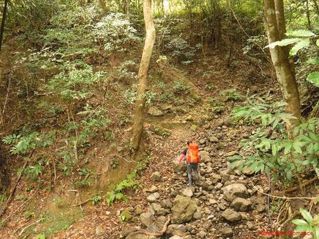
As we neared the mountain’s shoulder, the trail became steeper. But that was just half of the challenge. The dry, loose soil was very slippery, and we had to really dig our shoe treads so our feet can get a good grip. Else, we will be sliding down the trail.
After about two hours of walking, we arrived at the last water source where we ate our packed lunch. It was a good spot because we can drink all the water we want and refill our bottles. Had we camped at the summit, we would cook our dinner here due to the abundance of water. We can then bring the cooked meals up the mountain where it would be reheated at the campsite.
Tip: If you plan to spend the night at the summit camp, we highly recommend preparing your meals here.This is especially true for dishes that need a lot of water such as rice, soup, or pasta. In that way, you don’t have to worry about conserving water at the campsite.
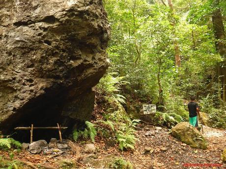
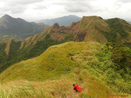
After a short after-lunch nap, we continued the trek until we came out of the jungle. What greeted us when we finally made it out of the woods was a spectacular sight of imposing slopes and peaks, a part of the Mt. Napulak range. For a brief moment, the scene is reminiscent of that of the mighty Mt. Guiting-Guiting in Sibuyan Island. Thick forests, grass-covered slopes, and sheet-rock cliffs all compose a landscape that literally took our breath away.
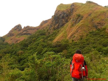
The last of the gradual ascent took place where the trail led to Mt. Napulak’s shoulder and e-camp. Healthy shrubs, thickets, and ferns scraped our legs as we approached the shoulder.
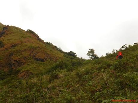
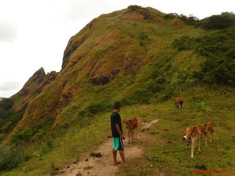
We took another short break at the grassy shoulder, which afforded beautiful views of the surrounding areas. The most interesting thing about the shoulder though is that this area seems to be a favorite grazing ground for a family of cows. There was no human owner in sight; where did this cows come from? If you wish to camp here, be ready for cow-mates!
Bong seems to be a cow lover. Hehehe!
After taking a few photos and sipping some water from our Nalgenes, it was time for the final push to the summit. We were quite excited after seeing the hand-painted “This Way to Mt. Napulak” sign. We’re really here! The inclination of the first part of the ascent, like the majority of the trail, was gradual.
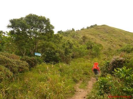
But a good reward always comes after a struggle—-a hefty struggle. As we went higher, the trail’s angle became abruptly steeper. No, that’s not a camera trick. The trail is really that steep.
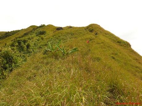
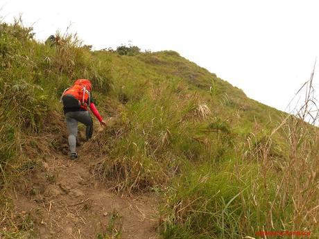
Compounding the already steep ascent was the fact that we were walking along a dusty trail made of loose dirt. Small rocks, seemingly embedded in the ground, got easily dislodged as we used them to brace our feet as we ascended. Grass, wilted from the sun, were yanked out of their roots as we tried to use them as handholds. Yes, the struggle was real!
Oh, no! Just when we thought our ordeal was over, we came face to face with this steep, grassy hill. Bong just smiled and said that Mt. Napulak’s summit is actually a “surprise.”
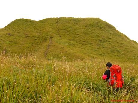
And he’s right! Suddenly, as we crested the hill, it was there! That’s Nipple Rock, a ragged limestone monolith that marks the peak of Mt. Napulak. Similar to the secondary summit of Mt. Igcuron, a religious order decided to erect an iron cross at the top of the monolith.
This geological formation is called Nipple Rock because from afar, it looks like the nipple of a woman’s breast. Indeed, the slope which we climbed is the mountain’s “breast.”
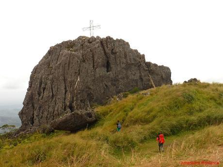
To go up Nipple Rock, we need to climb a ladder made of bamboo, tree branches, and wire. Without the ladder or rock climbing equipment, it would be difficult and dangerous to climb this monolith.
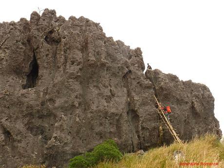
We had to be careful because those rocks were razor-sharp. Also, in many areas, there were gaping holes that drop to the bottom of the monolith. Falling in one such hole would definitely be injurious. Finally, there are the vertical walls on all sides of Nipple Rock where a single fall will most likely be fatal.
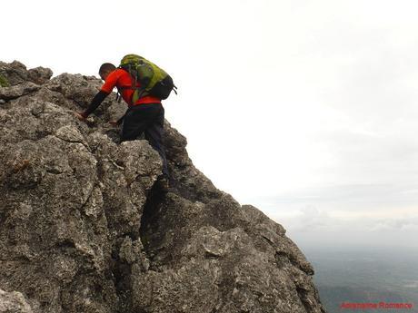
Finally, our last few trembling steps took us to the very top of Mt. Napulak. That’s our guide Bong at the top of the cross. How did he get up there?
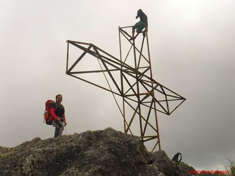
Save for a few words, we spent an hour at the summit mostly in silence. We listened to the howling wind, the whispering grass, and the melody of the forest. It was a canticle of redemption, one that has long been overdue.
It was the Mt. Napulak’s way of telling us that, after five years, we have finally proven ourselves to be worthy to step on top of her breast.
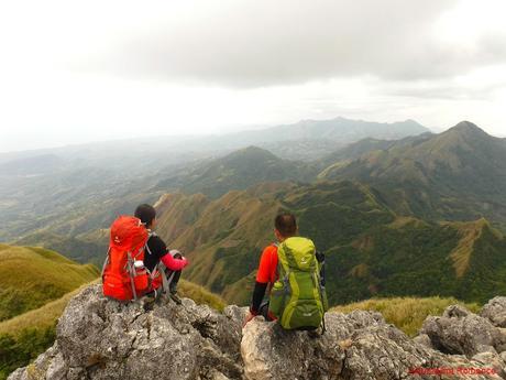
Let’s take a look around. Below us, joining the limestone outcroppings, is a thick first-generation dipterocarp forest that covered the mountain’s crest. It is among the remaining original forests of Panay Island. Bong pointed out that our e-camp 5-years ago was located at the edge of this forest.
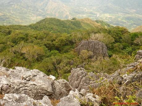
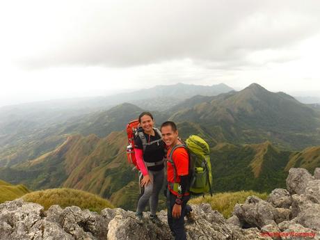
Far beyond the mountain is a forested valley that holds more of Panay’s diverse biological and geological secrets.
As we silently admired the scenery, we came upon a realization. Life is not all about majestic peaks. It is about beautiful valleys as well. The mountains have a lot to teach us.
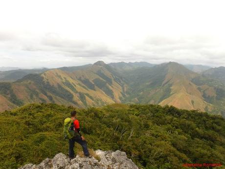
While we took photos, Bong went down ahead of us to clean the campsite. Sadly, there were discarded bottles, plastic bags, and other debris left behind by irresponsible campers. Come on, people. We are merely visitors of sacred mountains. You wouldn’t leave your trash in someone else’s home, would you?
If we want our children and future generations of climbers to enjoy the mountain, if we want Mt. Napulak to provide us with all of Nature’s bounties, then we have to do our part. We have to be responsible. And it all starts with cleaning up after ourselves.
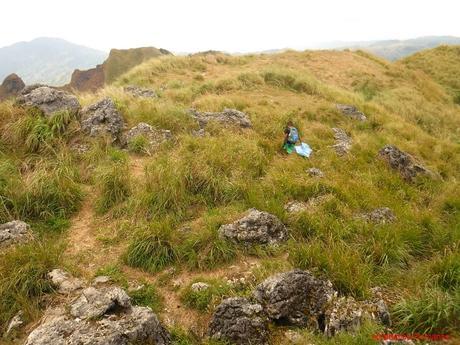
A gathering of dark clouds and the distant peal of thunder signaled us that it was time to go down. We took a last look around our surroundings and silently thanked Mt. Napulak for the adventure. We truly felt the touch of the mountain’s spirit, giving us a pat on the back and another new lesson in our heart.
With our team reunited (Bong disappeared for a while since he made his way around Nipple Rock to collect garbage), we carefully made our way down the steep trail, going back the same way. Wit the loose soil, it was trickier and more difficult than going up!
We opted not to do a traverse, which was supposedly much quicker. That’s because we had to pay an expensive exit fee at the adjoining barangay of Tigbanaba.
Special Thanks
We would like to thank our cheerful and friendly guide Bong. He knows the mountain like the back of his hand. He also helped me carry my pack at some segments of the trail; the lack of sleep made me feel faint and exhausted during the climb.
Finally, after five long years of waiting, we considered ourselves redeemed. That perennial question as to whether Mt. Napulak want to receive us or not has been answered—we have earned her admiration. Our patience and perseverance has truly paid off. We had a fun, grand experience; and we were able to witness one of the most regal sights in the country.
Itineraries, Budgets, and Tips to Follow
Save
Save

