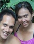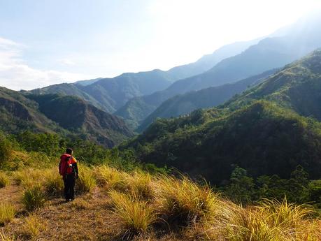
The call to climb a mountain is simply irresistible. For us, every climb we do is an opportunity to enjoy stunning scenery, meet new people, listen to old tales, and experience culture. Each climb teaches us lessons of humility—that we are not exempt from an ecosystem; we are a part of it. That there are powers that are unfathomable for us to comprehend. That we are only ephemeral in the universe. Mt. Madjaas, the first of the Antique trilogy, once again taught us those lessons.
We took a red-eye flight so we can make it to the first bus trip from Kalibo to Culasi. Soon, we arrived at Culasi, ate a heavy breakfast, registered at the tourism and police station, and bought some supplies.
Originally, we were to meet our habal-habal driver and head directly to Barangay Flores, our jump-off point, where we will spend the night. However, the sleepless overnight trip allowed exhaustion to creep in. Having a good rest is too tempting to resist. So, Sweetie and I decided to book a hotel in Culasi for the night for a much-needed rest—and food trip.
Like many of our our climbs, we had an early start the next day. Our habal-habal driver fetched us from the hotel, and after a 45-minute ride, we reached Tatay Josue’s house in Barangay Flores. Tatay is the lead guide here, and we were honored that he decided to personally guide us on our climb.
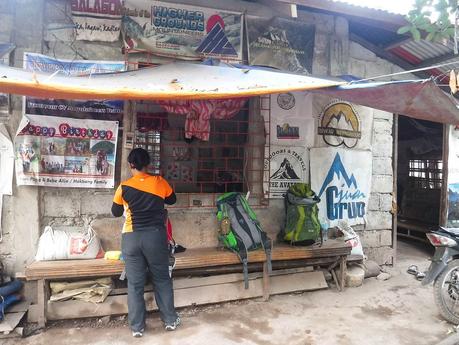
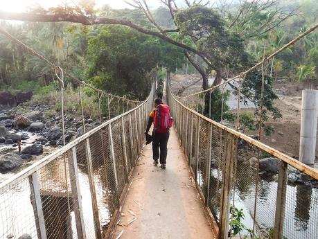
After a final pre-climb check, we donned our Deuter bags and started our 3-day trek to the summit of one of the highest mountains in the Visayas. Crossing this still bridge that spanned a shallow river seemed like walking through a gate to another realm.
The ground immediately started rising, giving our leg muscles a good warm-up. For more than a couple of months already, the blazing sun scorched the ground, making the soil extremely dry. Every step was a challenge because the ground was loose and slippery.
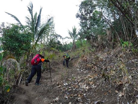
We’re still an hour away from the jump-off point, but we were already sweating gallons and catching our breath. The trail was incredibly steep; we slipped a few times trying to get our shoe treads to grip the loose soil. Good thing though that we were still on the good side of the hill, sheltering us from the morning sun’s blaze.
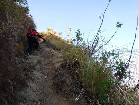
The earth thirsts! Beneath the sunny, cloudless sky lay parched rice terraces, the rice beds cracked due to lack of moisture. For rice farmers, the hot summer months is a financially challenging season as stalks wither and die. Farmers have learned to diversify their crops to make it through the dry season.
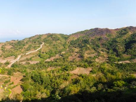
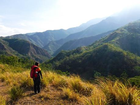
At 7:30 AM, we crested the base of an ascending L-shaped ridge. The scenery was indescribably breathtaking…and intimidating. In the wilderness, we found utmost solace. Yet, surrounded by the immensity and majesty of these forest-covered mountains, we also felt utterly insignificant. In the grand scheme of things, we were invisible.
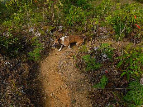
Let us introduce you to our co-guide—Kumpol. Kumpol is Tatay Josue’s beloved pet and companion, and he acts as a co-guide. Kumpol, which meant “stub-tail,” always goes with Tatay Josue whenever he guides guests up the mountain. The pooch knows Mt. Madjaas inside out as he chases monkeys, deer, and wild boars in the bush. During our climb, we were genuinely amazed at Kumpol’s skills, attitude, and loyalty to his master.
His “payment”? A good serving of camp meals, of course!
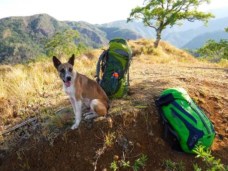
After a short rest, we continued our way up the ridge on open, grassy trail. The full power of the morning sun mercilessly shone on us, making us sweat like crazy. The only creatures that enjoyed refuge are ants, bugs, and worms that reside under the soil. We couldn’t wait to get out of the open trail and find some shade.
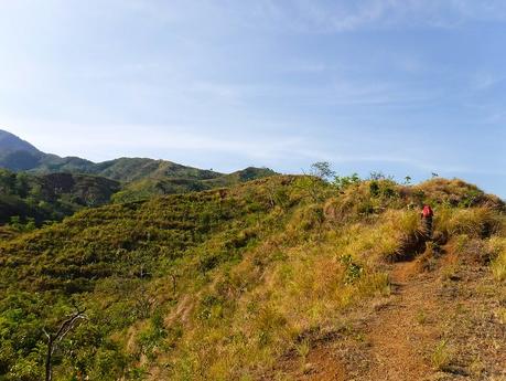
Still on the open trail, but at least, we left the radiating farmlands behind. It was still hot, but the air was refreshing thanks to the trees and the high altitude.
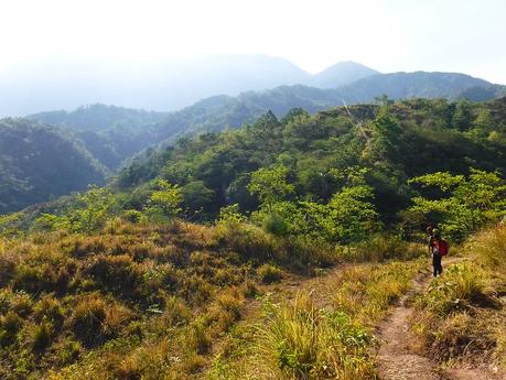
This stream was almost as dry as a bone, leaving a small puddle behind. During rainy season, this stream brings rainwater to the lowlands. Farmers create channels, canals, and ditches to direct the flow to the rice terraces. Yes, Filipino highlanders are master earthwork engineers, their knowledge of irrigation learned over hundreds of generations.
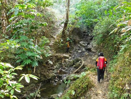
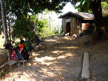
A little over two hours since we left Barangay Flores, we arrived at this small house at the lip of a rice terrace. This was the second to the last snippet of civilized dwelling place for the next two days, so we had a long rest here. We exchanged stories while snacking on some fresh mangoes.
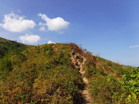
Revitalized from the 30-minute rest, we continued our trek on parched, open grasslands. From the photo below, you can see just how steep the trail is. The dry, loose soil made the ascent even more challenging as we tend to slip back a step. Little did we know that these were just “warm-up” trails to prepare us for the next two days of excruciating walking and climbing.
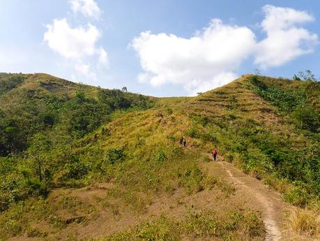
But Mt. Madjaas is friendly to us on our first day. Perhaps sensing our determination, the mountain decided to reward us with wide swatches of level trails, rolling terrain, or gentle ascents. Certain sections of the open trail made walking a pleasure, giving our leg muscles a break.
Soon, we crested the first ridge and started walking along the main ridge that leads directly to Mt. Madjaas. Although we were walking on exposed terrain, the breeze was cool and refreshing, blowing bits of exhaustion off our bodies.
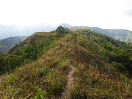
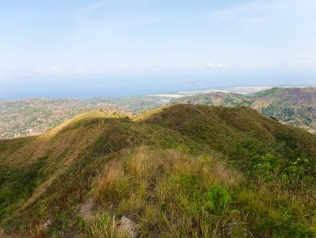
The best thing about walking on high-altitude open terrain is that we are treated with super amazing views. We looked back at where we started. Look at just how far we’ve climbed! From below, we could see the first part of the ridge that we climbed a few hours ago; it’s actually a series of tall, grassy hills with steep ascents.
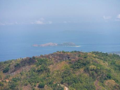
From our viewpoint, we could see faraway Mararison Island. We visited this island during our Experience Antique tour a few years ago. It remains to be one of the best island destinations we’ve ever visited. Aside from the usual white-sand beach, there’s trekking, snorkeling, and a little caving waiting for you. All the while serenaded by the Mararison Children’s Choir.
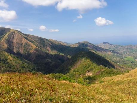
South from where we’re standing are large mountain ridges extending towards the shoreline of Antique. You can see that a lot of the ridges are bare and brown; the hot summer really took its toll on the foliage. During rainy season though, the plants grow, and these ridges will be once again covered in thick green tree canopies.
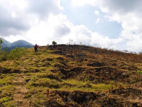
As we climbed higher, we came across patches of blackened land which appears to have been burned. Apparently, farmers want to till the land to create more rice terraces. It’s totally understandable; mountain soil is extremely fertile, and crops grown here are healthy and abundant.
However, we do hope that the LGU, the Department of Agriculture, or the Department of Environment and Natural Resources moderate these activities. The economy of Antique still revolves around agriculture, but that should not be an “excuse” to destroy the environment. As always, moderation is always for the greater good of everybody.
Right on schedule! At 10 AM, we reached the edge of the Mt. Madjaas’s forest cover. We’re definitely looking forward to finally enjoy some shade.
Based on our research and the natural lay of the land, Mt. Madjaas is covered with ancient dipterocarp forests. Thus, we were quite pleasantly surprised when we saw this grove of pine trees that form the gateway to the forest. Pine trees are abundant in the Cordilleras and the Sierra Madre regions in Northern Luzon, but a little unheard of here in this part of Antique.
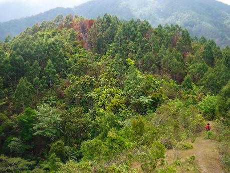
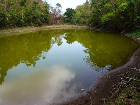
We decided to have a snack break under one of the pine trees. After shrugging off our backpacks, Tatay Josue took on a short, well-hidden side trail at the edge of the ridge. The trail culminated in a hidden pond that locals call Dinawan Lake. Now, as subscribers to Jonathan Bird’s Blue World YouTube channel, we know that a mysterious body of water like this may be the entrance to an immense underwater cave. Could this be one?
One thing is sure though. Several cows who decided to spend some lazy time here made this their personal watering hole.
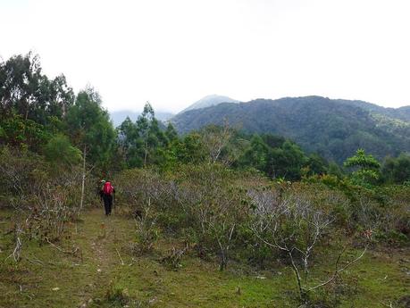
Patches of small clearings mark the first couple of kilometers inside the forest cover. Check out those miniature Gemilina trees. They look like mini forests!
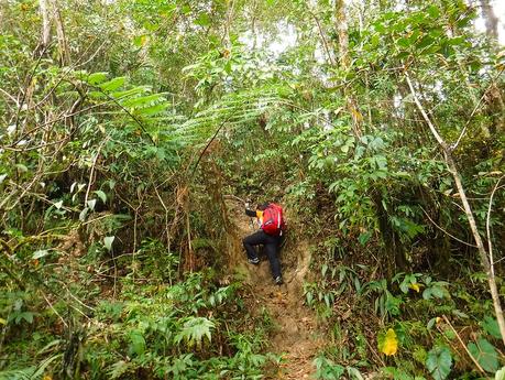
Going through Mt. Madjaas’s forest cover was tough. In addition to thick foliage, the trail also rose steeply. In fact, in some parts, we had to use our hands and feet (yes, we went 4X4) to haul ourselves up. Embedded roots and rocks were useful, but we still had to be careful. A few times, we dislodged some of those rocks as we trusted our weight on them.
But the climb was awesome. We had fun spotting and identifying ferns, rare shrubs, bugs, and telltale signs of passing wildlife. We were a bit better on spotting and appreciating these things thanks to the walking educational tour we have with Sir Jing every time we walk a segment of the Cebu Highlands Trail.
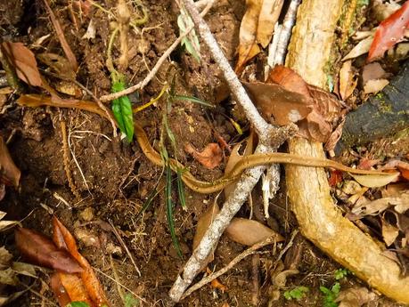
Our very first live wildlife sighting since we started climbing mountains! A small brown snake slithered across the trail, perhaps trying to get across before we can see her. Unfortunately, Tatay Josue had incredibly sharp eyes, and he spotted her in the middle of the trail. Out of fear—or perhaps curiosity—the snake held her position perfectly still while we took a few photos.
Tatay Josue announced that we were actually just a little over an hour from our first campsite. Excited to finally have a well-deserved rest for the day, we took our lunches of our packs to refuel our bodies. Suddenly, we heard a rustling sound behind us.
It was Kumpol catching up to us. He disappeared a couple of hours earlier to chase some wildlife that only he can detect. All the while, we were quite worried he’d get lost, but Tatay Josue assured us he’ll be all right. Sure enough, Kumpol arrived right on time for lunch!
After lunch, we resumed our trek to the increasingly thickening forest. Far below, we could hear the faint but unmistakable murmur of rushing water, which meant that there’s a river somewhere here.
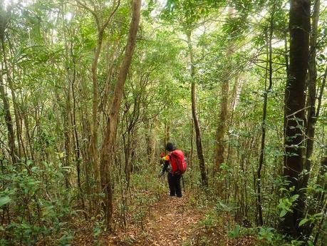
But the last leg of this trail to the campsite posed quite a challenge. You can’t see it in the photo below, but we were actually descending down a knife edge ridge, with the sides hidden by thick foliage.
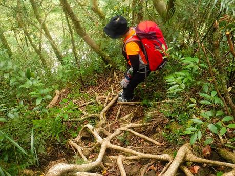
Going down was tricky as well. We stepped on slippery roots that could entangle our feet if we’re careless. And we don’t want that because at either side are hundred-foot drops…
At around 2 PM, we finally reached our campsite at Bantang River. It’s an ideal campsite; it’s on high ground and surrounded by trees and cliffs that shield us from brunt of the wind. Most importantly, we have an entire river as a water source!
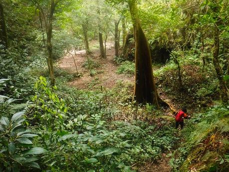
We like being ahead of time as we can prep up shelters and cook food without any hurry. And since we don’t drink alcohol, being early at the campsite allows us to relax and enjoy the serenity of the surroundings.
Based on our itinerary, we reached the Bantang River campsite two hours earlier than scheduled.
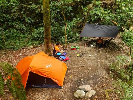
One of the best things about being near a limitless water source is that we can refresh ourselves! Getting the sweat and dust off our bodies gives us a really relaxing sleep. And we smell good as well!
Sweetie and I eagerly dipped into the clean water, which was quite cold. We also washed our trekking clothes here; not only does washing remove body odor that sticks to the cloth, but it also prevents the formation of salt crystals from evaporating sweat. Salt crystals chaff the skin, causing each movement itchy and uncomfortable.
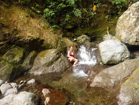
The water source is right along here, just a little bit upriver. You can see how incredibly clear and clean the water is. And no one would be surprised if you can see a pretty diwata here, wearing a diaphanous gown and playing her violin.
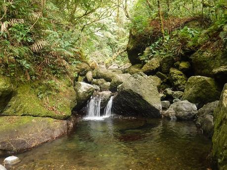
While we went back to the campsite, Tatay Josue seemed to be busy looking for something. Did he lose some stuff?
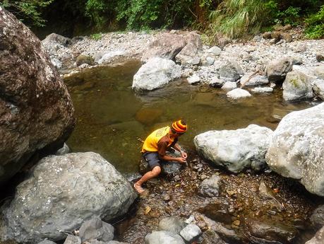
Nope! He was hunting for some fresh crayfish that we intend to cook. We decided to make them the “meat” of our soup.
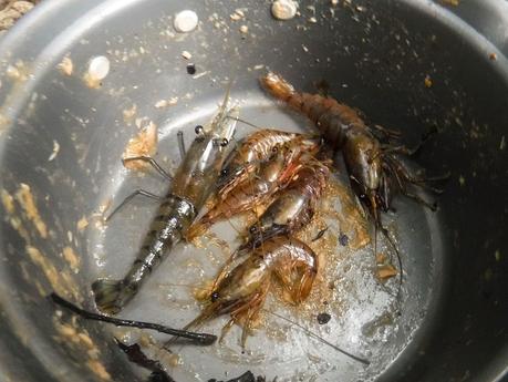
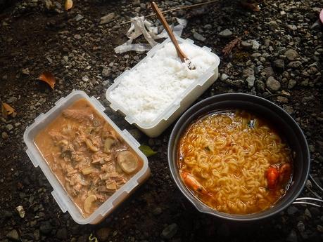
Here’s our delicious dinner! That’s steamed rice, canned tuna and mushrooms, and hot-and-spicy Korean noodles with boiled crayfish. Yummy and filling indeed!
The cool bath, the hot meal, and our brand-new inflatable mattresses—-everything made our sleep very comfortable, very relaxed, and dreamless.
So far, so good. Our first day of climbing Mt. Madjaas went on without a hitch. The ascent was relatively pleasant, the views were stunning, we arrived at the campsite way ahead of time, and we had a relaxing bath. That should prepare and reinvigorate us in preparation for the next day’s climb. Tatay Josue said that the climb to Camp 3 at the mountain’s shoulder is going to be quite challenging. Will we make it? Watch out for Part 2 of this series!
Tips
The itinerary, budget, and other important information about the climb proper are in subsequent posts. What we will put here in our Tips section is information to complete the most crucial elements of the adventure, the filing and processing of your climbing permits.
1. Before climbing Mt. Madjaas, you need to register at the Culasi Municipal Hall and the Culasi Police Station for your Safe Conduct Pass. This is important for safety. Please bring a valid ID upon getting your Safe Conduct at the Municipal Tourism Office.
2. Log-in and log-out at the Municipal Police Station. The police station office is open from 8:00 AM to 5:00 PM only.
3. Use these contact details for more information:
- Street Address: Culasi Municipal Hall, LGU Culasi, Antique, Philippines
- Contact Person: Mr. Johnjohn Sumanting (Culasi Tourism Officer)
- Landline: (036) 277-8167 / (036) 277-8077
- Cellphone Number: 0917-736032
- Email: [email protected]
4. The Permit to Climb Fee of Php 150.00 per head per day. You can pay in advance by sending it via Palawan Express Pera Padala to this receiver:
- John John U. Sumanting
- Municipal Tourism Officer
- LGU Culasi, Antique
- Cell phone No.: 0916-7736032
5. Many climbers line up for a slot to climb this glorious mountain. To ensure your slot, it is best to send and have your permits processed at least a month before your actual climb schedule.
6. For guideship services, the LGU can assist you. Alternatively, you can directly get in touch with Josue Alejo at 0907-0693946.
- Guide – Php 600 per guide per group per day (guide ratio is 1 guide per 5 climbers)
- Porter – Php 800 per porter per group per day
For budget planning, related expenses, and itinerary, please check Part 2.
For a list of important tips, please check Part 3.
