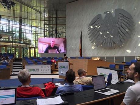
Jeff McKenna of Gateway Geomatics in Nova Scotia was recently awarded with the 2016 Sol Katz Award for Geospatial Free and Open Source Software during the FOSS4G 2016 conference in Bonn, Germany. The award is awarded annually by OSGeo at the annual FOSS4G conference to individuals who have demonstrated leadership in the GFOSS community.
The Sol Katz Award
The award was presented to Jeff in recognition of his passion for FOSS4G and his relentless efforts to promote the OSGeo Foundation. He has been involved in OSGeo since the foundation was formed in 2006 and was one of the original co-founders of the global FOSS4G event.
The award was announced by Prof. Venkatesh Raghavan, President, OSGeo Foundation in front of 900 attendees. For more information about the Sol Katz Award see the OSGeo Foundation website.
Open Source Geospatial Foundation
The Open Source Geospatial Foundation (OSGeo) is a not-for-profit organization whose mission is to foster global adoption of open geospatial technology by being an inclusive software foundation devoted to an open philosophy and participatory community driven development. The foundation provides financial, organizational and legal support to the broader open source geospatial community.
Filed in: Geo Industry NewsTags: FOSS4G, Jeff McKenna, Nova Scotia, OSGeo, Sol Katz AwardAlso Check Out ...

For years now LinkedIn has proven to be a powerful online career tool that people have been including in their job hunting arsenal of tools. Besides some the more obvious features that it provides (such as online portfolios, resumes available 24/7, job postings and recruiters) it has allowed people to network with others in the same industry much easier, often connecting with people well beyond their geographic regions.
The Canadian GIS & Geomatics group for example has grown to over 2000 members in the past year, and contains a wide range of active geomatics people from Newfoundland to British Columbia who have a wide range of backgrounds, knowledge and experience (GIS, Cartography, Remote Sensing, LIDAR, Surveying etc.).

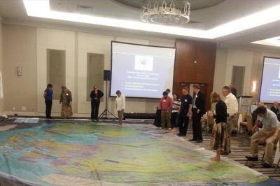
Canadian Geographic is providing Canadian educators (K to 12) with a new innovative hands-on creative way to teach Canada’s rich geographic history to younger generations. Their “Giant Floor Map Program” is a free resource that teachers can borrow to help enhance students’ geography experiences through a hands-on, fun creative way to learn.
It is really hard to appreciate the true size, resolution and quality of these maps through photos on the web, however one of the maps were displayed at the June CGCRT national workshop that I attended and I must say, these giant floor maps are just as impressive as they sound and certainly will provide many young people with a new perspective for mapping and the spatial extent of Canada.
The Giant Floor maps are available on loan for 3-week periods …

GeoAlliance Canada will soon be launching their community projects portal, a valuable piece of digital infrastructure that they hope will allow their members to refine project ideas, build teams, and seek out funding. The portal will provide a neutral platform for project teams to share documents and collaborate. Find out more details such as how will the portal operate …
new GIS Jobs Search and Posting Tools
