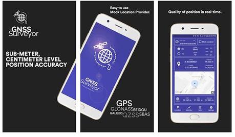
Global GNSS launches a GNSS Surveyor Application for Geospatial Industry
Global GNSS a subsidiary of Polosoft technologies are launching a new mobile application named GNSS Surveyor designed for the people working in the geospatial industry.
After speaking with executives from Global GNSS, various facts about the company and the exciting application are found .Being in the GIS industry for that long and having an inhouse mobile application development team enabled Global GNSS to develop such an application.
The application GNSS Surveyor will give location information and quality of the position data in real-time with sub-meter/ centimeter accuracy. It needs to be connected to any external GNSS receiver via Bluetooth.
"This is a very big accomplishment for us. It shows Global GNSS recognizes all the effort and time that our team puts into staying a step further from our competition in the GIS and the application development industry. We recognised how this development can be used to improve the way our clients use our platform." says Lalit Tyagi, CEO of Global GNSS. He also added "A lot of credit goes to the team, with the huge innovations with the industry, it is a big task to adapt to the latest technology and innovations. With this team, I am confident and even look forward to work with clients working in Geospatial industry to build them custom applications just like GNSS Surveyor."
Some salient features of the application are:
- One touch configured command to communicate directly with GNSS Bluetooth device.
- Location information and quality of the position data in real-time with centimetre accuracy.
- GPS Data like position, height, satellites, velocity, etc can be received.
- RTK correction data can be forwarded to high accuracy external device. The internal NTRIP client loads the RTCM data from the internet.
- Constellation Information for GPS, GLONASS, GALILEO, BEIDOU, QZSS, SBAS satellites in the orbit.
- Direct IP feature for RTK corrections data.
- DMS to DD conversion or vice versa.
With GNSS Surveyor location information would be collected as:


