Providing a Glimpse into What the Autonomous Future Will Look Like
Therefore, geospatial data has become more important than it has ever been. Combine that with all the advancements in location based technology and you quickly realize that geomatics is helping pave the way towards a safer and more efficient world.
Last week I was fortunate enough to attend the biggest technology show in the world, known by most techies as CES (Consumer Electronics Show). HERE, an international company based out of Germany known for data and location related services, included me in a group of professionals that they invited to experience their vision of an Autonomous Future and the products and services that they believe will help make it possible. This fast approaching autonomous world will be safer, gentler, more efficient, and provide more time to enjoy life with the people we love.
The concept of collaboration and strategic partnerships with partners in other sectors that share similar visions is nothing new to HERE. Originally started from a combination of Navteq and Nokia Maps, HERE was built upon a strong mapping and satellite navigation framework with the knowledge to go with it.
Their vision for the future of spatial based services and a strong belief of the importance of accurate mapping has helped establish them as one of the largest companies specializing in location technology.
Just like Google has established them as the go-to people for Searching, or Amazon has for online shopping, HERE has established themselves as the location technology experts.
This was my first time attending the CES so to be honest was not sure what to expect. I was told that close to 200,000 people would be there and that CES is the event that all the top companies introduce their latest technology related gadgets (everything from cell phones to cars). Therefore I should not have been surprised that the HERE booth was not actually a booth in the conference center like most other companies had but actually an impressive two story building constructed out in the parking lot.
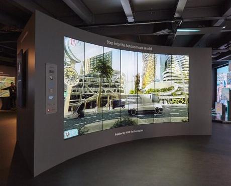
The main focus of the exhibit was showcasing how location technology is leading the way, and included several demos involving smart cities, autonomous vehicles, fleet tracking, advances in mobility, managing drones, and high speed transportation.
Using state of the art displays, over sized high-resolution screens and custom animation, they wowed visitors from the moment they stepped inside. Some of the highlights that I was able to take back from my time spent with the various staff of HERE are included below with various links that provide much more information.
HERE Open Location Platform & Connected Services
"I want you to imagine a city, where, everything is connected and fully autonomous cars are on the roadways.
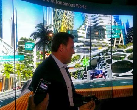
Those cars share a constant stream of data to the cloud, and to each other, reducing traffic incidents to near zero. They move efficiently, so pollution is massively reduced. In the air, drones provide delivery services. They also inspect buildings, survey crops, and create 3D maps of our skies to optimize flight patterns.
Automated fleets are the norm. Deliveries are planned using the traffic data shared by automobiles, so road blockages for double-parked delivery vehicles are a distant memory.
Each of these systems is powered by open data, and each shares data back into the system for others to leverage. Each one informs the other, making each service better and more intelligent. That is the collaboration that the Open Location Platform enables." Edzard Overbeek (CEO of HERE Technologies)
The CEO of HERE Technologies, Edzard Overbeek took the opportunity to welcome us and shared how he feels that an autonomous world will make our lives safer and more efficient. He told us that until now, HERE has been dominantly known as a mapping data company and although they did start off working with maps over 30 years ago, they have been rapidly evolving and expanding into more exciting technologies.
His vision of the future involves more collaboration and partnerships, because no company is going to be able to do it all alone. A world that everyone has the ability to benefit from shared data. Through services like the HERE Open Location Platform, a location-centric development environment, people (and machines) can access information, and then contribute other data back into it.
Data is the dominant infrastructure of the 21st century, and unlike a cloud service that simply stores and shares data, the HERE Open Location Platform helps prevent fragmented data sources in a collaborative environment, by analyzing and adding value to it thanks to functionality like the Reality Index™.
Click the white arrows to scroll the images ...
The self-service kiosk interactive demo demonstrated how a consumer would plan things more efficiently, easier and save them time (that they can use to enjoy other aspects of life).
The Mobility Dispatch system application demo showed how fleet managers can better connect with their drivers and help solve logistics problems before drivers encounter them. It not only makes use of the latest data but uses various algorithms to help predict various patterns and situations to help maximize the fleet.
The explosive growth of mobile technology, low-cost high-powered processors, and high-resolution cameras, with rise of smarter networks and more accessible WiFi is making it easier to connect to the cloud.
At CES, HERE Mobility was introduced, a competitive marketplace powered by intelligent technological solutions that enables businesses to improve how they deliver products and services. It helps connect millions of mobile devices allowing people to make smarter decisions, providing faster more viable solutions, and in the end making lives easier.
Customers often use many different aps and tools to help plan their trips, however using the Mobility Marketplace they could easily plan all aspects of their entire trip at the same time. It would not only allow customers to customize different options but also provide the most efficient solution based on real time input from the Open Location Platform.
The Future of Transportation
Several of the demonstrations revealed how the years ahead will be drastically different in the ways that people and goods will be transported from place to place. The transportation industry is one of the largest carbon gas contributors and one where millions of accidents occur every year. The ability to determine in real-time how goods can be moved more efficiently, combined with improved technology to allow vehicles the ability learn and predict situations using data shared from other vehicles, will help make the transportation industry safer and better for the environment.
HERE conducts research on an array of new technologies to help improve traffic, mapping, delivery and driving experiences, so it was no surprise that sitting outside in front of the their building was a Hyperloop One Pod (and actually the first time one has been on display outside of any test area).
Hyperloop One, a new form of high speed transportation (that is expected to be available to the public by 2021), is meant to provide an effortless, dynamic, on-demand travel experience. Traveling safely while going over 1100 km/h is an amazing feat of engineering, however even more impressive when coupled with leading mobile location technology.
Later inside, we were provided with details on the high speed system and how location based technology have been combined into one single, intelligent user-face, that would not only allow customers to book Hyperloop trips, but also plan their entire journey including getting to and from the station to their other destinations. For an example, a trip for someone to travel from where they reside in Los Angeles to the CES in Las Vegas (about 440 km) would only take about 30 min.
Many people are aware of the funny looking cars with the equipment attached to the top of them that Google uses to generate the millions of miles of Street View data.
HERE has a similar fleet of vehicles equipped with GPS, IMUs, 360-degree cameras and LiDAR sensors. However this fleet does much more than just scan the surroundings as they drive. Data collected is combined with the reality index, the open location platform & other connected services to help create more reliable mapping data, in the end making driving safer and more efficient.
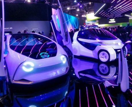
New car navigation systems are moving away from just displaying typical navigation maps to more robust smarter systems that can depict what's happening ahead of you down the road, providing intelligent recommendations based on real-time data, and helping drivers avoid situations like traffic or accidents.
Over the past few years, autonomous driving has moved from a concept to a reality; however autonomous vehicles require more accurate information about our roads and its surroundings. Through a combination of on-board sensors and connections to the cloud, artificial intelligence can leverage a new type of mapping data. Mapping data designed with machine learning and artificial intelligence in mind.
Using an innovative service called self-healing maps, crowd sourced data from on-board sensors can be constantly scanning and updating maps in real-time allowing vehicles to be proactive, predicting and preparing for situations using critical information before they arise.
"When you think about it, when our country was first settled, horseback riding was the most popular form of transportation, therefore almost everyone knew how to ride a horse.
Things have changed significantly over time, and now very few people actually know how to ride a horse.
In an autonomous future, artificial intelligence will be driving cars for us, and the interior of vehicles will become an extension of our living and working space.
Then perhaps, very little people will know how to drive a car!" Christof Hellmis (HERE Vice President, Strategic Programs)
 So now I am sure you can see that even though the role of geomatics has evolved drastically in recent decades. It is pretty clear that spatial data and location data is still one of the basic components that everything else is built upon and more important than it has ever been, helping pave the way towards a safer and more efficient environment.
Thanks to the multitude of technologies demonstrated at CES (and the multiple discussions from various staff at HERE), it was pretty evident that living in an autonomous world is attainable and not that far off in the future. If you have never ever been to CES and ever get the opportunity then I would highly recommend it.
Note: This post contains content featuring HERE Technologies who generously provided my trip to CES 2018 so that I could observe first-hand how they leverage location technology to create an autonomous future. So I would like to thank HERE Technologies and staff for their time and kind hospitality, and 1000heads for considering me as part of their group.
Note: Although my trip was sponsored, any opinions expressed are my own.

