The joy of hiking often lies in the journey and what we discover along the way. At HiiKER, we understand that and continually strive to deliver the tools necessary for our community of avid hikers to plan, navigate, and track their adventures confidently and effectively. Today, we are excited to announce an exclusive new addition to HiiKER that promises to redefine your hiking experience – the detailed digital maps of the Dingle Peninsula from EastWest Mapping.
Since our partnership began in 2022, EastWest Mapping has been exclusively available on HiiKER, a testament to our commitment to offering the highest quality navigational tools to our users. An established and highly respected mapping company from Ireland, EastWest Mapping is renowned for its meticulously detailed maps tailored to the needs of hillwalkers and hikers alike.
The company’s passion for creating comprehensive maps is appreciated by the hiking and hillwalking community. No other mapping provider offers the level of detail EastWest Mapping provides, which incorporates an intricate understanding of the landscape, including roads, tracks, and local history. Such extensive information not only aids navigation but also makes the hiking experience richer and more engaging.
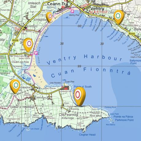
 Sample of EastWest Mapping over Ventry Harbour
The newly released maps cover the Dingle Peninsula in a 1:25,000 scale, incorporating areas like the Slieve Mish Mountains and Mount Brandon, the 8th highest mountain in Ireland. This well-loved area is a favorite amongst hikers and hillwalkers, and the anticipation for these new maps has been palpable.
Paul Finlay, CEO of HiiKER, shares the community’s excitement: “We are very excited to launch these maps on HiiKER. As a user of EastWest Mapping myself, I understand why our users have been anticipating this release. The level of detail that EastWest Mapping provide enhances our users’ experience and helps keep them safe in the hills.”
To access the Dingle Peninsula maps, users with a HiiKER PRO+ subscription can easily add the EastWest mapping layer on any map in the app. If you are yet to explore the benefits of HiiKER PRO+, you can test it out for a week free of charge, allowing you to experience firsthand how these comprehensive maps can enrich your next adventure.
The release of the Dingle Peninsula maps marks a significant milestone in our continued partnership with EastWest Mapping. We’re thrilled to announce that soon, we’ll be adding more maps to our collection, including the newly released paper maps of the Cooley region. Our goal is to continuously improve the hiking experience for our users, and we believe these additions will provide unrivalled detail to aid in planning and navigating your next hiking adventure.
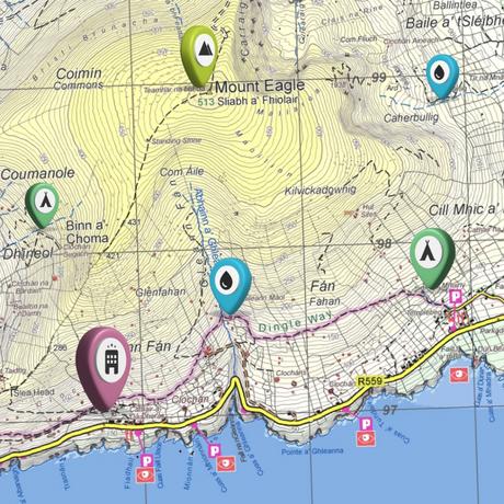
 Sample of EastWest Mapping over Mount Eagle.
As we move forward, we promise to continue integrating features and enhancements that align with our mission – to ensure every hike you embark on is a unique journey of discovery, aided by reliable navigation tools. Enjoy the enhanced experience on your next hike with the Dingle Peninsula maps, and stay tuned for more exciting updates!

