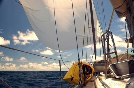
There’s a problem: many cruisers think that sailing performance isn’t important. Hey, cruising is about slowing down, right?! But dismissing performance is poor seamanship. Part two in a series.
Efficient sailing is partly about sail trim and sail handling (that’s covered here), and partly about routing. With a few rules, routing from A to B can be faster (and safer).
Zoom in on details of sailing to the next place and you’re into A to B routing. Sometimes this is easy; a straight path without complicating factors. Often subtle variables can cost you time or diesel, and elevate risk.
Going from Seattle to Friday Harbor, you look at the weather and the tide for when you expect to be at Cattle Pass. This is A to B routing. Practical experience from attempting Cattle Pass on the wrong tide (as we once did) indelibly marks this detail as one not to forget. There are many “Cattle Pass” lessons that you learn to incorporate in A to B routing. This is local knowledge and it saves time, money, and lowers risk. Venture to a new area and local knowledge is gone.
Fortunately, wherever you’re going, somebody went there and wrote about it. Many blue water cruisers reference Jimmy Cornell’s World Cruising Routes. It’s a fine book for big picture routing and guidance on A to B routing, but it’s not a roadmap.
Our passage in April from Ascension Island to Barbados was 3,100 miles long. The small group of boats doing this passage referenced Cornell, and set out with the author’s advice on crossing the equator between 28 and 30 degrees west longitude. Crossing further west into northeast trade winds can make the Caribbean upwind and hard to reach. This advice has the downside of being into a wider band of ITCZ, meaning more squalls. Off the boats went, one by one, aimed at 28 degrees west. We chose a different route.
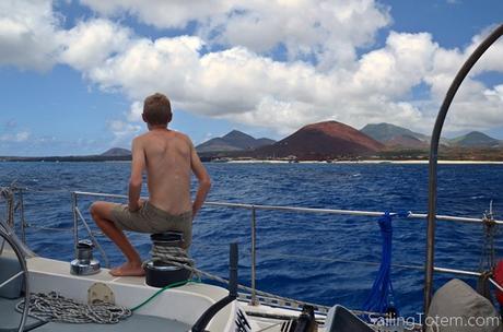
Landfall: Ascension Island
In A to B routing, the longer or more complicated the route, the more days in advance I study weather and variables. For weeks I studied several different GRIB models. Day after day, trade winds were not northeast as Cornell said, but east north east and just fine for getting to the Caribbean. Investigating a route along the coast of Brazil, 900 miles west of Cornell’s route, I found reference to a strong current flowing northward along the coast. Fine wind, less lightning (narrower band of ITCZ), and positive current was too good to ignore. PredictWind’s routing algorithms (that’s our track in their viewer below, automatically generated with pings from our Iridium GO underway) in the Offshore app concurred, and bingo, we were off to the Brazilian coast. It was beautiful sailing with very few squalls, averaging 180 NM per day over 17.2 days. The “book route” took boats 5 to 7 days longer, experienced more squalls, and burned a lot more diesel.
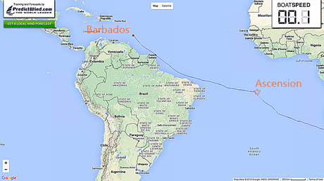
After this passage I happened to reread Slocum’s Sailing Alone Around the World. In 1898, Slocum sailed Spray on the same route along the coast of Brazil to reach the Caribbean in good time, noting, “the current, now at its height, amounted to forty miles a day.” Eighty-nine years later, Jimmy Cornell missed or disregarded this current. His book is still a great resource, but scenarios like this are a good reminder that it’s only one static resource.
From this lesson and others, here are six rules for A to B routing.
- Use multiple data sources.
- Schedules are inconvenient.
- When weather sources disagree, don’t pick one as best.
- Consider tidal and current flow.
- “Group think” weather analysis is always one opinion to many.
- Forecast accuracy varies regionally; compare forecasted and actual weather over time.
Efficient sailing will get you there faster, safer, and with less wear and tear. Just don’t confuse it with performance sailing! That can lead to soggy spinnaker and sour party mood.
This post was contributed by Jamie, who shares his more technical sailing experience from time to time. It’s really two legs on a three-legged stool, because routing is as important to efficient passagemaking as sail trim and sail handling…that post will have to come later.
