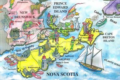
The Geomatics Association of Nova Scotia (GANS) have announced that they are hosting a Creative Map Competition for Nova Scotian Students for International Map Year.
The creative mapping GANS contest is open to students of all grades including post secondary students and is intended to help encourage young people to participate in creative cartographic activities while learning more about the geography, heritage and history of Nova Scotia.Creative Map Competition for Nova Scotian Students
Prizes will be awarded to 1st, 2nd, & 3rd place entries in 7 different categories thanks to several generous sponsors including Heritage Trust of Nova Scotia, Centre of Geographic Sciences (COGS), Esri Canada, Geomatics Association of Nova Scotia (GANS) and Canadian Geographic.Nova Scotian teachers/students may submit maps, on the theme “Nova Scotia – A Province Rich in Heritage”.
Categories of competition:

- Primary – Grade 2 – Creative Maps
- Grade 3 – Grade 6 – Creative Maps
- Grade 7 – Grade 9 – Creative Maps
- Grade 10 – Grade 12 – Creative Maps
- Grade 10 – Grade 12 – GIS Story Maps
- Post-secondary – Creative Maps
- Post-secondary – GIS Story Maps
Also Check Out ...

The GeoGeeks Fraser Valley Group is for those interested in spatial related things and for those who are interested in sharing that passion with others through spatial technology.
There is so much that cab be learned and shared from one another: open data, open street mapping, open source software, new technology and techniques, and more. So if you are in the Fraser Valley area then you should get together, network and support one other!

TeachMeGIS, a Houston based GIS training company, has recently announced a decision to expand its public petroleum based GIS training classes to Calgary, Canada. This expansion has been expedited by the growing demand for geospatial skills in the industry.

Calgary-based experts are charting a bold new course in geographic education by introducing geospatial software designed for the next generations of tech-savvy learners. The software package, developed with support from TECTERRA, creates 3D maps combining multiple data streams (such as traffic flows, wildlife migration patterns and watersheds) on one digital platform to see how they interact with each other.
W. H. Pugsley Collection of Early Canadian Maps (1556 to 1857)
