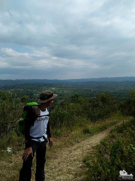
When undertaking adventures, we usually think of doing these activities for personal accomplishments. But there are times when we suddenly realize that we are doing these to honor someone. To show respect to people who have done so much for us even though they are usually invisible in our radar. Hiking Segment 3 of the Cebu Highlands Trail is honoring the men and women in uniform. The unfairly castigated law enforcers who are ready to give up their lives to keep us safe.
Tired from a long hike, we slept soundly, sheltered against elements in the unfinished Mompeller Health Center. We woke up at 5:30 AM and cooked a big, hot breakfast. We needed a huge carbohydrate-and-protein meal because we expect to have a very long walk ahead. In fact, it would probably be the longest walk in our CHT adventure.
You see, completing CHT Segment 3 was supposed to take 3 days and 2 nights. Due to that infallible reason of saving our careers (yes, we are full-time employees), we decided to make it a 2-day weekend affair. That meant we will be stretching our limits on this hike.
As we said goodbye to our Mompeller caretakers, we once again entered into Cebu’s vast and beautiful landscapes under the growing heat of a sunny day. If eggs, hot dogs, veggies, and soup were the breakfast of the stomach, then these wonderful views were the breakfast for our souls.
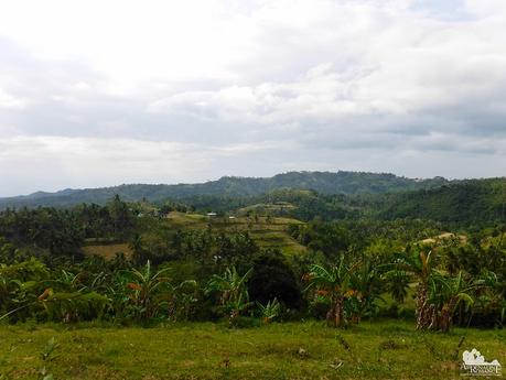
The non-stop walk yesterday took a toll on Sweetie. She complained of some pain in her calves the night before even though I gave her a leg massage and a healthy splotch of liniment.
Not wanting to be a burden to the team, she decided to ride our police escort’s jeep to the segment’s various stop points while we continue the hike. Lucky Sweetie! Hmph!
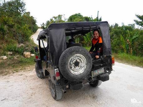
Some sections of the road branch off. If you’re not familiar with where these roads go, you may end up in a community, village, or town far from your destination!
Ask locals for the right directions? Yeah, if you find human souls here! People rarely ply these roads, and the occasional drone of a lone, rickety motorcycle is perhaps a great relief to a desperate and lost visitor.
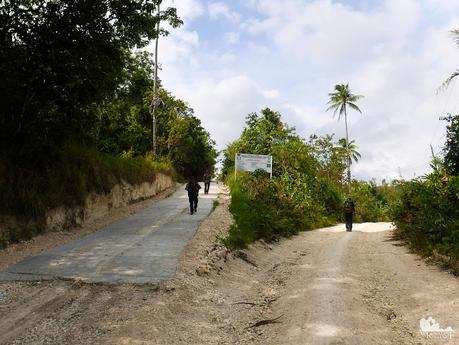
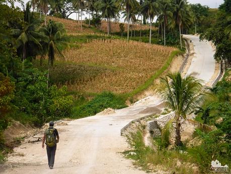
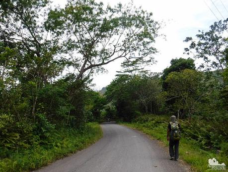
A long time ago, the road which we were walking on was nothing more than a dirt trail that winds around, through, and following the mountains. Locals had to hump it out—feet and shoulders—to travel from one place to another sell their harvests or buy supplies.
The government saw their predicament. As such, these trails became asphalted or concreted roads. After decades of being a whisper in the cacophony, locals in these areas finally have an easier and more accessible way to travel and transport their goods.
While we may be averse to concreted roads when it comes to trekking, we absolutely understand that they are vital for the progress—and even survival—of mountain communities.
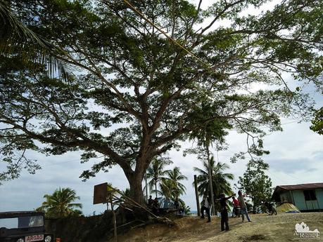
Two hours since we left, we finally came to our first stop point, a small community surrounding this gigantic, shady acacia tree. Acacia trees are stuff of Filipino folklore; local legends say that these are dwelling places of anitos (ancestors), duwendes (gnomes), and diwatas (fairies). They might very well so, considering their large expanse and majestic tendrils. Today though, they offer us a comfortable shade from the hot morning sun.
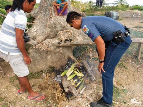
When we arrived there, Sweetie, our policemen escorts, and a few locals were busy doing something underneath the tree. While we don’t know what they’re doing, our noses detected the scent of something smoky—and delicious!
It turned out that the locals were roasting some fresh ears of corn on a hot open fire! Mmmmmm….perfect timing! We were starving after that long walk!
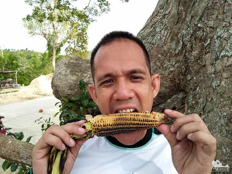
Tough but yummy! Roasted corn is one of our favorite “natural” snacks. Our grandparents used to prepare these for merienda when we were young. Eating these slightly bitter, slightly sweet kernels reminded us of childhood. Not only are they delicious, they are also nutritious! They are rich in vitamins, minerals, and fiber.
Re-energized by the roasted corn, we bade goodbye and continued on our way. Our feet started to hurt, and we could feel heat spots in every step. But we continued on. As the saying goes, “every step is one step closer to your destination.”
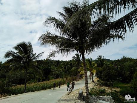
There are many sights of local life all around the rarely traveled road. Earth banks like these are signs of contour farming, which is still practiced until today. Contour farming is a traditional farming methodology involving plowing or planting across a mountain slope, following the slope’s elevation contour lines. Doing so creates water breaks that prevent erosion during the rainy season.
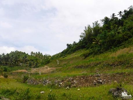
The hot sun slowly but steadily drained us of our energy as the morning wore on. Good thing that as we neared our designated lunch stop, we came to a long, straight section of road that runs in the middle of two small mountain ranges. The trees of the first-generation forest pumped out fresh cool air while the slopes acted as natural sun shields.
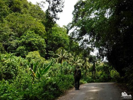
For years, these vast stretches have been under the care of generations of locals. Unlike developers who bulldoze entire mountains for money, these people intimately know the value of their land, their ancestors living here for generations.
They are aware of the symbiosis here. The land provides them with what they need to live. The people, in return, judiciously protect and take care of the land, ensuring that its richness is not abused.
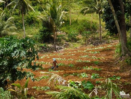
We reached our lunch point a little past noon, but we were simply too hungry and exhausted to take photos. Hahaha! What we were focused on was eating bowls of hot and freshly cooked linat-an (chunks of pork stewed in a broth filled with leafy vegetables), soft tortang talong (broiled eggplants that are coated in scrambled eggs and fried) and ice-cold soft drinks. We also took the time to take off our shoes to give relief to our overheated feet.
An hour later, we continued our long trek to Dalaguete. We were just a little over halfway to the border of the municipality! The agony was real. The call to quit and ride a habal-habal straight to Mantalongon was strong. Sir Jing already warned us that by cutting our hike to 2 days, we have walked the path of the philosopher.
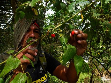
Good thing that the fertile bushes alongside the road have these ready-to-eat snacks. These are wild raspberries, and they have a somewhat sour taste. Pick the largest, reddest ones—they have a tinge of sweetness in them.
One of the landmarks of Segment 3—and this part of Argao—is this centuries-old balete tree, which acts as a forlorn guardian of the valley beyond. Our escorts said that this is a popular spot for children and teens. We wonder why.
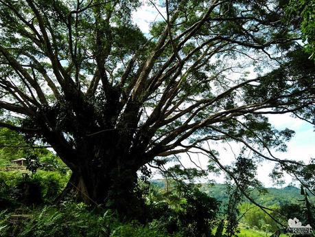
Just look at the size of that tree! It dwarfs Apol and Keir! Because of their ominous viney forms, balete trees are often regarded as sacred dwelling places of supernatural beings. In fact, in some cultures, locals perform magical rituals beside or inside the hollow chambers of huge balete trees.
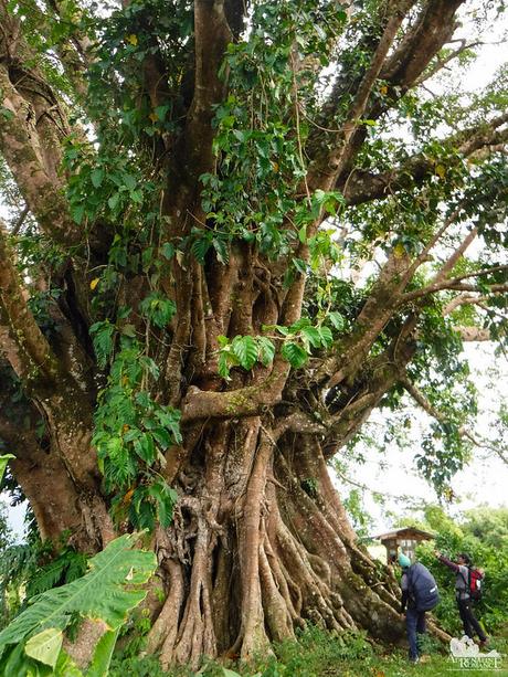
Following the short pathway that wound around the balete, we understood why this is a frequently visited spot. Beneath its sprawling canopy is a pool of fresh spring water whose flow is endless. This seems to be a makeshift swimming pool for the locals although the presence of discarded soap bar wrappers also suggests this is a place where they do their laundry.
Are we tempted to swim? Hell, if not for our itinerary, we would have dived in right away! A cool swim with a wonderful view! What more could you ask for?
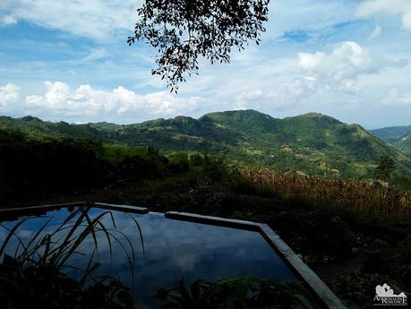
The balete tree looks over a deep valley that cuts across the municipality of Argao. Quietly admiring this view, it was hard for us to fathom just how huge Cebu is!
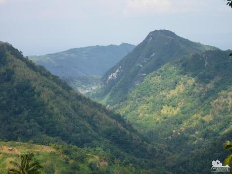
At this point, we could see Mt. Lantoy, a popular hiking destination in Argao. That white scar is colloquially called White Horse Stone due to—well—you can see what it resembles, don’t you? Somewhere over there is the cavernous Balay sa Agta, an enormous cave that we plan to visit soon.
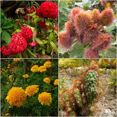
One of the nicest things about the CHT is that you see a whole lot of strange flowers. These beautiful ones look like they grow on alien worlds! These would cost a lot when sold in the lowlands. No, don’t get any ideas!
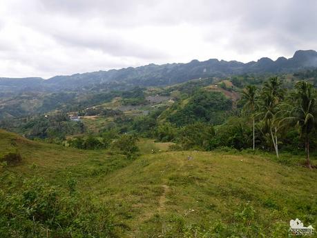
Right on time! At 4 PM, 9 hours since we left Mompeller, we entered the municipality of Dalaguete. From afar, we could see the hill-like karst mountain tops that the municipality of Dalaguete is known for. Some of its most well-known mountains such as Osmeña Peak and Candongao Peak are located here.
Rice terraces sprawl in large plots of land in Dalaguete. These terraces help control erosion.
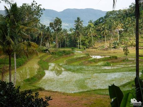
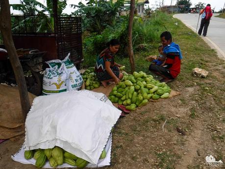
Dalaguete is also known as the Vegetable Basket of Cebu. The fertile mountain soil and the cool highland temperature make the entirety of the municipality an ideal place for growing vegetables.
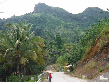
As we walked on the road that cuts across Dalaguete, we found familiar adventure sites. That topmost summit in the photo below is Candongao Peak, which has become quite popular since the publication of our article about our climb there.
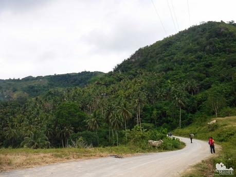
It was a long last stretch to Mantalongon, a hike of about 13 kilometers. The hike was extremely painful and exhausting for everyone considering that we have already walked on concrete for most of the day. Sweetie, who has been injured, had to walk this last stretch because our lone police escort in Dalaguete rode a rented habal-habal.
It took us around 5 long, excruciating hours to finally reach our destination. The only things that kept replenishing our energy reserves were the fresh, cool mountain air and the thought that there’s a delicious hot dinner at the end of the road.
Finally, at 9 PM, 14 hours since we left Mompeller, we finally stumbled—half dead—at the Mantalongon Barangay Hall. What a hike! And finishing Segment 3 in just two days deserves a feast. We ate some barbecued pork and veggies we bought from the market. The king of the table, however, was a sumptuous Bisayang manok tinola (native chicken cooked tinola style) that the Barangay officials shared with us.
We took a refreshing shower and decided to sleep at the barangay hall so we could wake up early and catch the first bus trip back to Cebu.
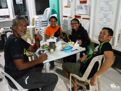
Special Thanks
We would like to thank our police escorts in Carcar, Barili, Sibonga, Argao, and Dalaguete who accompanied us all throughout the hike, making sure we are safe and secure. We would also like to thank the barangay officials who fed us with delicacies and meals to keep us nourished during this grueling hike.
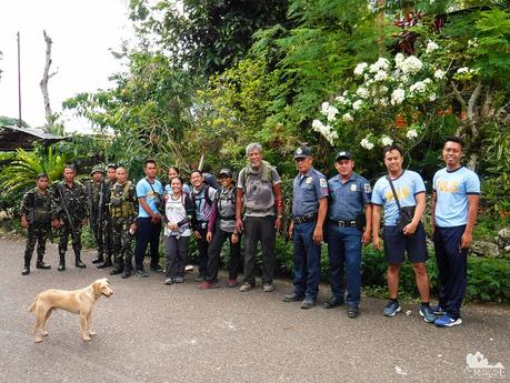
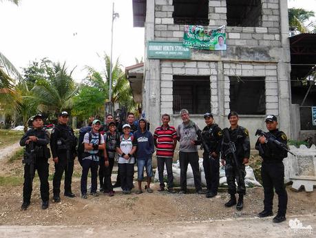
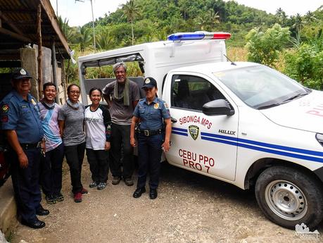
We would like to think that finishing Segment 3 of the Cebu Highlands Trail is a personal achievement. But after tagging along with these dedicated, kind, and friendly law enforcers, we realized that this strenuous hike is an honor for them. For that, we salute you sirs! This hike is for you.
Itinerary*
Day 1
5:00 AM – Assemble at Cebu South Bus Terminal
5:30 AM – Leave Cebu City by bus
7:00 AM – Arrive Mantalongon, Barili. Breakfast
8:00 AM – Leave Mantalongon
9:45 AM – Arrive Guadalupe, Carcar City
10:45 AM – Arrive Napo, Carcar City
11:00 AM – Arrive Lamac, Barili, lunch
12:30 PM – Leave Lamac
4:00 PM – Arrive Mompeller, Argao, set camp, cook dinner
6:00 PM – dinner
8:00 PM – Lights out
Day 2
5:00 AM – Wakeup call, prepare breakfast
6:00 AM – Breakfast, break camp
7:00 AM – Leave Mompeller
12:00 PM – Arrive Bayabas, Cansuje, Argao, lunch
1:15 PM – Leave Bayabas
4:00 PM – Arrive Manlapay, Dalaguete
9:00 PM – Arrive Mantalongon, Dalaguete barangay hall, Dinner
10:00 PM – shower and rest
Day 3
3:00 AM – wake up, leave barangay hall
3:30 AM – ride first bus trip to Cebu
Budget**
- Php 70 per person – bus fare per person, Cebu South Bus Terminal to Barili Public Market to Cebu South Bus Terminal
- Php 100 per person – bus fare per person, Mantalongon Market, Dalaguete to Cebu South Bus Terminal
- TBN (to be negotiated) – Sir Jing’s professional guideship fee
* To avoid exhaustion and the likelihood of injury during this long hike, it is strongly recommended that you follow the original 3-day, 2-night schedule. On the 3rd day, you can have a side trip to Candongao Peak, Osmeña Peak, and other attractions in Dalaguete. We only compressed ours because we have work on Monday.
** Rates can change without prior notice. Note that we didn’t include the budget for meals, snacks, and personal expenses as you may have different sharing schemes or preferences.
Tips
1. For guideship services, contact Mr. Jing Lavilles de Egurrola at 0933-3225005. You can also get in touch with him through his personal Facebook account and through the Camp Red Facebook Group. He and his partner Jonathan Apurado are the only ones who have completed the CHT.
Please have the courtesy to introduce yourself first when contacting him. Let him know that we referred you to him through our blog.
2. Presently, self-guided hikes on the CHT are not yet possible. The trail is not marked, and you could get easily lost. Moreover, locals are wary of strangers, and visiting their place unannounced can make them suspicious of your presence. This could constitute a misunderstanding or worse, a security issue. It’s mandatory to hire Sir Jing as he will get the necessary permissions and arrange the courtesy visits for you.
3. As of this writing, a guided thru-hike is not yet possible. Until the trail is marked and the Cebu Province supports its protection and documentation, only guided segment/sub-segment hikes can be done.
4. Bring a wide-brimmed hat or scarf to protect yourself from the heat. Don’t hesitate to tell the guide to stop if you feel exhausted.
5. Water sources are aplenty on the trail. You can also buy bottled water and resupply at the sari-sari stores along the way.
6. Wear arm guards and trekking pants to protect your skin from the sun and prickly plants. Also, a dry-fit shirt or rash guard will help keep you cool. Se7en makes very comfortable outdoor apparel.
7. Wear trekking shoes or sandals with an aggressive tread. You will need a lot of traction since you will be scrambling over loose soil and slippery rocks.
8. Bring salt tablets or ion-filled beverages such as Gatorade, coconut water, or fruit juice aside from water. The hot sun, multiple ascents, and exposed trails can make you sweat a lot. When you lose enough ions and salts via your sweat, cramps will occur. If cramps happen, rest for a while, drink a lot of water or ionic drinks. This will replenish the ions in your system.
9. Bring energy-rich trail food such as nuts, crackers, bread, and bananas. Don’t underestimate the trail.
10. Pack light but do bring the following:
- water (at least 2 liters)
- good-quality 3-season tent with fly sheet and groundsheet (or hammock)
- cookset (can be shared with the group)
- burner (can be shared with the group)
- cold weather gear (warmer, thermal underwear, fleece
- jacket, windbreaker or winter jacket)
- extra clothes (1 set for climbing, 1 set for sleeping, 1 set for returning home)
- trekking shoes/boots and light flip-flops (for walking around the campsite)
- raincoat, rain jacket, or poncho
- hat, scarf, and sunglasses (to protect yourself from the sun)
- first aid kit
- food for dinner, breakfast, and lunch
- hydration salts, table salt, or Gatorade (to avoid and relieve cramps)
- toiletries
- headlamp or flashlight
- whistle
- cellphone
- extra money
- trail snack
- personal medication
11. Don’t forget to waterproof your belongings. You can do this easily by wrapping your stuff inside dry sacks or plastic bags.
12. Please mind your trash; do not leave any of your garbage behind. Keep your voices low, and avoid unruly behavior.

