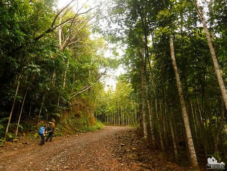
There is nothing ordinary. The simplest lifeforms, the most humble homes, the most basic communities—they all have something special. But you need to have an open mind, a keen willingness to learn, a humble heart, and a ready sense of acceptance to experience their unique salience. When hiking the CHT, you need these qualities to truly take into heart the uniqueness of Cebu’s highlands. If you walk CHT for Instagram photos or bragging rights, you won’t be able to experience the trail’s essence.
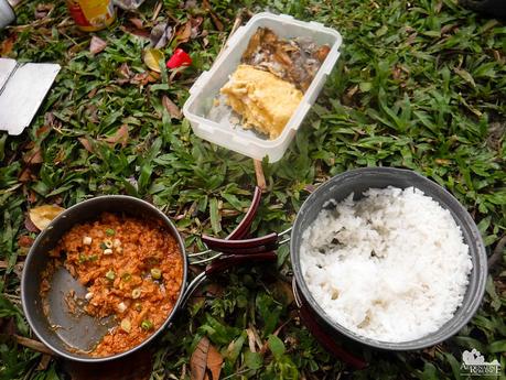
We woke up to a gray, cold, and windy early morning—fortunately, there was no rain—thanks to a tropical depression southwest of the country. To stave off the heat, we prepared a steaming breakfast of spicy tuna, scrambled eggs, fried dried fish, and rice. This would get us going—and warm—for the remainder of the morning.
After breaking camp and making sure we did not leave anything behind, we started walking down the trail that led to the town of Buot. The not-so-promising weather forecast got us a bit apprehensive, but not exactly worried. We just wanted to stay dry because it’s just a pain to wash dried mud when we get back home.
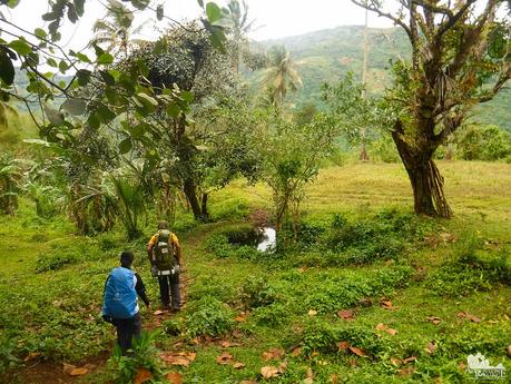
As we descended down the valley, we could see the start of farm encroachment on the slope’s features. Trees were cleared in preparation for plowing the soil.
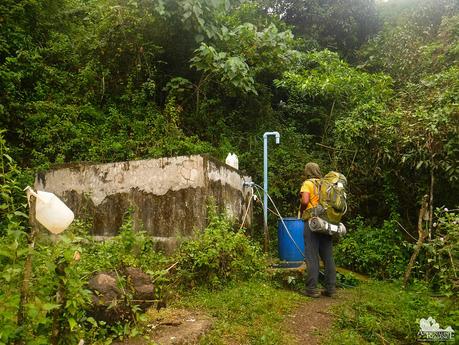
Deep-well systems such as these provide nearby communities with a virtually never-ending supply of fresh, potable spring water. Without a proper plumbing system, locals are forced to bring large water containers and fill them up here every day. Then they laboriously haul back the containers back to their homes where they will use the water for drinking and washing.
We do hope locals will take care of water sources like these. When we re-filled our Nalgenes with fresh water, we saw mounds of plastic waste (usually soap and shampoo sachets) in the vicinity.
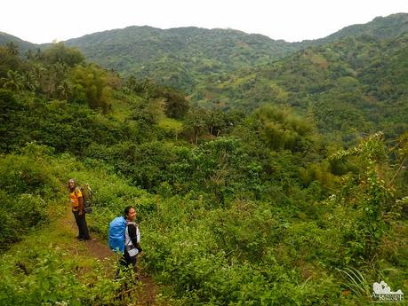
The surroundings may appear to be wilderness due to the dense vegetation and lofty mountain ranges. But this trail we were walking on is actually a farm trail, a snaking pathway with high foot traffic. Locals use trails like these to get to their farms as well as other towns and villages. Today though, we were the only ones walking here.
Trails like these crisscross across the land, some taking several hours to traverse. That’s why you need Sir Jing as a guide if you want to walk the CHT as he is the only one who is familiar with these trails.
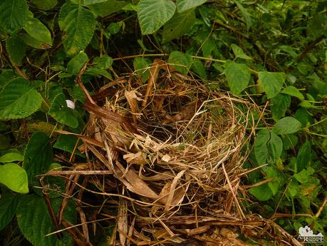
We found some interesting things along the trail. For example, we came across this empty nest. Mama Bird must be hunting for something to eat before she lays her eggs here. Nature definitely is both unbelievably gentle and horrendously harsh.
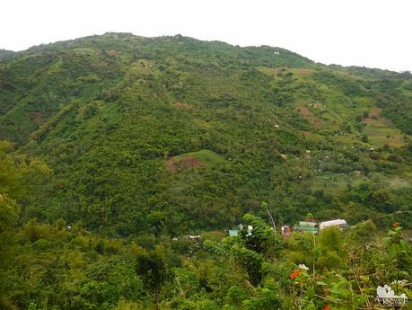
Far below us was the quiet town of Buot, a small farming community that is almost lost in Cebu’s economic map. Most residents here are farmers, loggers, and flower and vegetable vendors. Being surrounded by vast mountains and located far away from the metro, there’s hardly any other industry here.
But not all is bad though. Buot is a perfect place to stay for people who want to wind up, relax, and temporarily distance themselves away from the noise of the city. Residents here are generally happier and less stressed than their counterparts in the metropolis.
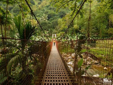
This hanging cable bridge is one of the town’s defining features. The footbridge allows people to safely cross the span of Buot River. It swayed a little bit as we crossed it, and Sweetie’s heart skipped a bit when I playfully shook the cables. Hahaha!
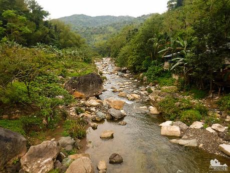
From the bridge, we could see a section of the Buot River below us. We could see why this bridge is necessary. During a heavy rain, the waterway swells, making it dangerous for anyone to cross through. Anyone unfortunate enough to be caught in a flash flood will surely crash on those humongous boulders.
But many Filipinos are born (or made) daredevils though. A few moments after taking this photo, a motorcycle driver and his wife crossed the river at a shallow point—-on their two-wheel motorcycle!
At the end of the bridge is this old, giant Acacia tree. This one must have been more than a hundred years old. Centuries ago, the island of Cebu is covered with forests of huge native acacias like these. But endless deforestation, logging, and clearing activities—both legal and illegal—virtually eradicated the island’s first-generation forests, including the acacias.
Today, acacia trees can be only found singly or in small groves. Their rarity and magnificence have earned them a mystical reputation.
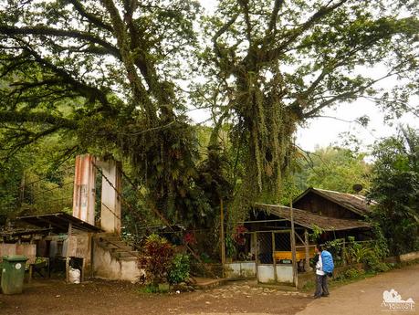
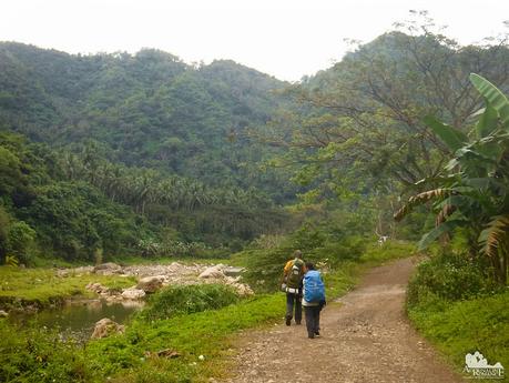
From here, most of the way to Lutopan consists of an alternating landscape of dirt roads and asphalted roads. Walking on these started to hurt our feet, but we didn’t mind. The stunning green mountains that surround us and the lovely flowing river that we’re following were enough to take our mind away from the pain.
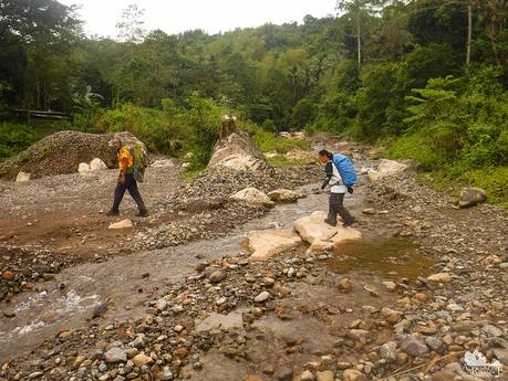
One of the main industries in Buot is gravel extraction. In the Philippines, gravel is mixed with cement as an aggregate to make the binding agent stronger.
The gravel extraction isn’t done in the river itself but in one of its major tributaries. We can actually see the tributaries draining to a trickle due to the extraction activities.
As we mentioned in our earlier CHT entry, there are so many interesting things in rural life that make you realize just how rich and unique our history and culture is.
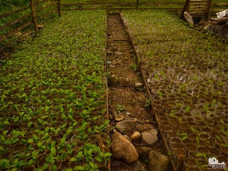
For example, we saw large fenced and sheltered areas reserved for saplings just along the roadside. The saplings are taken care off until it’s time to transplant them. Farms carefully and laboriously carry these saplings to their farms located on steep mountain slopes.
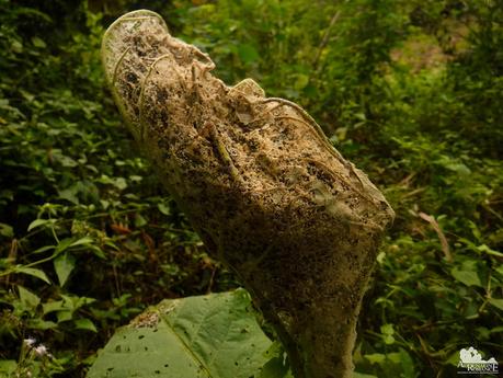
We also saw these large cocoons made of wild silk. In the olden days, our ancestors harvested these cocoons and carefully unwound the silk so it could be made into beautiful, smooth, glimmering cloth. Apparently, that industry has been abandoned in Cebu a long time ago.
Today, natural silk is produced through sericulture, or silk farming, and not in the wild.
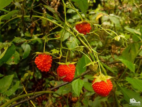
Bushes alongside the road bear tiny raspberries of a local species. We plucked a few and munched on them as we walked; they taste delightfully sour. Raspberries are rich in vitamin C, manganese, and dietary fiber.
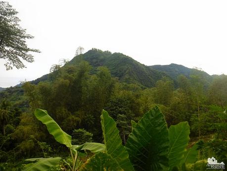
From afar, we could see the hump-like peak of Mt. Samboryo. It’s always a cool feeling to see the entirety of a mountain and realize that you’ve just climbed it a few days ago.
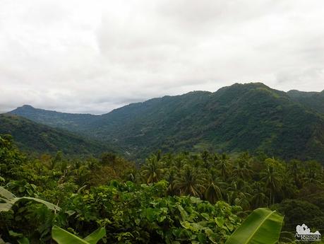
But that’s actually nothing when, after more than an hour of walking, we came to a nice clearing where we can see the entire length of Cebu’s Babag Range. We whooped in elation after we realized that we have just traversed that mountain range in a weekend. Suddenly, we remember what we had to face to cross that range—drenching rain, chilly winds, lose and muddy soil, trails that skim along steep slopes and ravines, and an approaching low-pressure area.
In life, success is always sweeter when you know you’ve done it through your own blood, sweat, and tears without any shortcut.
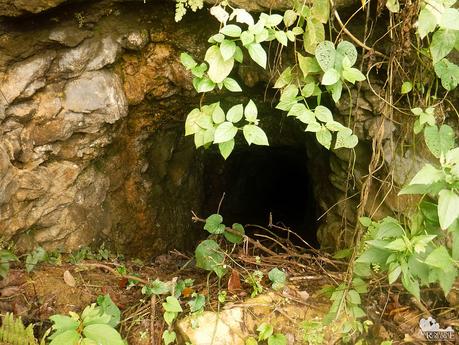
Continuing our hike to Lutopan, we found the remnants of another tunnel system. Sir Jing said that this is one of the many tunnels that the Japanese soldiers dug during World War 2. They used these tunnels to move around undetected so they could raid villages, gather supplies, or ambush American and Filipino soldiers.
We came across a small house where they had a flowing water source. We asked the owner if we could get some water so we could brush our teeth and wash our faces.
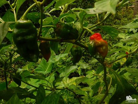
While we did that, Sir Jing couldn’t hold his excitement when he saw a certain plant in the homeowner’s small farm. It turned out to be the Naga Viper, a species of pepper that originates in Indonesia. In the local dialect, it is called siling demonyo (demon pepper). The Naga Viper is one of the world’s hottest pepper, having a rating of 1,382,118 Scoville Heat Units. In fact, in 2011, it was officially recorded as the “World’s Hottest Chili” by the Guinness World Records. That record is now surpassed by other peppers.
We asked the owner if we could get some so we can plant the seeds at home. It’s evident that the owner is unaware that he has a world-renowned, award-winning pepper growing in his home as he told us to take as many peppers as we want!
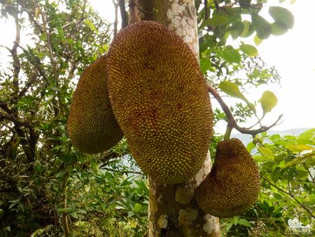
With a couple of siling demonyo carefully stowed in our packs, we continued on our way. We spotted a lot of fruits growing on trees that line up the roadside. There are giant jackfruits, for example. The sweet, luscious, and slightly crispy meat of the ripe fruit can be eaten straight from the husk once you free it from its fibrous and sticky gum.
The raw meat can be cooked as a vegetable stew that is thickened with some coconut milk. Finally, the large seeds can be boiled until tender, and they’re usually eaten as a snack.
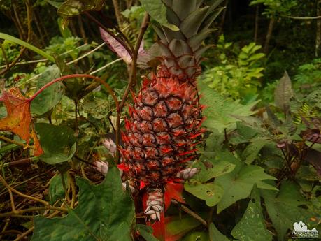
We also found wild pineapples a bit farther off the road. We were tempted to take it with us. Hahahaha!
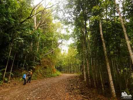
The ascending road cut through a forest of these trees with thin trunks. Judging from the almost uniform arrangement of the grove, this is apparently a reforested area.
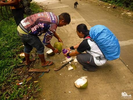
Nearing Manipis Road, we came across two lads snacking on coconuts. We offered to buy a few coconuts, and they gladly climbed a tree to get some young bukos for us.
Coconut is one of the most nutritious drupes in the world, and it’s a welcome food-and-drink source for hikers. Sweet coconut water, which is full of ions and mineral salts, is Mother Nature’s sports drink. The meat is filled with protein and healthy oils.
We stayed for a while, snacking on coconuts and sharing stories before we went on our way.
After more than an hour of walking, we finally reached the DENR Osmeña Reforestation Project in Camp 7, Minglanilla, Cebu. If you remember, this is our exit point when we climbed Mt. KM 28 and our entry point during our Seven Caves adventure.
Officially started in 1916 and supported by the late President Sergio Osmena Sr., the ORP is the first and oldest successful reforestation project in the Philippines. The initial investment for the project was P10,000, a huge amount during that time.
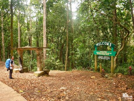
The ORP serves as a habitat for indigenous flora and fauna. Ipil, acacia, and other indigenous trees are found around the area. The ORP also houses the 123-hectare Experimental Forest Station. It serves as a training center for the management of forest plantation as well as a field laboratory for Environmental and Natural Resources technologies. A seed production area, nursery, and complex cave systems are also located here.
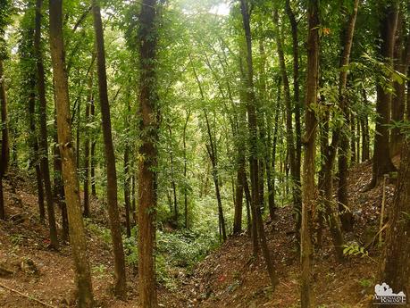
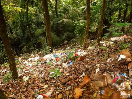
Unfortunately, locals don’t seem to realize and understand that they have a treasure in their midst. Huge amounts of plastic garbage are simply dumped in the ORP. But what is sadder is that the local DENR officials, who are supposed to be the custodians of the ORP, seem to be indifferent in preventing this lazy foolishness.
The long-term solution to this problem should be two-fold: One—continuously educating the locals about environment protection, conservation, and sustainable practices. Second—strictly enforcing environmental laws.
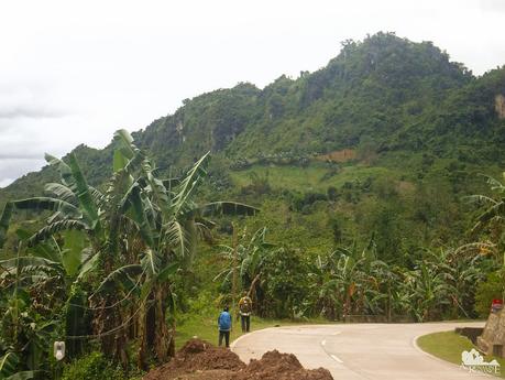
Our least favorite part of this segment was walking on the paved road. It’s painful on the feet, and the road radiates heat, making the hike hotter and more exhausting than it already is.
Nevertheless, relief washed upon us when we saw the forest-covered limestone karst formations nearby. We’ve reached Cantabaco, the southernmost barangay of Toledo. This is our weekend playground because Cantabaco has a world-class rock climbing crag where we enjoy ascending pure limestone cliffs.
It also means that we’re near our destination; right after Cantabaco is barangay Lutopan.
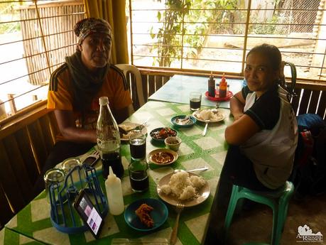
After 7 hours of walking, we finally arrived in Lutopan. We celebrated our triumph by eating a simple, filling lunch of tinolang isda, bistek, and fried chicken in a nearby carenderia.
Carenderias are small family-owned roadside restaurants that serve cheap, simple viands. You can see them everywhere, from remote villages to massive metropolises, around the Philippines. The best ones are those that serve a family specialty, usually a uniquely prepared version of a local dish.
We have successfully finished Segment 1 of the Cebu Highlands Trail with flying colors! 4 days, 3 nights, 2 weekends. Around 60 kilometers of trails and roads. An amazing team of people with a burning passion for the outdoors. Stunning, mystical sceneries. Rich, first-hand experiences of local culture and history.
But we know that this is just the beginning. There are still 360 kilometers more to go. We know that within this beautiful long-distance trail are virtually endless opportunities to experience nature, history, culture, and camaraderie.
CHT Segment 1 Links
Check out our CHT Segment 1 story by clicking the following links:
- Cebu Highlands Trail Segment 1A: Mt. Manunggal to Mt. Tongkay
- Cebu Highlands Trail Segment 1A: Mt. Tongkay to Tugop
- Cebu Highlands Trail Segment 1B: Tugop to Mt. Samboryo
- Cebu Highlands Trail Segment 1B: Mt. Samboryo to Lutopan (this article)
Itinerary
Day 1
5:00 AM – assemble at JY Square
5:30 AM – leave JY square, ride habal-habal to Tugop-Transcentral Highway crossing
6:00 AM – arrive at Tugop-Transcentral Highway crossing, start trek to Mt. Babag
9:00 AM – arrive at Muffin Hill, Bocaue Peak
12:00 PM – lunch on the trail, rest
1:00 PM – resume trek
3:00 PM – arrive at Mt. Samboryo, set shelter, prepare dinner, fetch water
6:00 PM – dinner, free time
8:00 PM – lights out
Day 2
5:00 AM – wake up, prepare breakfast
6:00 AM – breakfast, break camp
7:00 AM – leave Mt.Samboryo Campsite, trek to Baranggay Buot
11:00 AM – arrival at ORP-DENR Reforestation Area
12:00 PM – arrival at Cantabaco, lunch
1:00 PM – resume trek
2:00 PM – arrival at Lutopan, ride the bus back to Cebu
Budget*
- P 40 per person – habal-habal fare per person, JY Square to Tungkop Crossing, Transcentral Highway
- P 50 per person – bus fare per person, Lutopan to Cebu City
- TBN (to be negotiated) – Sir Jing’s professional guideship fee
* Rates can change without prior notice. Note that we didn’t include the budget for meals, snacks, and personal expenses as you may have different sharing schemes or preferences.
Tips
1. For guideship services, contact Mr. Jing Lavilles de Egurrola at 0933-3225005. You can also get in touch with him through his personal Facebook account and through the Camp Red Facebook Group. He and his partner Jonathan Apurado are the only ones who have completed the CHT.
Please have the courtesy to introduce yourself first when contacting him. Let him know that we referred you to him through our blog.
2. Presently, self-guided hikes on the CHT are not yet possible. The trail is not marked, and you could get easily lost. Moreover, locals are wary of strangers, and visiting their place unannounced can make them suspicious of your presence. This could constitute a misunderstanding or worse, a security issue. It’s mandatory to hire Sir Jing as he will get the necessary permissions and arrange the courtesy visits for you.
3. As of this writing, a guided thru-hike is not yet possible. Until the trail is marked and the Cebu Province supports its protection and documentation, only guided segment/sub-segment hikes can be done.
4. Bring a wide-brimmed hat or scarf to protect yourself from the heat. Don’t hesitate to tell the guide to stop if you feel exhausted.
5. Water sources are aplenty on the trail. You can also buy bottled water and resupply at the sari-sari stores along the way.
6. Wear arm guards and trekking pants to protect your skin from the sun and prickly plants. Also, a dry-fit shirt or rash guard will help keep you cool. Se7en makes very comfortable outdoor apparel.
7. Wear trekking shoes or sandals with an aggressive tread. You will need a lot of traction since you will be scrambling over loose soil and slippery rocks.
8. Bring salt tablets or ion-filled beverages such as Gatorade, coconut water, or fruit juice aside from water. The hot sun, multiple ascents, and exposed trails can make you sweat a lot. When you lose enough ions and salts via your sweat, cramps will occur. If cramps happen, rest for awhile, drink a lot of water or ionic drinks. This will replenish the ions in your system.
9. Bring energy-rich trail food such as nuts, crackers, bread, and bananas. Don’t underestimate the trail.
10. Pack light but do bring the following:
- water (at least 2 liters)
- good-quality 3-season tent with fly sheet and groundsheet
- cookset (can be shared with the group)
- burner (can be shared with the group)cold weather gear (warmer, thermal underwear, fleece
- jacket, windbreaker or winter jacket)
- extra clothes (1 set for climbing, 1 set for sleeping, 1 set for returning home)
- trekking shoes/boots and light flip-flops (for walking around the campsite)
- raincoat, rain jacket, or poncho
- hat, scarf, and sunglasses (to protect yourself from the sun)
- first aid kit
- food for dinner, breakfast, and lunch
- hydration salts, table salt, or Gatorade (to avoid and relieve cramps)
- toiletries
- headlamp or flashlight
- whistle
- cellphone
- extra money
- trail snack
- personal medication
11. Don’t forget to waterproof your belongings. You can do this easily by wrapping your stuff inside dry sacks or plastic bags.
12. Please mind your trash; do not leave any of your garbage behind. Keep your voices low, and avoid unruly behavior.

