Mother Nature has an eternal cycle of destruction and creation. A supermassive star, for example, explodes as a supernova, its shockwave instigating the gas in a nearby nebula to start the cosmic activity that results to the birth of a star. A forest consumed by wildfire during the hot summer months start to re-grow after the autumn rains bathe the lands. Corals, destroyed by ships landing on top of them, find new life on the steel hulk. In time, the wreck turns into a vibrant artificial reef.
We wanted to witness an actual, developing evidence of that cycle of death and rebirth during Holy Week 2014. That evidence was the aftermath of the cataclysmic eruption of Mt. Pinatubo in Luzon, Philippines more than a decade ago. The eruption and the resulting ashfall and lahar swept away farms and houses, destroyed mountains and forests, snuffed out lives, destroyed infrastructure, dented national economy, and even affected global weather.
However, in the years that followed, lands that were covered by Mt. Pinatubo’s ashfall became extremely fertile. Volcano tourism and scientific research at the tripoint of the provinces of Zambales, Tarlac, and Pampanga soared high. And undiscovered, barren coves began to take life, showing a new, gorgeous face of natural beauty.
Sweetie and I planned to see just how the volcano breathed life to these coves, namely the now-popular coves of Annawangin and Nagsasa. Of course, our adventure and learning wouldn’t be complete without a visit to the heart of it all—Mt. Pinatubo itself. Coming with us to experience the adventure were Sir Jigz Santiago, former Mt. Kanlaon head guide and now Canlaon City kagawad, and his partner Maam Efrylle. If you go back to our earlier adventures, you may recognize them as the couple who went with us to Osmeña Peak in Dalaguete, Cebu a few years ago. You could thus call our trip an adventure-couple reunion with a tinge of a Holy Week holiday!
It was a good thing that Sir Jigz and Maam Efrylle were able to take a much earlier flight. After lining up for almost 5 hours, they were able to purchase bus tickets for all of us before we arrived. Had we’ve been booked in the same flight as ours or had they waited for us before buying tickets, we wouldn’t have been able to faithfully follow our itinerary. For that, we are forever grateful to them.
We left Manila at around 3:30 AM and arrived at Olongapo at 6:00 AM. Then we took another bus bound for San Antonio in Zambales.

We skirted the beautiful “urbanized” coastline of Subic Bay where we saw fleets of giant ships, expansive harbors, and clean beaches filled with happy throngs of beachgoers in perfect harmony. Activity here, even in the early morning hours, is bustling.
As we left Subic and headed deeper into Southern Zambales, we saw the golden slopes of the majestic and massive Pundaquit mountain range.
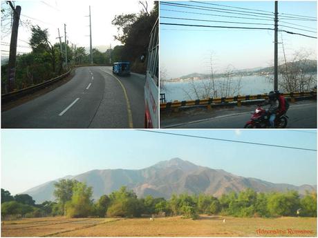
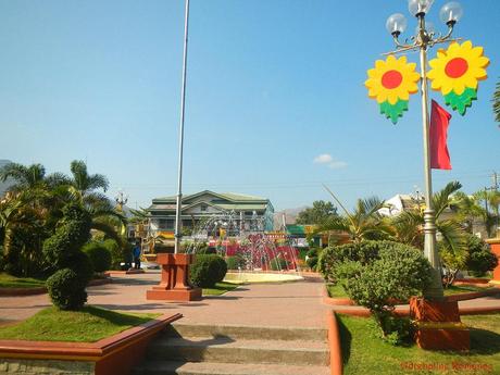
After an hour, we arrived at the quaint, lovely town of San Antonio. Check out their gorgeous town plaza!
Knowing that it was going to be quite a long, tiring day, we headed down to San Antonio’s wet market where we found this large eatery. As what we always say, a good adventure starts with a good meal! Thus, we ordered a big, filling breakfast.
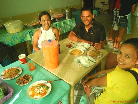
As adventurers, we always make it a point to try out a region’s specialties. San Antonio’s specialty is pancit palabok, a delicious salty-sour Filipino-Chinese dish that consists of thin rice noodles with a special shrimp sauce poured on it. The dish is then topped with chopped spring onions, slices of eggs, and pork rind bits.
Pancit palabok is found everywhere in the Philippines, but the defining characteristic of San Antonio’s palabok is its very generous serving of shrimp sauce.

After a heavy breakfast, we headed into the wet market proper to buy ingredients for our meals. It is imperative that you purchase ingredients or packed meals in San Antonio because there are no restaurants, carenderias, or eateries in the hidden coves of Zambales.

After shopping for ingredients, we headed out to the tourism desk just beside the municipal hall for registration. The tourism officers secured the tricycle and island hopping arrangements for us.

We were actually pleasantly surprised when we learned that our tricycle driver was a lithe, lively female rather than a burly male. Now, we don’t have anything against women drivers, but it’s not every day that you can see female tricycle drivers!

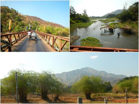
On the way to Pundaquit Beach, which involved a 30-minute tricycle ride, we were treated to a rich plethora of sights. A nice highlight of the ride was passing by a resort of some sort that is established right in the middle of a river. The resort seemingly shares the same space with farmers who use the river for agricultural purposes.
Meanwhile, the massive Pundaquit mountain range loomed ahead, obscuring the view of the secret coves, which are located behind that range.
Pundaquit Beach
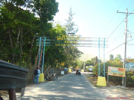
At last, we arrived at Barangay Pundaquit, which meant that the real adventure was about to start! The most prominent thing we noticed is that the Barangay is chock full of beach resorts!
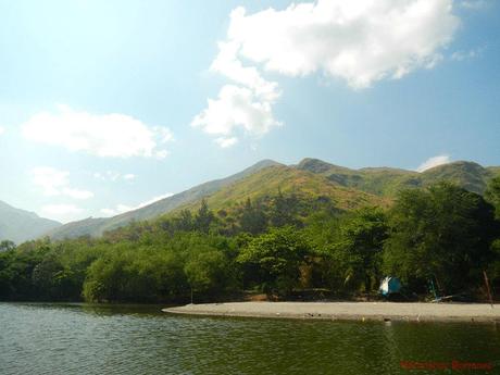
We stopped at Pundaquit Beach, a public beach and a staging point for island hopping tours around the bay. Sans the noise and the throngs of tourists, this place was the perfect definition of idyllic. Just check the photo below: that’s a gorgeous scene of sky, mountain, and sea!
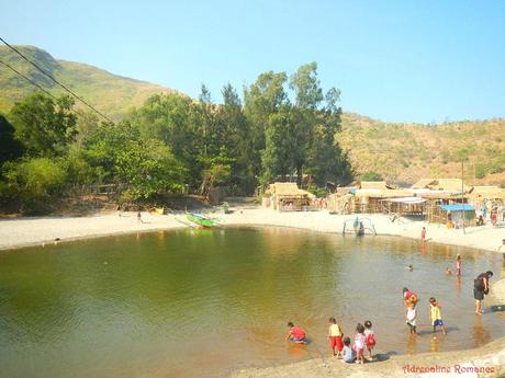
During high tide, the sea fills up this nice sandy pool. Local kids usually take a dip here during searing days such as today.
We did say searing, yes? Due to global warming, our summers of late have been extremely scorching. To cool off during the hot morning, we treated ourselves to generous servings of halo-halo, a popular Filipino beverage/dessert made of jellies, pieces of kaong, custard, pinipig crisps, and other ingredients mixed in shaved ice and milk! No soft drink, juice, or beverage can ever come to the “refreshing power” of a good halo-halo!
Aside from the usual ingredients, Pundaquit’s halo-halo has an additional ingredient—sweet, nutty caramel syrup that stuck to our taste buds.

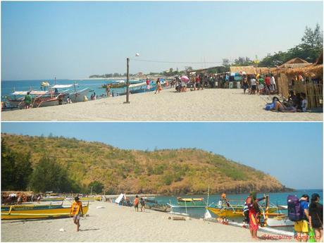
Because it was Holy Week (Good Friday, to be specific), Pundaquit beach was quite crowded with locals and visitors who want to take a break from the chaotic city life and simply take a much-needed vacation to recharge themselves. The sand that covers Pundaquit Beach is exquisite, clean, and fine, but there was really something peculiar about it. We’ll tell you about that sand in our next post.
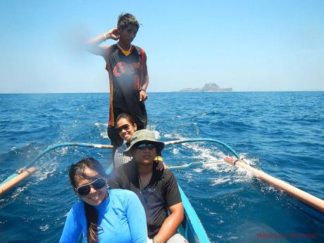
Since there were only four of us, we were assigned to a small boat, roofless boat. Later, during the cruise, we told ourselves, “We should have gotten a bigger boat.” Hehe! You’ll know why as you read this blog post.
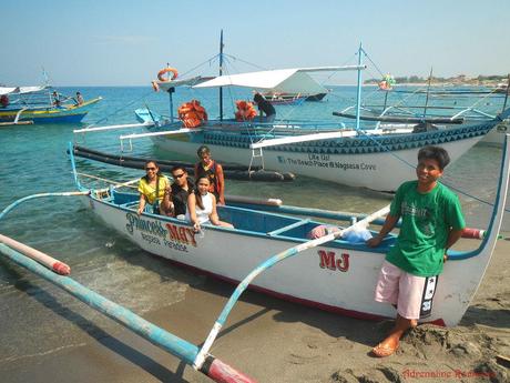
Starting with a loud guttural growl, the boat’s engine sputtered to life. We launched off from Pundaquit beach to head to our first destination Islas de Punta Capones, or, in short, Capones Island.
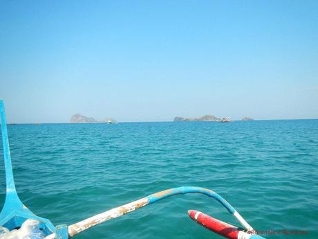
Capones Island
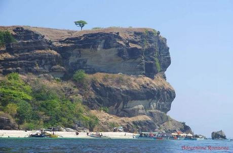
Our boat sliced through the waves as we approached Capones Island. Capones Island is an oversized shoe-shaped rock outcropping that juts out of the water. Even from afar, we could already see the magnificent limestone cliffs that make up most of the island’s perimeter.
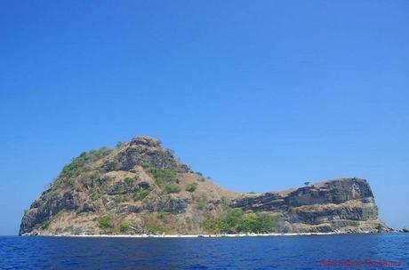
(Photo credit: Jigz Santiago)
A sandy shore faces the mainland, and we could see throngs of visitors enjoying the sand and sea. The high rocky cliff forms a protective wall that embraces the beach. More than that, you already know what went through our minds, considering we are rock climbers. Yes, that rock face is a very good candidate for bolting.
(Photo credit: Jigz Santiago)
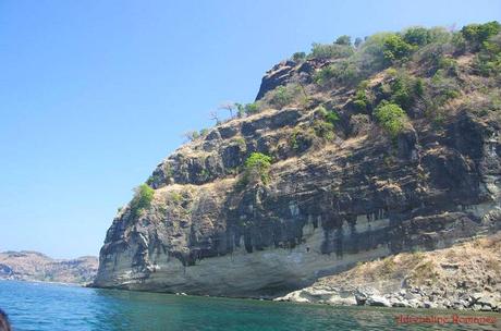
Gorgeous limestone cliffs! We weren’t able to take a closer look at these marvelous walls. However, if the water right beneath it is deep enough, these rock faces may be excellent routes for deep water soloing, a style of non-roped climbing wherein the climber falls in the water in case he or she falls.
(Photo credit: Jigz Santiago)
We docked at the south part of Capones Island, which is the entry point to the island’s highlight, the ruins of the Capones Island Lighthouse. Huge rocks embraced by rock cliffs compose the southern shore.
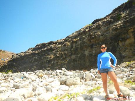
Sadly, the island’s natural beauty up close was blemished by this ugly pile of garbage. Sad sights like these always never fail to elicit a tired, exasperated sigh from us. Why do people throw trash in paradise? Are they just too lazy to clean up after themselves?
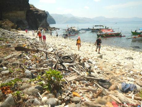
We climbed up the rocky trail that led to lighthouse. The day was immensely hot, and the short, easy climb rapidly drained our strength. We should have brought an umbrella.
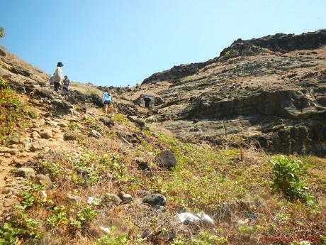
All things considered, however, it was a very easy climb. Concrete and stone steps carved on the rock faces made the trek completely manageable even for old folks.
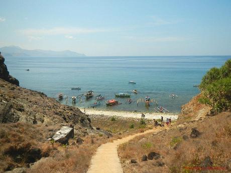
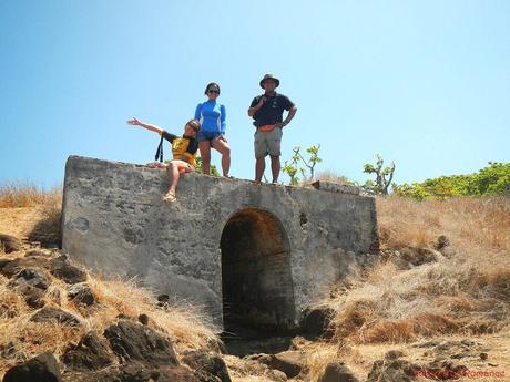
Along the way, we passed by this old stone bridge which, during its time, doubled as a bunker of some sort.
A well-established dirt trail led to the lighthouse, which was quite visible when we reached the top of the flight of rock steps. Check out the grass; the onslaught of salty moisture and the sun’s extreme heat made them wither.
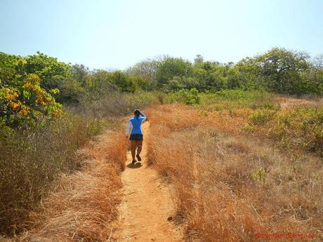
The trail continued through a lightly wooded area, much to our relief. A few minutes later, we entered through an old, eerie gate that was very reminiscent of gates in haunted-house flicks. We didn’t feel any sense of dread as we went passed through the gate and into the compound, but we’re pretty sure that the experience would be quite, well, scary at night.
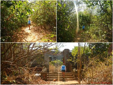
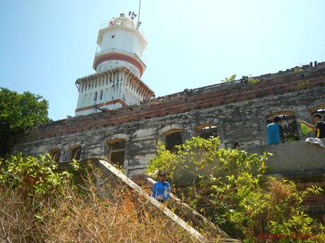
We arrived at the Capones Island Lighthouse, which is, in fact, a historic lighthouse. This lighthouse once guided vessels coming from the north towards Subic Bay, Corregidor Island, or Manila Bay. It was built and became operational sometime in the late 1890s.
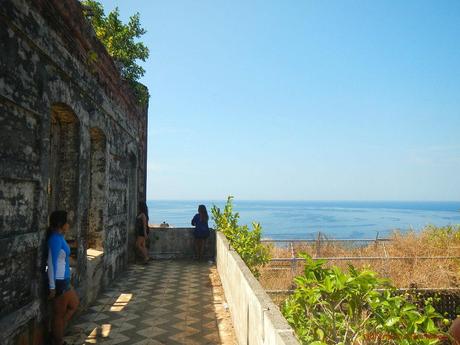
From the facility’s veranda, one can see a beautiful, encompassing view of the expanse of the West Philippine Sea. We imagine that during the lighthouse’s heyday, lonely crew members would gather around here, chat with each other, play a guitar, share glasses of tuba (coconut wine), and appreciate the view during their break.
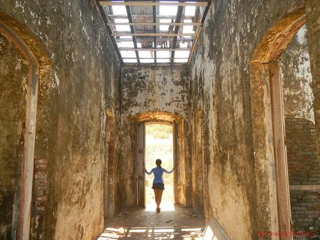
Stepping into the lighthouse’s lower levels was like stepping back in time. Sometime in the early 20th century, the Capones Lighthouse was abandoned. Years ago, in compliance with the Philippine Coast Guard’s Maritime Safety protocol, the tower was renovated and a solar-powered light was installed to replace the old lamp-and-lantern assembly. The rest of the station was left to deteriorate.
The top of the 65-foot lighthouse can be accessed by a rusty spiral ladder that shakes with each step and a series of equally rusty ladders.
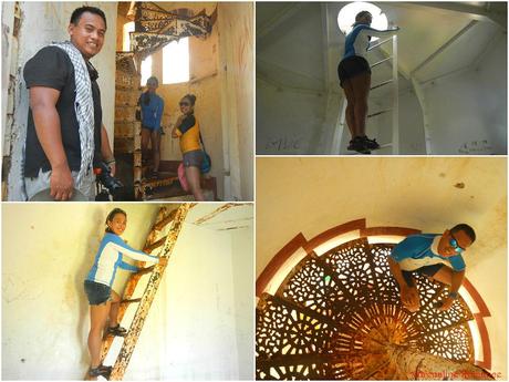
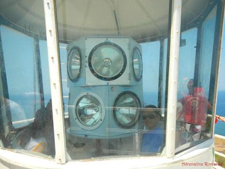
After a short climb, we arrived at the heart of the lighthouse, a set of rotating lamps that could send beams of bright lights to guide ships and boats. We’re not sure if the lamps are still functional.
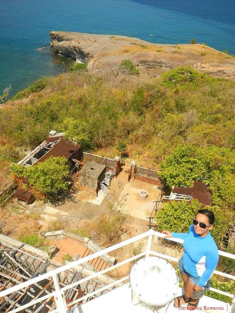
I climbed at the very top of the lighthouse, which turned out to be an excellent vantage point. Below the main lighthouse are the severely deteriorated keeper’s house and miscellaneous buildings, a deep well, and a non-functional water tank. Most of the rusting station is overgrown by plants.
According to my research, the Environmental Protection of Asia Foundation was supposed to renovate and convert the lighthouse into a marine conservation research center. Until now since the agreement was signed in 2004, no visible development is evident.
Light woods cover one side of the island. We wouldn’t be surprised if this patch of vegetation would be filled with snakes, lizards, and other reptiles.
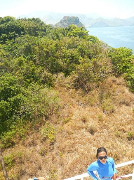
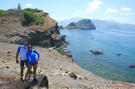
Now, that’s a completely stunning view of a peninsula, the sky, and the vast expanse of the West Philippine Sea. We would gladly wake up to a view like this every day!
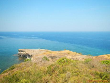
After half an hour, we descended from the lighthouse and headed towards the island’s prominent peninsula. Check out the grass; they’re golden in color! Yes, they are almost hay-like in appearance. A wonder of nature, don’t you agree?
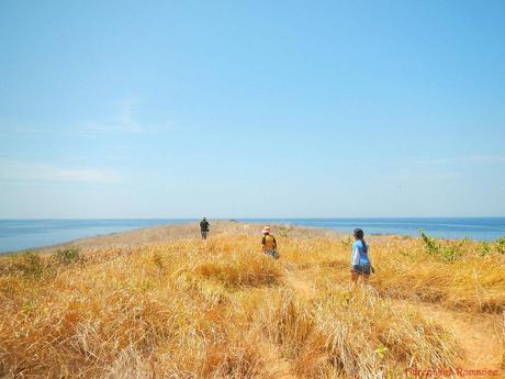
Laid out in front of us is the splendor of Zambales! And personally, the beauty of the place becomes even better when I’m together with my Sweetie! Hehehe!
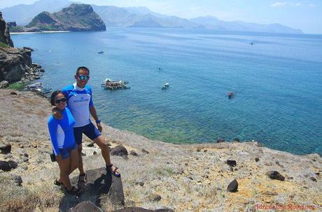
(Photo credit: Jigz Santiago)
After taking a couple of photos, we went back to our boat. Check out the rocks that line up the shore; they almost look like the pebbles of Mabua Pebble Beach in Surigao City.
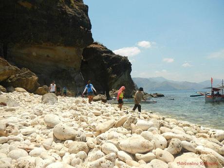
Annawangin Cove
After a satisfying hour-long visit in Capones Island, we were ready to cruise to our next destination. The 30-minute cruise to Annawanin Cove was unexpectedly choppy despite the calm, windless weather.
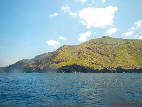
As we skirted Pundaquit’s coastline, we witnessed gorgeous mountains that abruptly ended in massive sea cliffs. Looking at the mountains, you might think that the bare slopes are the results of deforestation. Nope, these are all natural; the slopes are made up of either grasslands or loose soil.
We didn’t expect it! Just like a stage curtain, we saw this beautiful sandy cove half an hour later. The cove was nestled in the loving embrace of a protective range of high, grass-covered mountains. We have arrived at the much touted Annawangin Cove.
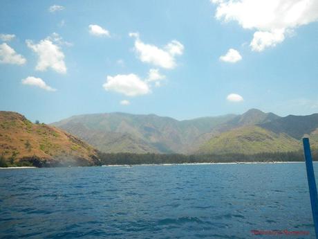
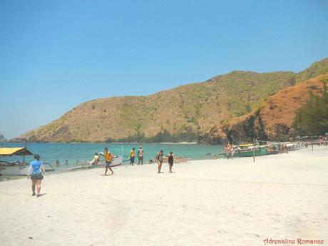
As we approached the shore of Annawangin Cove, we saw massive numbers of vacationers and beachgoers, all excited for a weekend of cool water, relaxing sea breeze, and great fun with friends and family. We didn’t expect that such a secluded cove could be so crowded.
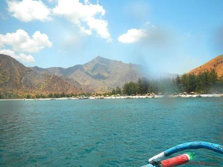
Just check out the photo below. Now, that’s what we call a beach! Powdery white sand, aquamarine waters, and encompassing mountains!
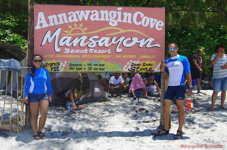
But like any other place that attracts tourists or has a huge potential as a tourist destination, Annawangin Cove has become commercialized in no time at all. Check out the rates; they’re quite high considering that the cove is technically a public beach.
Most vacationers who wish to stay overnight in Annawangin Cove bring and pitch tents rather than rent a cottage. Beachgoers who don’t have tents can rent one at an affordable price. However, rental tents are limited in number, so we strongly advice bringing your own tent.
When we arrived at Annawangin Cove, there were already hundreds of tents and even more vacationers. We understand that these places get heavily crowded during Holy Week, but we never expected that such a remote, secluded area could be THAT crowded.
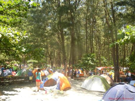
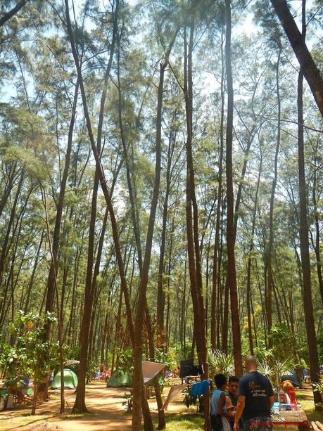
A large forest of pine-like agoho trees provides shade to give beachgoers respite from the unrelenting, punishing summer sun. Behind this forest is a marsh that provides sea birds with plenty of critters for food.
It didn’t take long before we decided that Annawangin Cove was just too crowded. So we boarded our small boat and decided to head out to the much-farther and, hopefully, less crowded Nagsasa Cove.
It was one of the most intense 45-minute boat ride in our lives. You see, the waves were quite massive even though we were close to shore; that’s not surprising since we were sailing in open water. But we still held on to the boat until our knuckles turned white. Wave after wave battered our small boat, and we were sure that our vessel would disintegrate any moment. At times, we flew right over a wave’s crest; in other times, we huddled in fear as we surf down through a deep trough.
Our boatman, however, was not even slightly perturbed!
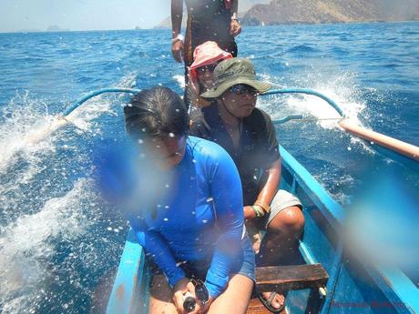
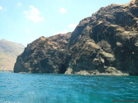
Along the way, we were treated to a spectacular display of immense sea cliffs and sea caves, clear testaments that speaks volumes of just how magnificent, powerful, and pitiless Mother Nature is.
Note: due to the cold water and the warm air, our camera lens fogged at this point. We weren’t able to take good photos of the sea cliffs. But don’t worry, they will be featured in the next article.
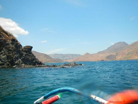
Finally, after almost an hour, we turned right towards a well-protected, secluded bay which fronted a sandy shore. At last, after a hair-raising, harrowing, wet boat ride, we reached Nagsasa Cove, our destination for the day.
Stay tuned for details of our stay in the picturesque Nagsasa Cove.
(Cover photo by Jigz Santiago)


