High Resolution Digital Elevation Model (HRDEM)
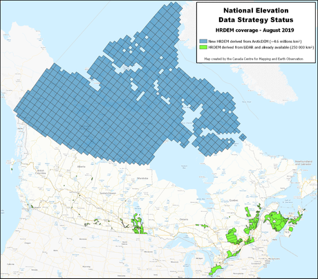
Natural Resources Canada (NRCan) has recently produced a new release of the High Resolution Digital Elevation Model (HRDEM) product for the entire Canadian Arctic and made it available to download from the Open Government Portal.
The HRDEM product was created through collaboration with provinces and territories to help support the National Elevation Strategy. Data sets have been created from DigitalGlobe satellite imagery and includes a seamless digital terrain model (DTM), digital surface model (DSM), and other derived elevation data such as slope, aspect, shaded relief, and color shaded relief models.
Previously released data has also been replaced with 2 metre resolution high resolution elevation data. For more information on this new data and on the improvements that were performed, see the HRDEM product specifications.

