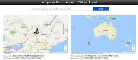
Have you ever thought where you would end up if you drilled a tunnel through the center of the Earth and climbed out the other side? Well that location is considered an antipodal point. The antipodes of any place on a globe is the point on the surface which is diametrically opposite to it. Two points that are antipodal to each other are connected by a straight line connecting through the center.
Mathematically, the geographical coordinates of an antipodal point can be calculate as: the latitude of the place you want to find the antipodes must be converted to the opposite hemisphere (eg: 45° North will be 45° South or -45°); the longitude of the place you want to find the antipodes must be subtracted from 180° and the result will be converted to opposite hemisphere (eg: 25° West will be 180° – 25° = 155° East or -155°).
Antipodes Maps

The majority of locations on land do not have land-based antipodes.
In 2013 I wrote an article for GoGeomatics magazine about an interactive maps that revealed what the Antipodes for any given location was. It has turned out to be one of the busiest articles in the magazine, attracting a lot of attention, perhaps because many geomatics people have not taken many geography courses.
The site that I was referencing to in the article seemed to have disappeared some time last winter, therefore no one could use the interactive antipodes calculator. Well now the site is once again active and people can once again learn a little bit of geography in a funny and simple way.
Filed in: GIS & Geomatics Education, Web MappingTags: Antipodes Maps, Geography, maps, web mapsSo check out http://www.antipodesmap.com to have a little fun exploring their interactive antipode calculator map.
Also Check Out ...
 The future of GIS with Esri’s ArcGIS Online
Jack Dangermond discusses the potential of Esri’s ArcGIS online cloud based GIS and how mapping applications leverage it to access GIS file sharing and collaboration in a cloud environment.
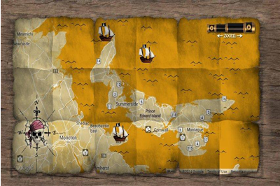
 Canadian Pirate maps
Pirate maps are often hand drawn spatial representation on paper that mark locaions of buried treasues and are ussually appear rough or tattered from being passed through time or simply being used in the rough elements, like on salt spray on the deck of a pirate ship.
Where does one look when they want to find Canadian Pirate Maps?
 Alberta's Changing Political Landscape
On April 23, 2012 thousands of electors headed to the polls for Alberta’s 28th provincial election. In all 87 candidates were elected to the Legislative Assembly of Alberta, 4 more then 2008 due to an increase in the provinces growing population. The Progressive Conservative party won a majority with 61 of the 87 elected ridings. More information about Alberta general elections can be found at the Elections Alberta website. Instead I want to discuss Alberta’s election as it relates to mapping, but what does a provincial election have to do with mapping?
Well… ESRI Canada has what they refer to as a Public Map Gallery that is a collection of custom web maps created by their mapping team featuring Canadian community maps, Canadian election results, and various census data. Here they leveraged some of their online spatial tools and features available together with public domain data to create an interactive online mapping application of Alberta’s Changing Political Landscape.
The Value of Geospatial Information in Economy
