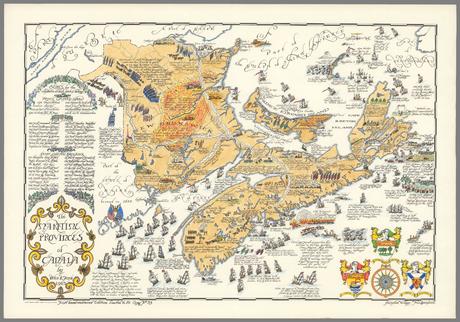
Title: The Maritime Provinces of Canada
Author: Peter Furse
Date: 1963
Publisher: Peter Furse
Map Dimensions: 38 cm x 60cm
Image Source: David Rumsey Map Collection, David Rumsey Map Center, Stanford Libraries
This work is licensed under a Creative Commons License.
*** Image shown above is low resolution, scroll down further on this page for a high resolution image that you can zoom into to see the finer details, as well as a download link, if you wish to print your own copy. ***Notes: This artistic pictorial map of the Maritime Provinces was created by Peter Furse in 1963. the map encompasses cartographic features, artwork, and various history of the Maritime Provinces.
Peter Furse was a cartographer who graduated Emmanuel College, University of Cambridge in 1922. This map featured in this scan was one of 50 limited edition copies created on superfine linen produced by Rolland Paper Co., St. Jerome, Quebec.
Map was scanned and made available through the David Rumsey Map Collection. This work is licensed under a Creative Commons License. By downloading any images of this map, you are agreeing to the original terms of that license. Users are expected to abide by all copyright laws.

