Trig points, short for ‘triangulation points’, are fixtures of the landscapes across the UK and Ireland. These bland (yet intriguing) structures, often perched on hilltops and mountain peaks, have a fascinating history and still serve a purpose for today’s explorers and hikers.
If you’ve ever summited a peak in Ireland or the UK in the past 100 years (I’m guessing that’s including everyone), you might have seen one of these and wondered what it was. Well let’s have a look at their history and relevance to hikers today.
The History of Trig Points
The trig point system was established by the Ordnance Survey, the national mapping agency for Great Britain, during the early 1930s as a means of retriangulation – a way to accurately measure Britain’s landmass. A similar system was also set up in Ireland by Ordnance Survey Ireland. The name ‘triangulation points’ derives from the geometric process used to map out areas, wherein a series of triangles were created to precisely measure distances.

Structure and Function of Trig Points
Trig points are typically concrete pillars, about 4 feet high, with a brass plate on top for attaching surveying instruments. They’re most commonly pyramid-shaped, but the design can vary, and some older ones are cylindrical. In the past, these points were crucial in topographic surveys, used to measure angles between different locations.
Today, with the advent of satellite technology, trig points are no longer needed for their original purpose. However, they remain important historical markers and are often sought out by hikers and walkers for the challenge they represent and the often spectacular views they afford.
Trig Bagging
Trig bagging, a pastime that combines the joys of hiking with a unique historical pursuit, is gaining popularity among outdoor enthusiasts in the UK and Ireland. Stemming from the term ‘peak bagging’— a term used by hillwalkers to describe the act of reaching a summit — trig bagging refers to the practice of locating and visiting trig points, the concrete pillars scattered across the countryside that were once vital for topographic surveys.
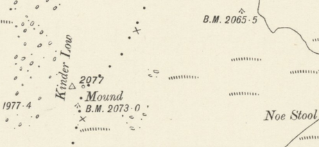
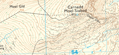
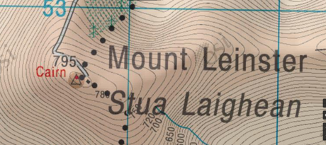
There are over 6,500 trig points in the UK alone, and each one has its story. Some are easily accessible, while others require strenuous hikes to remote hilltops. Many trig baggers document their conquests, noting down the date, the weather conditions, and their observations about the location. You can find most trig points on OS maps and other Topographical mapping such as Harvey Maps. They are normally depicted with a Blue or Black triangle (depending on the map maker).


The appeal of trig bagging lies in its simplicity. It requires no special equipment — just a good pair of hiking boots, your trusty HiiKER app and a sense of adventure.
Trig Points across Ireland and the UK
Ireland and the UK have thousands of trig points scattered across their landscapes. Some notable ones include:
1. Ben Nevis, Scotland: The UK’s highest trig point is located on the summit of Ben Nevis, Scotland’s tallest mountain, at an impressive 1,344 meters above sea level.
2. Lugnaquilla, Ireland: The trig point atop Lugnaquilla, the highest peak in the Wicklow Mountains, offers stunning views of the surrounding landscape, rewarding hikers for their challenging climb.
3. Kinder Scout, England: Situated in the Peak District, the Kinder Scout trig point marks the highest point in Derbyshire and the wider East Midlands.
4. Slieve Donard, Northern Ireland: The Slieve Donard trig point is perched atop Northern Ireland’s highest peak, offering breathtaking views of the Mourne Mountains and the Irish Sea.
Slieve Donard’s trig point sitting atop a pillar of the Mourne Wall5. Moel Siabod, Wales: This mountain is the highest in the Moelwynion range which sits opposite Snowdon. Reaching the Moel Siabod trig point here offers stunning views over the surrounding snowdonia national park.
Trig points offer a unique perspective on the history of mapping and surveying in Ireland and the UK. For modern explorers, they add an element of historical interest to any hike and often mark the best vantage points for stunning views of the surrounding countryside. As you embark on your next adventure, keep an eye out for these distinctive landmarks and the stories they tell about our past.
Do you have any special trig points we have not mentioned?

