Tilaiya Dam is one of the best tourist destinations in the Koderma district of Jharkhand. The word 'Tilaiya' in Hindi means a 'small lake'. The dam is a well-known picnic destination for the people of Bihar, Jharkhand and West Bengal. Thousands of people from the nearby state visit the dam each year mostly during the winter months. Here we bring you a complete travel guide for Tilaiya Dam.
Table of Contents
Where is Tilaiya Dam located?
Tilaiya Dam is located in the Koderma district of the state of Jharkhand. Koderma district came into existence on 10 April 1994 after it was separated from the Hazaribagh district.
What is Tilaiya Dam famous for?
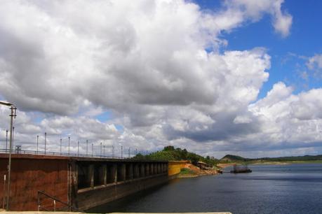
Tilaiya Dam is the first dam constructed out of the four multi-purpose dams planned during the first phase of Damodar Valley Corporation.
In the year 1955 on 26th January, Indian Postal services issued a set of four stamps for the five-year plan, out of which one stamp having a value of one anna, represented the Tilaiya Dam.
When was Tilaiya Dam inaugurated?
Tilaiya Dam was inaugurated on 21 February 1953.
What is Damodar Valley Corporation?
Damodar Valley Corporation is a government organization and operates both hydel and thermal power stations, under the Ministry of Power of Government of India.

List of the multi-purpose dams constructed in the first phase of the Damodar Valley Corporation
Here is the list of multipurpose dams constructed in the first phase of Damodar Valley Corporation:
- Taliya Dam on Barakar river
- Konar Dam on Konar river
- Maithon Dam on Barakar river
- Panchet Dam on Damodar river
Which organization operates and manages Tilaiya Dam?
Tilaiya Dam is operated and managed by Damodar Valley Corporation.
What was the purpose behind constructing Tilaiya Dam?
Tilaiya Dam, in fact, all the four multi-purpose dams constructed in the first phase of the Damodar Valley Corporation, were build to control flood which occurred frequently due to the uncertain river Damodar. The valley, which stretches over an area of 25,235 sq km, covering the state of Jharkhand ( then Bihar) and West Bengal witnessed vital floods over the year 1730, 1823, 1848, 1856, 1882, 1898, 1901, 1916, 1923, 1935 & 1943, which caused huge losses. Therefore, the government of West Bengal created the "Damodar Flood Enquiry Committee" to control the occurrence of the flood. The committee later drafted the plan of constructing all the four multipurpose dams.

What is the height of the Tilaiya Dam?
The height of the Tilaiya Dam is 99.3 ft.
What is the length of the Tilaiya Dam?
The length of the Tilaiya Dam is 1,201 ft.
On which river is Tilaiya Dam constructed?
Tilaiya Dam is constructed across river Barakar, a tributary of river Damodar.
Barakar river is the tributary of which river?
River Barakar is a tributary of river Damodar.
Weather at Tilaiya Dam
Tilaiya Dam enjoys a tropical climate. Summers stretches from the month of March to June with the temperature ranging between 35 to 49-degree centigrade. The rainy season begins in the month of July and continues till the month of September. The winter season ranges between November to February with the temperature dropping as low as 10 to 15 degrees centigrades.

Best time to visit Tilaiya Dam
The best time to visit Tilaiya Dam is during the monsoon i.e in the month of August as the water level of the dam is high during the rainy season or during the winter months of December to February.
Tourism at Tilaiya Dam
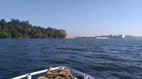
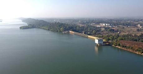
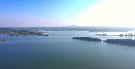
Tilaiya Dam is very popular among the people of Bihar, Jharkhand and West Bengal. The dam is located in the middle of the hills and is surrounded by a lush green landscape. The dam has an island which is the home for Deers and Gharials. The breathtaking beauty surrounding the dam attracts thousands of picnickers every year during the months of December to February.
Does the Tilaiya Dam offer a boating facility?
Yes, one can enjoy boating in Tilaiya Dam. The dam has double-decker launch boats as well as speed boats for the tourist to have a tour around the dam.
The launch has snacks and refreshment stalls on board. It offers a 45-minute ride around the dam. The ticket charges for launch is INR 100 for adults and INR 50 for children.

What is the ticket price at Tilaiya Dam?
Entry to Tilaiya Dam is free.
What is the timing of the Tilaiya Dam?
The dam remains open 24 hours, however, boating is not allowed after dawn. The dam is located far from the nearby city and therefore becomes isolated after dawn so it is not advisable to visit the dam after sunset.
Which is the nearest city from Tilaiya Dam?
The nearest city from Tilaiya Dam is Jhumri Telaiya, located in the Koderma district of the state of Jharkhand. The distance from Jhumri Telaiya to Tilaiya Dam is
- 13.8 km via Tilaiya Dam Rd - approx 30 min.
- 9.2 km via Ranchi Patna Rd and Urman - Kanti Rd/Urwan - Kanti Rd - approx 40 min.
- 21.7 km via Ranchi Patna Rd and Koderma Thermal Power Station Rd - approx 45 min.
Which is the nearest railway station from the Tilaiya Dam?
The nearest railway station from Tilaiya Dam is Koderma Junction (Station Code: KQR), which falls under the East Central Railway and serves the city of Jhumri Telaiya.
Which is the nearest bus stand from Tilaiya Dam?
The nearest bus stand of Tilaiya Dam is Tilaiya Bus Stand.
Which is the nearest airport from Tilaiya Dam?
The nearest airport from Tilaiya Dam is Birsa Munda Airport, Ranchi located at a distance of 163.7 km via NH20.
How to reach Tilaiya Dam from Kolkata?
By rail
Board a train from Howrah Junction and get down at Koderma Junction. The minimum journey time from Howrah to Koderma is five to six hours by train. After getting down at Koderma Junction railway station, book a cab to Tilaiya Dam. The distance between Koderma Junction and Tilaiya dam is
- 14.4 km via Tilaiya Dam Rd - approx 30 min.
- 18.8 km via Ranchi Patna Rd and Urman - Kanti Rd/Urwan - Kanti Rd - approx 40 min.
- 21.2 km via Ranchi Patna Rd and Koderma Thermal Power Station Rd - approx 50 min.
By road
The distance between Kolkata to Tilaiya Dam
- 390.6 km via NH19 - approx 8 hours.
- 484.2 km via NH 14 and NH19 - approx 12 hours.
By air
Take a flight from Netaji Subhash Chandra Bose International Airport, Kolkata to Birsa Munda Airport, Ranchi. It takes approx one to one and a half hours to reach Ranchi by air. After reaching take a cab from Ranchi to Tilaiya Dam.
The distance of Tilaiya Dam from Ranchi is
- 161.2 km via NH20 - approx four and a half hours.
- 187.3 km via NH320 - approx five hours.
- 213.8 km via NH320 and NH19 - approx six hours.

Is Tilaiya Dam safe for tourists?
Yes, Tilaiya Dam is safe for tourists. However, the following tips will help you to have a safe and sound visit to Tilaiya Dam
Tips for visiting Tilaiya Dam
- As the dam is located at a distance from the city, it becomes isolated after the dawn, therefore, avoid visiting the dam after sunset.
- Avoid visiting the dam alone, always be in a group.
- The safest time to visit is between 6 am to 4 pm.
- It is much safer to visit the dam during the peak season, i.e December to February.
- Carry water bottles, medicines, snacks, and other refreshments along.
Where to stay while visiting Tilaiya Dam? Hotels near Tilaiya Dam?
Damodar Valley Corporation has a guest house at the top of the hill, General Bhagat House. So if you are an employee of DVC you can book the guest house.
Jharkhand Tourism Development Corporation Limited has a tourist complex at Urwan which is at a distance of 9 km from Tilaiya Dam. The city of Jhumri Telaiya has many budget hotels where one can check in while visiting Tilaiya Dam. There are no 5-star hotels in the district of Koderma.
Places to visit near Tilaiya Dam
- Chanchala Devi Shakti Peeth
- Ghodsimar Dhaam
- Harihar Dham
- Dhwajadhari Dham
- Koderma Reserve Forest
- Satagawan Petro Falls
- Dhwajadhari Hill
- Makamaro Hills
- Sonbhandar Caves
- Saint Paramhans Baba Tomb

