The video below contains an interview with Ed Kennedy, an Associate with Hickling Arthurs Low Corporation, who helps explain the value of geospatial information in economy and the significant role of the Canadian geomatics sector. In the interview, Kennedy identifies the Canadian Geomatics Environmental Scan and Value Study, that was aimed to help update the profile of the geomatics sector in Canada and identify changes in the geospatial market.

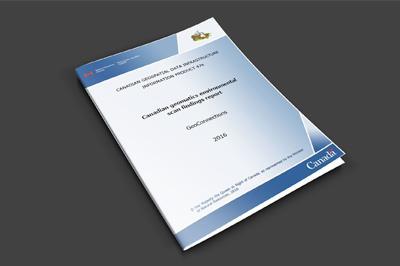
The Canadian Geomatics Environmental Scan and Value Study provides highlights and key results from work carried out by Hickling Arthurs Low Corporation on behalf of Natural Resources Canada. This research represents the most comprehensive assessment of geomatics and geospatial information in Canada to date.
In the study, geospatial information was used to estimate the Canadian economy, based on in depth case studies of 14 different sectors of the economy and an expert panel made up of people from both the geospatial community and the economics community. The Geomatics Sector produces geospatial information and makes use of it possible for other sectors through geospatial services and technologies. The geomatics sector includes a wide range of organizations from industry, government and academic institutions.
What does the summary report tell us?
- In 2013, about 2,450 private sector geomatics firms contributed $2.3 billion to the Canadian economy.
- The use of geospatial information contributed $20.7 billion – or 1.1% of national Gross Domestic Product (GDP), $19 billion to Real Income, and generated approximately 19,000 jobs to the Canadian economy in 2013. Regional distributions of GDP and Real Income by region are available in the report.
- The uptake of “open” geospatial data (data available a minimal or no cost and for use without restriction) provides an estimated additional $695 million to GDP and $635 million in real income in 2013.
- National scale productivity impact estimates attributed to the use of geospatial information (measured by percentage change in industry output) are most significant (>1.0%) for:
Click here to download a digital copy of the 287 page Canadian geomatics environmental scan findings report referred to in the interview below.
The Value of Geospatial Information in Economy
Filed in: Canadian Geomatics IndustryTags: Canadian Geomatics Environmental Scan and Value Study, Ed Kennedy, geomatics firms, geomatics sector, geospatial community, Hickling Arthurs Low CorporationAlso Check Out ...

While reading the ArcGIS Book, I noticed that the last of the ten ‘Big Ideas’ was that ‘GIS is social. GIS is collaborative’ and that ‘Geography is key for integrating work across communities’.
Therefore, it seems that the time is right to test the ‘collaborative’ hypothesis. Coincidentally, the Nova Scotia Provincial Government was announcing their new open data policy and created a new online open data site providing the geospatial community with free access to base maps and data sets featuring Nova Scotia. Also by chance the Geomatics Association of Nova Scotia (GANS) has been recently working on a concept for an online digital atlas (Digital Atlas of Nova Scotia – DANS).
Geography is Key for Integrating Communities & access to a digital atlas is a prerequisite for groups to develop apps that meet the needs of citizens.
The significant role proposed by GANS to obtain the technology resources to support apps and associated maps will help them remain sustainable into the future. However, this is only one pillar of the shared vision.

Many of us do not realize but a number of factors are involved when businesses establish new locations, quite often it is dependent on what product or services they offer or produce, however these days more and more are taking advantage of the ‘Power of Location Economics’. Location economics, unlike product differentiation strategies (where products or services are created different in order to attract more customers), addresses economic activities such as where people are located in order to produce or sell similar products in an existing market while maximizing their accessibility and profits.
Address recognition algorithms Over the past decade or so the GIS and Geomatics industry has been rapidly evolving and has crossed over into virtually almost every other industry and market, to the point where most people quite often do not even realize that they are using some aspect of geomatics. A common trend happening everywhere these days is …

Attending a geomatics event or professional conference is a great way to keep update about what is currently happening in the Geomatics industry and also an opportunity to have a good time while networking and mingling with others.
Many organizations across Canada offer great conferences and events, so the Conference and Events section provides free information about the various GIS related conferences, events, workshops, training and webinars that are available to or could be of related interest to other Canadians.
Some upcoming geomatics related conference and events in Canada include …
Jeff McKenna receives International Open Source Software Award
