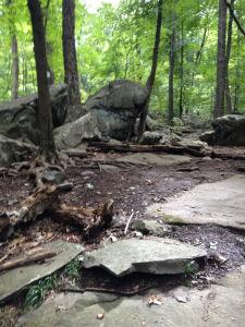
The Sourlands, apart from being the setting of Joyce Carol Oates stories, are one of New Jersey’s characteristic features. Although the Garden State brings visions of heavy industrialization to many imaginations, there are also lots of outdoor options for getting back to nature. One is the Sourland Mountain Preserve. No one’s sure of the origin of the name—was it named after a person, or was the land poor for farming? Could it have come from another language? No matter what the source might be, these areas are today criss-crossed with hiking trails—some of them quite rugged. On a sunny September weekend my wife and I decided to take a walk. The sunshine and cool temperatures made the opportunity beguiling. Although it’s not far from where we live, we’d never been there before. Time to look at a map.
The most distinctive point listed was the Devil’s Half-Acre Boulders. Geonyms, or place names, can be quite evocative. New Jersey and Pennsylvania along the Delaware both lay claim to some impressive boulder fields. The Devil’s Half-Acre was clearly a place for rock climbing, as chalk dust on the trail indicated. It’s not territory that you can get through quickly. But why devilish? Across the Delaware may lie the origins of the name. Near another boulder field, Ringing Rocks, is the site of a tavern along the Pennsylvania Canal. Said to have been the locale of lawlessness, haunted by the ghosts of dead canal workers, the location earned the same diabolical sobriquet in the early nineteenth century. What we found on the Jersey side, however, was an impressive jumble of massive stone and a rather popular hiking path.
“The map is not the territory” Alfred Korzybski once famously wrote. His expression was borrowed and adapted by religionist Jonathan Z. Smith in a book that’s still required reading for those starting out in the field. The point of the saying is that a map is an abstraction. The experience down here on the ground is very different from that projected from a bird’s eye-view. We can easily adjust to the concept however, using maps to tell us what lies ahead. The difficult work of digging a canal, or the unyielding nature of boulders, may symbolically point to the devil. At several points on the trail we had to pull out our map to make sure of our bearings. Trails are hard to follow over rocks. There was no literal devil there, but territory might just help to explain the name on a map.
