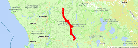
 The Overland Track map on HiiKER
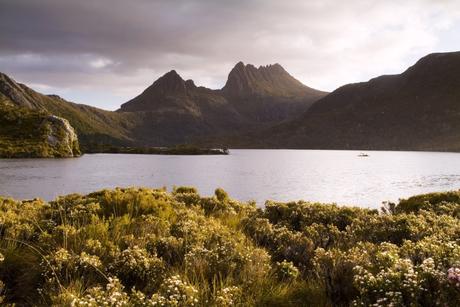
This beautiful Tasmanian hiking trail attracts hikers and walkers from all over the world and it’s easy to see why. The trail starts off at Cradle Mountain (with the option to take a detour up to the summit) and finishes at Lake St. Clair, Australia’s deepest lake. With so many optional detours along the trail, it can be easy to get disorientated, but you can confidently tackle this impressive bushwalking trail by using a trails app such as Hiiker.
In the summer months, the trail can get a little crowded so you have to reserve in advance, and permits are required between October and May.

Sample Itinerary
- Section 1: Ronny Creek to Waterfall Valley
- Section 2: Waterfall Valley to Lake Windermere
- Section 3: Lake Windermere to Pelion
- Section 4: Pelion to Kia Ora
- Section 5: Kia Ora to Windy Bridge
- Section 6: Windy Bridge to Narcissus
- Section 7: Narcissus to Cynthia Bay

Section 1: Ronny Creek to Waterfall Valley
Distance: 6.6 miles (10.7km)
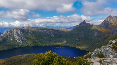
The majority of this section is exposed plateau walking, so be very wary of the conditions. You will come across a short, but steep, climb to Marion’s lookout which is followed by a gradual descent into Waterfall Valley. However, if you want to add a bit more excitement to the hike you can add in a trek to the Cradle Mountain summit. This can be quite a difficult hike so it will add a bit of a thrill to those of you who are brave enough to take it on.
Section 2: Waterfall Valley to Lake Windermere
Distance: 4.8 miles (7.8km)
This beautiful, but relaxing section takes you across magical alpine heathlands, lakes, and tarns before you arrive at the stunning Lake Windermere. If you want a little bit extra of an extra walk you can throw in Lake Will, which will add about 1.9 miles (3km) to your journey, but we reckon that it’s worth it.

Section 3: Lake Windermere to Pelion
Distance: 10.4 miles (16.8km)
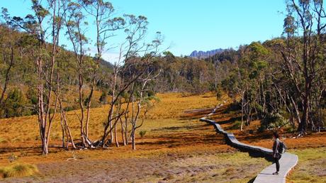
The second longest section of this hiking trail offers a wide variety of terrain and scenery from towering mountains in the distance to myrtle-beech rainforest and eucalyptus forests. If you have an extra four to six hours and don’t mind getting a bit wet and muddy you can take on the hike up to Mount Oakleigh.
Section 4: Pelion to Kia Ora
Distance: 5.3 miles (8.6km)
On the route between Pelion and Kia Ora, you will be treated to magnificent views of the surrounding rainforests and mountain treks. We highly recommend taking the detour up Mount Ossa. Standing at 5,305 ft (1,617m) it is the highest point on the island of Tasmania. The climb is steep but very rewarding and a great addition to your hiking expedition.
Section 5: Kia Ora to Windy Bridge
Distance: 5.9 miles (9.6km)
This beautiful section littered with magical forests and beautiful waterfalls is home to the historic Du Cane Hut, which is the perfect stop-off for a bit of lunch. Be sure to take at least one of the short detours to either D’Alton and Fergusson Falls or Hartnett Falls. They both showcase some breathtaking waterfalls and are another perfect place to sit back and relax for a while.
Section 6: Windy Bridge to Narcissus
Distance: 5.6 miles (9km)
This section offers a pleasant break from the trials of much of this hiking trail. Here you will gradually descend towards the Narcissus River where you will need to cross via a suspension bridge. This bridge offers such a unique perspective of the surrounding forestry and distant mountains, allowing you to appreciate the beauty of the island yet again.

Section 7: Narcissus to Cynthia Bay
Distance: 10.8 miles (17.5km)
To finish out your multi-day hike, meander your way along the shores of Lake St. Clair (did we mention that it’s Australia’s deepest lake?) to your final destination at Cynthia Bay where you can get a photo at the trail finish photo point to remember your epic journey across Tasmania.

