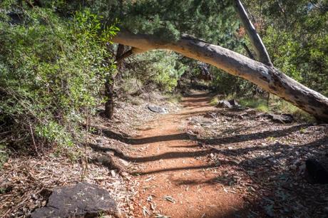
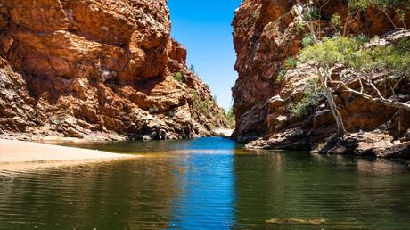
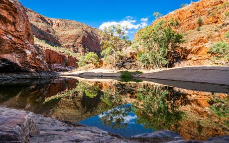
Located in Central Australia’s Northern Territory, the Larapinta trail is one of Australia’s most beautiful bushwalking trails. It is 135 miles of absolutely breath-taking nature, but can also be broken down into 12 distinctive sections. The best time to take on this monster hiking trail is between April and August. Using a hiking maps app like Hiiker allows you to tackle this multi-day hiking trail with confidence.

Sample Itinerary
- Telegraph Station to Simpson Gap
- Simpson Gap to Jay Creek
- Jay Creek to Standley Chasm
- Standley Chasm to Birthday Waterhole
- Birthday Waterhole to Hugh Gorge
- Hugh Gorge to Ellery Creek
- Ellery Creek to Serpentine Gorge
- Serpentine Gorge to Serpentine Chalet Dam
- Serpentine Chalet Dam to Ormiston Gorge
- Ormiston Gorge to Finke River
- Finke River to Redbank Gorge
- Redbank Gorge to Mount Sonder
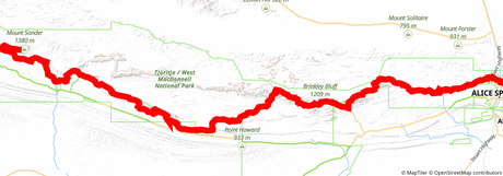
 Larapinta trail map via HiiKER
Stage 1: Telegraph Station to Simpson Gap
Distance: 14.8 miles
Difficulty: Moderate
This is the official starting point of the Larapinta hike and an excellent way for hikers to ease themselves into the intense adventure they have ahead of themselves. There are some beautiful stop-off points along this trail including the Euro Ridge and Hat Hill Saddle.
Stage 2: Simpson Gap to Jay Creek
Distance: 15.6 miles
Difficulty: Moderate
This section is a very comfortable walk as it is mostly flat and easy to navigate with a navigation app. You’ll find a beautiful retreat at Spring Gap and the views from here onto the next trailhead of Jay Creek are just spectacular.

Stage 3: Jay Creek to Standley Chasm
Distance: 8.5 miles
Difficulty: Hard
This section comes with a choice to explore the beautiful 360-degree views of the high route or to traverse some rocky and narrow gorges. The high route is still tougher but definitely more rewarding for the amazing views. Both routes are well waymarked.
Stage 4: Standley Chasm to Birthday Waterhole
Distance: 11.1 miles
Difficulty: Very Hard
This section comes with a wide variety of different terrains and challenges for you to navigate. This is often considered to be one of the most breath-taking sections of the Larapinta Trail, but it doesn’t come easy as it is one of the most exhausting parts of the hiking trail.
Stage 5: Birthday Waterhole to Hugh Gorge
Distance: 10 miles
Difficulty: Very Hard
The views along this section are a continuation of the previous, they are beyond stunning and like the previous section, it comes with its challenges. With plenty of ridge walking, steep climbs, and narrow gorges, you need to have your wits about you to hike this trail section.
Stage 6: Hugh Gorge to Ellery Creek
Distance: 19.4 miles
Difficulty: Moderate
Although this is the longest section of the Larapinta Trail, it is one of the easiest sections to complete. If you’re interested in bird watching along your hike then this is the section for you with amazing bird life to be seen all around you.
Stage 7: Ellery Creek to Serpentine Gorge
Distance: 8.6 miles
Difficulty: Hard
One of the more frustrating sections of the trail, the route takes you up and over small sections of jagged rocky high grounds. However, the geographical formations here are some of the most impressive in Australia.
Stage 8: Serpentine Gorge to Serpentine Chalet Dam
Distance: 8.3 miles
Difficulty: Hard
This section is a dream hiking trail. There are many steep ascents and descents, but the majority of them come equipped with rock steps and fantastic trail clearings, allowing you to easily navigate this route.
Stage 9: Serpentine Chalet Dam to Ormiston Gorge
Distance: 17.8 miles
Difficulty: Hard
One of the most spectacular sections of the trail, with stunning 360-degree views from the Mt Giles Lookout. However, you must be wary of the loose rock when ascending many of the steep inclines along this hiking section.
Stage 10: Ormiston Gorge to Finke River
Distance: 5.7 miles
Difficulty: Moderate
This section has multiple creek and river crossings to explore, although, they are almost always dry. There are magnificent views of Mount Sonder in the distance and the Ormiston Gorge itself is simply breathtaking. Even though this is the shortest section of the Larapinta Trail, it still offers a wide variety of unique views to enjoy while you hike.
Stage 11: Finke River to Redbank Gorge
Distance: 16.2 miles
Difficulty: Hard
This is a section that is pure bliss for every thru-hiker. The trail is well constructed and maintained all the way up to Hilltop Lookout where you are treated to some of the best views of Mount Sonder. If you can get to the top of Hill Top Lookout for sunrise you will experience one of the most spectacular views of the sun creeping out from behind Mount Sonder.
Stage 12: Redbank Gorge to Mount Sonder
Distance: 9.8 miles
Difficulty: Hard
What a way to finish off your thru-hike. You’ve navigated your way through one of Australia’s most popular hikes and now it’s an uphill battle to make it up to the summit of Mount Sonder. The trail here is loose, rocky, and sometimes hard to follow, but it is worth it for the beautiful views at the peak.

