Millions of years ago, the collision of two continental plates led to the formation of the Himalayas (Hindi name of Everest). The collision continues to this day - with consequences.
Source Credit: National Geographic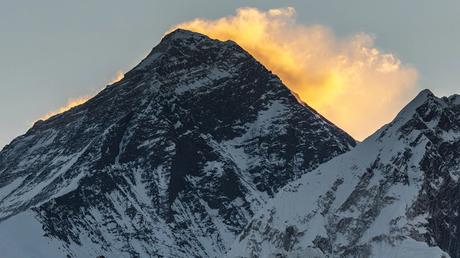
Seabed on Mount Everest? It has been scientifically proven, and yet it is difficult to imagine, that the rocks under the thick blanket of snow of the highest peak in the world at some point rested on the bottom of the sea.
The reason that they now rise almost 9,000 meters above sea level is the slow shifting of two continental plates - the rock plates that form the solid outer shell of our planet.
These plates never stand still, and their movements shape our nature every day. Where they drift apart, they form valleys and deep crevices. There, where they move towards each other, there is powerful crust thickening: the movement called convergence creates so-called fold mountains like the Himalayas.
Mount Everest, which rises on the border between Tibet and Nepal, was formed tens of millions of years ago from such a tectonic collision.
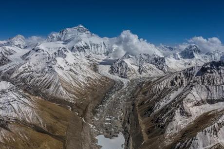
The collision of the Indian and Eurasian tectonic plates crumpled the landscape over a distance of around 2,500 kilometers - and thus created the highest mountains on our planet.
While the exact steps of this process are unclear, one thing is certain: To this day, the plates are moving towards each other, and that has consequences. The height of Mount Everest and the surrounding mountains change every year.
The birth of a mountain
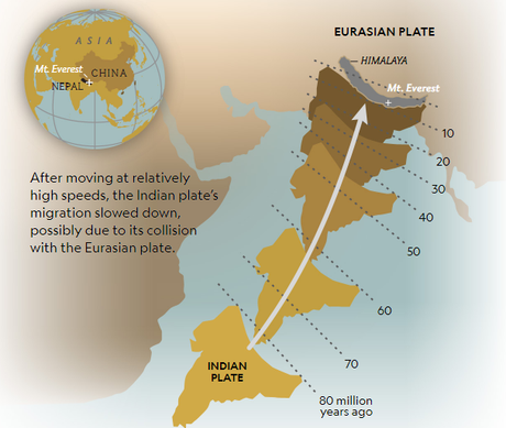
The history of the Himalayas begins sometime more than 200 million years ago when the ancient continent Pangea split into several parts. The Indian plate detached and moved north towards the land area we know today as Asia. In doing so, it showed a surprisingly fast speed: it shifted more than 14 meters per century.
The gap between India and Eurasia was filled by an ocean at that time, the Tethys. With the shift, this ocean became smaller and smaller until it eventually disappeared.
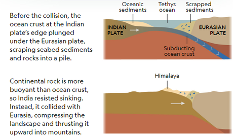
The oceanic lithosphere at the edge of the Indian plate dipped into the underlying part of the earth's mantle - a process known as subduction.
At the edge of the Eurasian Plate, meanwhile, a thick layer of seabed sediments piled up. Later the sandy layer was pressed into rock and finally lifted up to mountain peaks.
Around 50 million years ago the Indian plate slowed down. Many scientists suspect the first preliminary stage in the collision with the Eurasian plate. Evidence in marine sediments also suggests that the collision must have occurred 50 to 60 million years ago, as the Tethys Sea disappeared at that time.
Unlike an oceanic plate, which is cold and has a high density, the Indian continental plate is thicker and has more buoyancy. As the continents squeezed together and India pushed under Asia, the surface of the Indian plate arched, and its crust thickened.
This created the structure that would eventually become the mighty Himalayan mountain range. At least that was the accepted version of history for a long time
But as scientists continued to study every crack and rock in this system, many unanswered questions arose. Investigating ancient magnetic patterns in rock enables researchers to determine the position of a continent over millions of years of geological history.
Recent work with this method has shown that India must have been strikingly far south of Eurasia at the time of the mountain-forming collision about 55 million years ago. This would create a mysterious, yawning gap between the two continents.
So did the Indian plate colliding with an area of land that has long since disappeared and was located between the two continental plates? Or could the northern edge of the Indian plate have extended much further than previously thought? Why was the plate moving so extremely quickly before it collided with Eurasia? Scientists today are working on answers to these and many other questions.
Plate tectonics and mountain growth
Whenever the collision started exactly, it is certain that the plates continue to move to this day and that Mount Everest continues to change.
Every year India moves a little further north, and it is believed that the Eurasian Plate will continue to push the mountains up year after year.
An average elevation of around 10 millimeters per year is estimated in the north-western sections of the Himalayas and around one millimeter per year on Mount Everest.
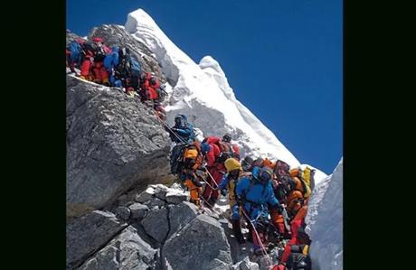
The growth comes in spurts triggered by violent collisions between the earth's plates. Because one plate is anything but smoothly pushed under another: Due to friction and compression, strong pressure is created, which at some point suddenly discharges in earthquakes.
However, not every earthquake means that a mountain is growing at the same time. It can even cause mountains to shrink. Analysis of satellite data suggests that this is exactly what happened during the devastating earthquake in Nepal in 2015.
While the plates move underground, wind, and rain above the earth ensure that nothing stays as it is. Erosion wears away the surface of the mountains, and sediment is washed down the slopes in bubbling streams.
In the Himalayas, much of the sediment flow through the Ganga and Brahmaputra rivers and settles as sand at the bottom. And so part of the mountain range forms new soil in Bangladesh and the Indian state of West Bengal.
Even if erosion and gravity keep the mighty mountains in check, the tectonic plates continue their geological dance - and Everest never really stands still.
Photos Credit: National Geographic
