If you round up two-thirds cloud cover to 100% cloud cover and assume they have an albedo of 0.3, then the real reason for the apparent 33 degree Greenhouse Effect is immediately obvious, as I explained a month ago.
The Alarmists make a right muddle of this. They calculate Earth's albedo 0.3 based on average albedo of clouds and exposed surface, and then assume that this is the albedo of the land and ocean surface. This gives them space to fabricate an explanation why it's warmer at sea level than at the cloud tops - following their logic, these should be the same (duh). After that they ignore clouds, except for the bit where they reflect IR radiation from the surface back down. They also (implicitly) assume that only the land and ocean surface absorbs solar radiation and that clouds don't. Dear oh dear.
It's easier explaining it properly than picking holes in their approach - just because their explanation is deeply flawed (i.e. based on false assumptions and hence completely wrong) doesn't tell us what the right explanation is.
The next question to be answered is, why do clouds form so that the average altitude of their upper surface (the surface which absorbs and is warmed by solar radiation) is at about 5 km (with a resulting sea level temperature of 288K)? I've struggled with this for the past month, and, much head scratching, calculating, sketching and Bingling later, what it boils down to is as follows:
1. The dew point of the water vapour in any 'parcel' of air depends on three variables. For a start let's focus on i. air temperature and ii. air density/pressure. We'll get back to variable iii. Relative Humidity later, You can merge ii. and iii. into one variable called 'partial water vapour pressure', but it's easier to treat them separately:
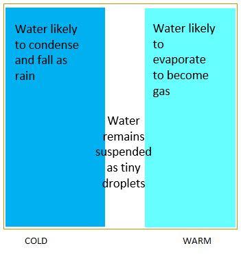
The impact of temperature (for a given R.H.) - in warm air, water vapour is likely to stay as a gas; in cold air it is more likely to condense and fall as rain. There's a narrow range of temperatures where it remains as tiny droplets which remain suspended in the air:
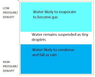
 2. For a given R.H., if air has low pressure/density, the water vapour is more likely to remain as vapour. If it's high pressure/density, it is more likely to condense and fall as rain:
 3. We can put those two together into a table:
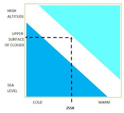
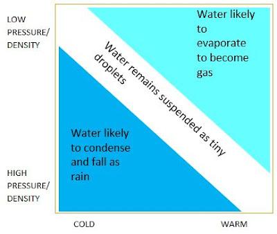 4. Some vapour in the air will condense into tiny droplets, small enough to stay suspended and form clouds. We know that the upper surface of clouds absorbs solar radiation. With an albedo of 0.3, they will reach a temperature of 255K. Only those clouds which happen to form at the altitude where that particular temperature/density combination is in the white band will remain as clouds. Too high, they will evaporate again, too low and they will condense and fall as rain:
 5. OK, so some clouds have formed at the 'right' altitude and are stable for now. We know the temperature of the upper surface, and that temperature plus altitude x lapse rate (also know) determines sea level temperature. But what determines the 'right' altitude? Is it an equation with two unknowns..?
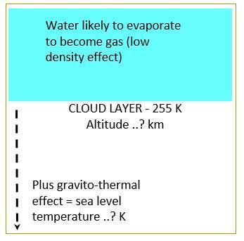 6. No, because there is a third leg of this three-legged stool. We now have to consider the third main factor for determing dew point - Relative Humidity. It is a chaotic and dynamic system. If the clouds are too high, so is sea level temperature, which leads to more evaporation, higher R.H. and higher R.H. means lower clouds, and vice versa:
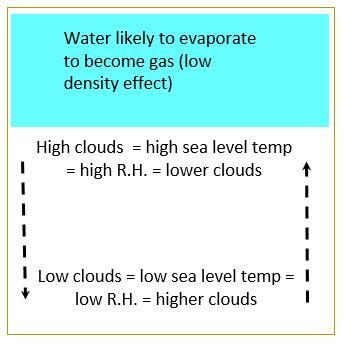 7. Some clouds will form at the 'Goldilocks' altitude where the resulting sea level temperature generates enough R.H. to maintain the clouds at that particular altitude. It's a circular calculation and self-correcting process. It's easiest to work this out by trial and error, and while the precise calculations are beyond human comprehension, clouds do it for us by simply following basic laws of phsyics until they 'get it right':
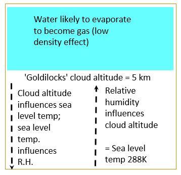 8. Finally, you end up with what you expect to see. Clear air up to a certain altitude (too warm for clouds to form), a layer of clouds 1 or 2 km thick (the 'Goldilocks altitude') and above that clear air again (the pressure/density is so low that clouds evaporate again) and a sea level temperature of 288K, all hovering round the perfect balance/equilibrium:
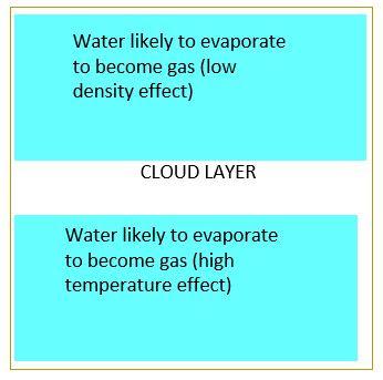 9. What other evidence to we have to support this, apart from it matching up to observations and being entirely consistent with basic physics and everything else in the overall theory?
a. All I can think of for now is that areas with higher R.H. tend to have lower clouds (as you would expect. If there's more water vapour it's more likely to condense at a lower altitude) and their sea level temperature tends to be a bit lower (lower cloud altitude means the difference in temperature between upper surface of clouds and sea level is lower, as there are fewer km to multiply by lapse rate) than in drier areas.
b. Higher R.H. and lower clouds also mean a much smaller day-night ('diurnal') temperature range - water vapour is good at holding on to thermal energy and the lower clouds are good at reflecting upwelling IR back down to sea level in the night time.
c. Venus and Mars follow exactly the same pattern, even though their atmospheres are nearly 100% CO2 and other 'greenhouse gases'.
