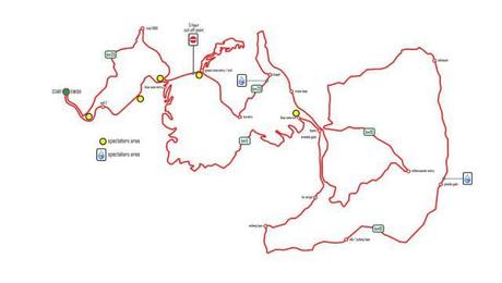
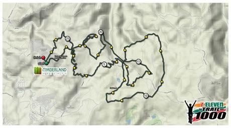
 To all biker friends that will join 7-11 Trail this year and haven’t done any recon or track read you may want to read this route information first, you still have 6 days to check the route until race day as of this writing.
Here we go, read the details below:


Prepare yourself for a challenging 35 km course. With trail features that will surely excite the mountain biker in you!
A mix of road climbs (10%), fire road (30%), and singletrack (60%), the single loop Trail 1000 course was stitched together using favorite routes of San Mateo regulars, otherwise inaccessible trails on private land, and new trails built just for the race.
Here’s a run down of what to expect (note: km markers are approximate, as some sections are still being built):
km 0-1: Wall 2 is a wide concrete road that narrows into fire road at the end. With a 10% grade, it serves to separate riders before the singletrack.
km 1-5: Blue Zone Undulating singletrack rewards a brief climb with killer views of the city, before dropping down through a rhythmic series of switchbacks and berms into a stream. It was cut into the side of the mountain by master IMBA trailbuilder Tony Boone (who also built the trails on President George Bush’s ranch) as he trained our trailbuilding crew.
km 5-6 Blue Zone Harder Dense foliage helps with the singletrack climb up the mountainside, but the 100m, 15% grade section is still hard to clear.
km 6-10 Ka Vergel – Accessed via the Araneta nursery gate (closed until race day), the rutted climb out of this motocross hangout will be smoothed before race day, but many will likely still push the 300m that steepens to 14% grade in some places. You can rest a bit on the rolling , mostly downhill 3km fire road to Sapinit Road.
km 10-14 Araneta Pineda (under construction) – Connects Pineda gate to Wawa-bound singletrack by going way down, then up, into the valley in between.
km 14-15 Sapinit Climb – The concrete road should be a welcome respite from technical climbing at this point.
km 15-17 Roller Coaster – Rutted fire road with natural berms and rollers. Exit closed until race day, exit via Ka Vergel during practice.
km 17-19 Roxas Boulevard – Cliffside former cement road with views of the Sierra Madre, then up a singletrack connector to basic. Closed until race day.
km 19-20 Chapel – Natural singletrack descent, then up through the gravelly fire road out of nursery.
km 20-22 New Green Zone – Canopied singletrack just behind basic that drops gently down through a series of bermed turns, then climbs, less gently, back up.
km 22-24 Old Roxas Through a construction site, then a short climb up overgrown fireroad
km 24-finish Trail 1000 Downhill (under construction) Drainage ditches indicate this was once intended as a road. Technical features, such as chicanes and optional jumps, will slow riders down the long, steep sections. It feels like you’re dropping down into the city, but try not to look – this finale demands total focus.
#711trail1500 #mytimberlandheights
Source: PMTB Facebook Page
