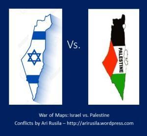
 Maps can be a powerful tool in geopolitics and information war for example by de-legitimising some country or even wiping its existence from schoolbooks; at least conflicting maps can lead to confusion about situation on the ground, mistaken map can even create a security risk.
Few opposite examples related to Israeli-Palestinian conflict may clarify this “map-war”.
School-atlas
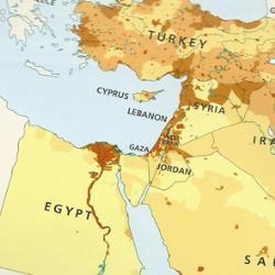
HarperCollins, the world’s leading book publisher produced and sold maps of the Middle east intentionally omitting Israel. The Tablet’s story about the the Middle East Atlas, which shows Jordan and Syria extending all the way to the Mediterranean Sea, was widely reported and caused an international outcry. Collins Middle East Atlases were sold to English-speaking schools in the Muslim-majority Gulf, and publicity about their existence has embarrassed the publishing giant. After the Bishops’ Conference of England and Wales said it was harmful to peace efforts in the Middle East, HarperCollins withdrew their atlas from sale. Earler, Collins Bartholomew, the subsidiary of HarperCollins that specialises in maps, had told The Tablet that including Israel in the Middle East Atlas would have been “unacceptable” to its customers in the Gulf and that the amendment incorporated “local preferences”. At the time, Bishop Declan Lang, chairman of the Bishops’ Conference Department of International Affairs, told The Tablet: “The publication of this atlas will confirm Israel’s belief that there exists a hostility towards their country from parts of the Arab world. It will not help to build up a spirit of trust leading to peaceful co-existence.” (Source: The Tablet )
Flight maps
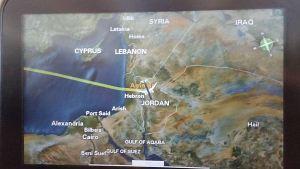
Air France has apologized for failing to include Israel or its major cities on its in-flight map. According Arutz Sheva Russia Today reported on Summer 2015 that Israeli activists had pointed out that Air France failed to include Israel while marking Judea, Samaria and Gaza. The issue with the map, which passengers of Air France flights can use to track progress or just check geography, was noticed by pro-Israel group Stand With Us. “Apparently, Air France removed Israel/Tel Aviv from their flight tracker map, despite the fact Tel Aviv is one of their official destinations. Additionally, they now note ‘West Bank’ and ‘Gaza Strip’ despite the fact neither of these are destinations of Air France,” the group said in a Facebook post, according to the Russia Today report. (Source: Arutz Sheva )
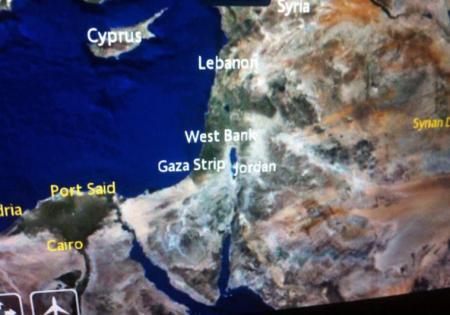
In a letter to Air France chairman and CEO, Frédéric Gagey, the Simon Wiesenthal Center director for international Relations, Dr. Shimon Samuels, noted that, “French members of our center have sent us reportedly captured shots from the English and French language of an Air France flight-path, taken last week between New York and Paris, and the locations ‘Israel’ and ‘Tel Aviv’ are glaringly absent.”The letter noted that, “We are asked whether Air France has succumbed to the BDS [Boycott, Divestment, Sanctions] campaign to delegitimize the Jewish State by literally wiping it off the map?” Air France issued an apology, saying they “deeply regret this incident, due to a map scale and display problem which is currently being resolved.” (Source: JPost )
Since 1994, Jordan has had a peace treaty with Israel. While the peace has been somewhat cool on 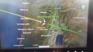
In 2009, British Midland International Airlines, a subset of British Airways, apologized for omitting Israel from their in-flight maps, also attributed to a technical error.
Related to travel but not exactly to maps The US Department of Transportation was preparing in January 2015 legal action against Kuwait Airways should it refuse to end its practice of discriminating against Israeli passengers flying to and from the United States (e.g. one Israeli-American was denied by the airline a ticket from New York to London in 2013).
Culinary map
Dutch restaurant owners cited their gastronomical focus in explaining why they had replaced Israel with Palestine in a map of the Middle East they had printed. The owners of Le Souq, a restaurant based in Rotterdam that specializes in food from the Middle East, offered the explanation after a local politician criticized their removal of Israel and replacement with Palestine in the restaurant’s signature place mat, which features a map of the Middle East. “A new country in the Middle East? In Rotterdam’s market hall they are straightforward about Israel’s position. Bizarre,” Jan Hutten, a regional chairman of the center-right Christian Democratic Appeal party, wrote on Twitter earlier this week. He also included a picture of the controversial place mat.
In response, the owners of the Le Souq restaurant that had the place mat printed, wrote in a statement that they “only deal with the tastes of the Middle East.” Among those tastes, owner Nadia Afkir told the Algemeen Dagblad daily Wednesday, “is the ancient Palestinian kitchen, the producer of the delicious maglubi and the kunefe dishes that we are passionate about.” The place mat, she added, “names countries producing the dishes and products (Source: JPost )
Maps in news
In 17th Oct., 2015 MSNBC aired following program using false maps:
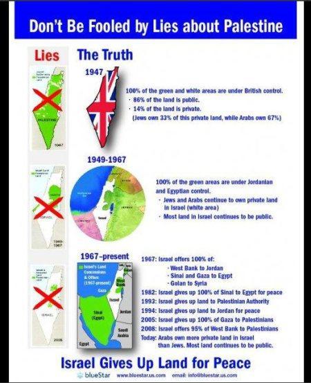
1946 map is lie: By the early 1940s Jews owned about one third of private land in Palestine and Arabs about two-thirds. The vast majority of the total land, however, belonged to the government, meaning that when the state of Israel was established, it became legally Israel’s. Of course, before 1948 the word “Palestinian” more often than not referred to Palestinian Jews, not Palestinian Arabs. For example, the Palestine exhibit at the 1939 World’s Fair was entirely Jewish, the Palestine Orchestra was entirely Jewish, the Palestine soccer team was almost entirely Jewish, and so forth. This map is not the territories … the map fails to distinguish between land that is owned by Jews or Palestinians, and land that is controlled by Jewish or Palestinian political entities. Take the vast triangular tract of land at the south of the map. That’s the Negev desert. Apart from a few small oases, kibbutzes and towns, it’s empty wasteland; it isn’t owned by anyone. It represents almost half of the territory of Israel/Palestine.
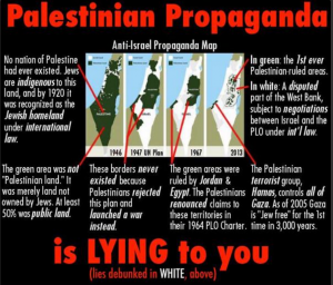
On 19th Oct. 2015 MSNBC apologized for using “not factually accurate” maps in a segment discussing the violence that has erupted across Israel.
Tourism map
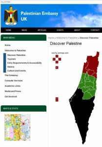
The other side
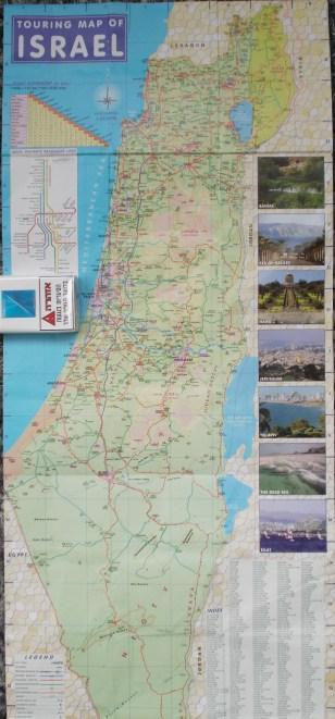
During my last visit in Israel on Summer 2015 I got ‘official’ touring map of Israel. The map is quite good detailed but one hardly can see any boundaries in Judea & Samaria (aka West-Bank). Especially during clashes and violence I think that it would be appropriate to show clearly A, B and C Zone boundaries for security reasons as different authorities are responsible about security in different zones.
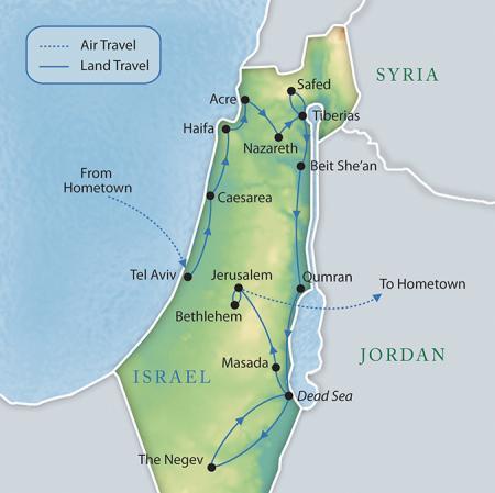
One other example from Israel: One of the leading global luxery travel operators Travcoa – part of TUI Group – is selling its “Mystical Israel” 12 days luxery tour with map below where one can not find Palestine or even Gaza.
Bottom line
One can understand that maps can be used as part of propaganda by different interest groups. Maps can be printed to t-shirts, posters, mugs etc to express strong provocative view of one party, they can be modified to send clear message and in my opinion there is nothing wrong with that.

Palestinian terrorist group symbols that have a map of Israel in their logo.
However examples earlier in this article are implemented by normal private companies or public organizations which primary aim is to provide profits to owners so the unintended consequences of their maps can be propagandist too.
