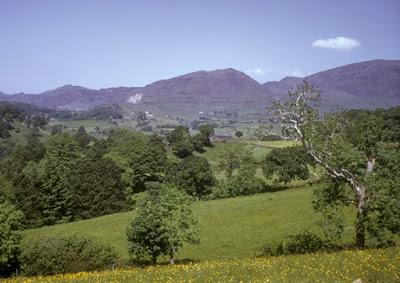
Clwydian Range from Cileaire, Wales
Perhaps the original intrepid tourist was Carolyn Arnold, my husband’s aunt. A single school teacher in Des Moines, she began traveling abroad when she was in her forties, beginning with a bicycling trip through Ireland in 1950. She went on from there to spend a year as a Fulbright Exchange Teacher in Wales, to more trips to Europe and beyond, and eventually became a tour leader, taking all her nieces and nephews (including my husband Art) on her travels. When she retired from teaching, she wrote of her experiences in a memoir called Up and Down and Around the World with Carrie. Today, as I read of her travels, I marvel at her spirit of adventure at a time when women did not have the independence they do today. The piece below, from her book, describes a typical weekend driving excursion from Mold, the town where she taught in Wales.
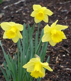
The national flower of Wales
Spring comes early to our valley. Children come in with arms full of daffodils, which grow wild in the woods. The daffodil is the national flower of Wales.On Saturdays I often rented a car with Muriel and a few friends and would spend the day driving through the beautiful mountains and valleys of North Wales. We would picnic at some scenic spot.
From Mold the road rises gently to the Twlch (the top) which overlooks the lovely Vale of Clwyd. This is a land of green valleys and stonewalls ringing tiny farms. Most areas of the countryside are good only for grazing and pastures for sheep and cattle. The Clwydian Hills are the highest point between Mold and the Snowdonia Range.
We pass through the small village of Ruthin (pronounced Rithin), which boasts a castle, now transformed into a tourist hotel.
Farther on is the town of Denbigh, also with the ruins of a castle. Charles I was born here. Another interesting site here is the cottage where Stanley, the explorer who found Livingstone in Africa, once lived.

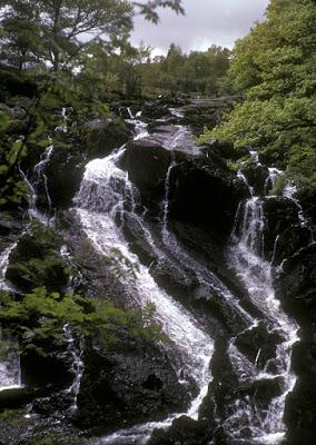
Swallow Falls near Betws-y-coed
Crossing the Conway River, we often turn south to Betws-y-coed. Remember the “w” is an “oo” and “y” as in “it”. “Coed” is all one syllable. Now you can say it! Betws-y-coed is the most famous beauty spot in the Snowdonia region, the area surrounding Mount Snowdon, a national park. The falls here tumble beneath a leafy overhang of many trees and are bordered by lacy bracken, a large wild species of fern.We continue on to Capel Curig and then to Llanberis Pass. Here the dark hills are barren on either side. We can hear the sound of bleating sheep and the rush of streams falling from the hills. Stone walls follow the line of the road. It is a sad and lonely place, especially in the rain. At the top of the pass two small inns stand near each other. We are grateful for a cup of tea and the sandwiches we have brought along. When we leave, the sun comes out and a great valley sweeps down before us, and the brown hills are outlined against the sky.
Llanberis lies at the foot of Mount Snowdon. At 3,500 feet, it is the second highest peak in Great Britain. One side is very rugged and steep. It is said that Hillary of Mount Everest fame practiced on this side. Many climbers use the other more gentle slope. A small cog railway steams to the top during tourist season. The view is fantastic when the weather is bright, but the top of Mount Snowdon is often hidden by clouds, even in fine weather below.

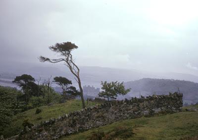
Conway, above the estuary
Not far from Llanberis is the town of Caernarvon and its famous castle, the most impressive and largest of the Welsh castles. The quickest way home from Caernarvon is back across the Menai Straits bridge and along the coast road bordering the Irish Sea, passing Bangor, Conway and Llandudno and on to Colwyn Bay and the town of Rhyl. There we must turn inland for home.Mold is only ten or fifteen miles from the coast. We can always tell when there is a storm at sea when the gulls come sweeping in from the coast.
