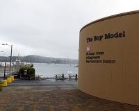
 One of my favorite places in the San Francisco Bay area (and unknown to most people) is the Bay Model, a working demonstration of water flow in and out of San Francisco Bay and the Sacramento/San Joaquin Delta. Tucked along the waterfront in Sausalito, the Bay Model is located inside buildings that were part of a bustling shipyard during World War II. (An exhibit on the main floor of the building displays photos and artifacts from the shipbuilding era.)
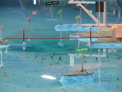
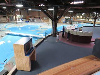
  Built in 1957 by the Army Corps of Engineers to test the impact of proposed changes in the Bay, the Bay Model spreads over 1.5 acres. As you walk the ramps and platforms around the water, you can orient yourself by signs and the miniature bridges that connect the land around the bay–the Golden Gate connecting Marin County to San Francisco, the Bay Bridge crossing from San Francisco to Oakland on the east side and, to the south, the long San Mateo bridge over the shallow water of the tide flats. Unlike in real life, in which the tide changes every twelve hours, the schedule of the model is speeded up so that the tide comes in and goes out every 14.9 minutes, whooshing through the Golden Gate and visibly creeping up the adjacent shores. It makes you realize the drama of this daily cycle and how important it is to people and wildlife along the shores.
 Until about ten years ago, the Bay Model was used for scientific purposes, as a place where people made important calculations about water movement in San Francisco Bay. Now, those calculations are done by computer and the model is no longer used in the same way for scientific research. Instead, it has become an educational facility. (I remember going to visit when it was a working model and watching scientists taking their measurements.) The building has been recently remodeled (it was reopened in January 2012) and now has a handsome redwood entrance to the visitor center with a gift shop and art gallery. In one corner is an amazing scale model of the Golden Gate Bridge made by a 14-year-old student as a 4-H project. Inside the main building along the walkways are photos, state-of-the-art videos, interactive displays, and explanatory panels telling about the history of the model, how it works, and the ecology of the Bay Area. On the day I visited with a friend we did a self-guided tour, but ahead of us was a school group getting a tour with a docent. Whether you go by yourself at your own pace, or with a group, it will definitely give you a new perspective on San Francisco Bay.
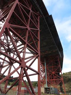
  After our visit to the Bay Model we explored downtown Sausalito, had lunch at one of the many cafes in this popular tourist town, and then went to Fort Baker for a close-up of the real Golden Gate Bridge from below.
Visiting Information:
The Bay Model is at 2100 Bridgeway, Sausalito, CA 94965, telephone (415) 332-3870. For directions, hours, and more information go to the website http://www.spn.usace.army.mil/bmvc/.
How do they make the tide in the model? To recreate the rising water level of a flood tide, more water is pumped into the Pacific Ocean area with less water allowed to flow out. To model the falling waters of an ebb tide, less water is pumped in and more water is allowed to flow out. A valve system controlled by a computer controls the flow of water.
