Thanks to a good idea given to me by my partner here at STL, I started to research and analyze some geographic information regarding the Jewish land-grab in Palestine. I then followed by studying some demographic info on the Gaza Strip and drew some interesting conclusions. Here’s what I found:
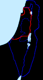
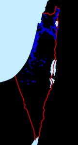
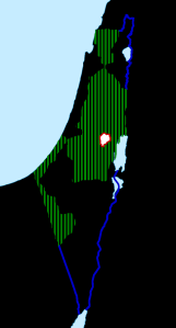
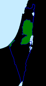
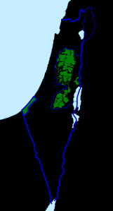
First, some great maps over at Wikipedia with adjoining historical context info and links portraying the boundaries of Palestine/Israel since the 1916 Sykes-Picot Agreement (The linked information could have you reading for days it’s so interesting).
Evolution of Mandate Palestine and modern Palestinian Territories
Second, I found some telling demographic information from the CIA World Factbook regarding the Gaza Strip that I found profoundly important:
- The area of the Gaza Strip is only 360 sq. km., which is only twice the size of Washington D.C., yet, the population of the nation’s capital is only 632,323, while Gaza’s population is 1,816,379.
- Gaza has a 22.5% unemployment rate with 38% of its people living below the poverty line.
- Gaza is under siege by air, land, and sea. The World Factbook even includes in the information regarding Gaza’s maritime activities, that, “[E]ffective 3 January 2009 the Gaza maritime area is closed to all maritime traffic and is under blockade imposed by Israeli Navy until further notice.”
So what should we say is going on here is that the Israelis are trapping the prisoners of the Gaza Strip into, and I use this term in light of how controversial it is, a Ghetto. I am not contending that the Jews are consciously doing what the Nazis did to them. Far from it. I just believe that they need to look into their own tragic past and hopefully derive some empathy for the people they have been bombing now for two weeks now.
//
effective 3 January 2009 the Gaza maritime area is closed to all maritime traffic and is under blockade imposed by Israeli Navy until further notice
Normal
0
false
false
false
EN-US
X-NONE
X-NONE
/* Style Definitions */
table.MsoNormalTable
{mso-style-name:”Table Normal”;
mso-tstyle-rowband-size:0;
mso-tstyle-colband-size:0;
mso-style-noshow:yes;
mso-style-priority:99;
mso-style-parent:””;
mso-padding-alt:0in 5.4pt 0in 5.4pt;
mso-para-margin-top:0in;
mso-para-margin-right:0in;
mso-para-margin-bottom:10.0pt;
mso-para-margin-left:0in;
line-height:115%;
mso-pagination:widow-orphan;
font-size:11.0pt;
font-family:”Calibri”,”sans-serif”;
mso-ascii-font-family:Calibri;
mso-ascii-theme-font:minor-latin;
mso-hansi-font-family:Calibri;
mso-hansi-theme-font:minor-latin;}
//
//

