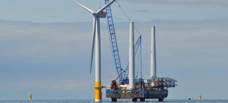
 Geological data are important for offshore wind farms. (Credit: UK Department of Energy & Climate Change)
When planning an offshore wind farm, it is important to consider the wind, waves and the seabed at the location where the turbines will stand. Researchers at Uni Research CIPR, Norway, have now developed a dedicated modeling tool that gives a combined overview of all the challenges that need to be considered by developers.
“When we began working with the wind power industry, it hit us that no-one really cares about what happens beneath the seabed. Yet there is a difference between installing turbines along a neat and tidy coastline like Denmark’s, and on the shoreline of Norway,” says researcher Jan Tveranger of Uni Research CIPR.
He has been working on creating a tool to streamline planning of offshore wind farms and provide more effective methods of installing offshore wind turbines for almost two years.
“Geology is treated unfairly. Many factors which can affect how installations can be positioned are not taken into consideration,” explains Tveranger.
Uni Research CIPR has collaborated with both Norwegian and international companies in its work to develop the new modeling tool.
The seabed in the North Sea has been thoroughly mapped in connection with oil extraction. And the conditions on land are also well documented.
“However, there is no data on the strip between the water’s edge and 60-70 metres beyond it. Nothing has been collected on the precise area in which turbines will be placed. We simply know very little about the seabed,” says the researcher.

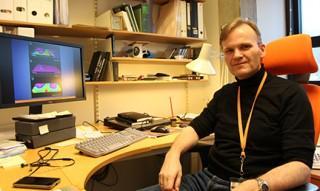
Researcher Jan Tveranger has been involved in creating a tool that will streamline the planning of offshore wind farms. (Credit: Camilla Aadland)
Offshore wind power industries are undergoing strong growth, even though Norway did not initially get off to a very good start. Most wind farms have been built in the UK, Germany, Denmark and the Baltics, although China and the USA are well on their way to becoming major players.
“We have great industrial benefits in Norway, which means we can get involved and contribute. We have experience from energy, shipping, offshore and mapping. Technology developed in Norway will be used in foreign projects. This is where the potential exists today,” says Tveranger.
In Norway, offshore wind power has not initially been competitive as it is not profitable enough. To date, the offshore wind power industry is dependent on subsidies in order to be able to exist here in Norway.
“We believe that we can contribute with research which could reduce the costs and makes wind farms more efficient,” explains Tveranger.
A lot needs to be put in place when processing license applications.
“Offshore wind farms are more controversial than an oil platform which is located far out into the North Sea. Installations like these, closer to the coast, come into conflict with business interests, housing, protected areas, leisure activities, the Norwegian Armed Forces, spawning areas, shipping lanes and much, much more,” he says.
This means that large amounts of data need to be processed.
“It is incredibly difficult to obtain an overview, and there are currently no planning tools which do this within the wind power industry. This makes planning difficult,” says Tveranger.
He compares the situation to how things stood in the oil industry 15-20 years ago, before the industry began to plan using modeling tools.
“Our main idea was to use tools from the offshore industry, and create a corresponding model for the offshore wind power industry,” says Tveranger.
The models used in the wind power industry today include atmospheric and oceanographic factors, in other words wind and waves and biological information.
“We have created an environment model which also includes the seabed conditions,” adds Tveranger.
The researchers have looked at the conditions in two different locations for which licences have been granted to develop offshore wind power.
“We discovered that there was astonishingly little underground data available for the 80 square meters in which the wind turbines would be located. Sediment samples were taken and a few seismic lines distributed, but that was it,” explains Tveranger.
The wind turbines were to be positioned in lines and rows, but when Tveranger and his colleagues carried out an analysis of the area, it turned out that large sections were unsuitable for the type of turbine foundations meant to be located there.
“Essentially, all proposed turbine locations in the application were unsuitable. It would have cost astronomic amounts to position the turbines there as each individual turbine foundation would have needed to be designed and built separately,” continues Tveranger.
The testing and development of the modeling tool was gradually moved to another wind power license just outside Karmøy. This is where researchers developed a model that provides detailed information on which type of turbine foundations can be located where. It also shows the consequences of changing different parameters, such as sea depth, sediment thickness and surface gradient.
The researchers are now discussing the creation of a full demonstration model with the supplier of the tool they used as a basis. The plan is to build a tool that can create 3D models which include all parameters that need to be considered by developers of offshore wind farms.
“This is a perfect example of how technology transfer can work in ways that were not considered before,” concludes Tveranger.

